
Djurberg, Daniel (sold)

Daniel Djurberg (June 3, 1744 – October 2, 1834) was a Swedish geographer and cartographer active in the late 18th and early 19th centuries. Djurberg as the grandson of the well-known theologian of the same name. He was born in Gävle, Sweden, and studied at Uppsala University. He held academic positions at several schools, including at the Katarina Skola (1776) and Klara Skola (1782). As a cartographer one of Djurberg's idiosyncrasies was using alternative indigenous nomenclature: Vingandacoa for North America and Ulimaroa for Australia, among others.
One of the very few maps to use the indigenous terms for Australia and New Zealand: Ulimaora (Australia), Tavai-Poenammoo (New Zealand South Island) and Ealiei-Nomauwe (North Island).
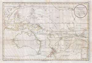
Polynesien (Inselwelt) oder der Funfte Welttheil Versasst von Herrn Daniel Djurberg.
sold
- Digital Map Information
- Suitable for large format printing
- DPI: 300
- File Size: 20.99 MB
- File Type: ZIP / TIFF
- ICC color profile embedded
- Delivered instantly via download link
This important 1789 map of Australia and Polynesia is one of the very few maps to use the indigenous terms for Australia and New Zealand: Ulimaora (Australia), Tavai-Poenammoo (New Zealand South Island) and Ealiei-Nomauwe (North Island). All three of these ... (more details)
Ulimaroa - rare use of indigenous name for Australia.
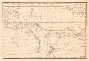
Polynesien (Inselwelt) oder der Funfte Welttheil Versasst von Herrn Daniel Djurberg.
sold
- Digital Map Information
- Suitable for large format printing
- File Size: 29.62 MB
- File Type: ZIP / TIFF
- ICC color profile embedded
- Delivered instantly via download link
This important 1789 Djurberg map of Australia and Polynesia is one of the very few maps to use the Indigenous terms for Australia and New Zealand: Ulimaora (Australia), Tavai-Poenammoo (New Zealand South Island), and Ealiei-Nomauwe (North Island). All three of these terms are extracted from accounts of Capt. James Cook's epic voyages of discovery. (more details)
Uses the indigenous name of Australia - Ulimaora! and New Zealand
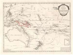
Karte von der Inselwelt, Polynesien oder dem Fünften Welttheile Nach Djurberg unde Roberts.
sold
- Digital Map Information
- Suitable for large format printing
- DPI: 600
- File Size: 21.59 MB
- File Type: ZIP / TIFF
- ICC color profile embedded
- Delivered instantly via download link
This important 1796 map of Australia and Polynesia is one of the very few maps to use the indigenous terms for Australia and New Zealand: Ulimaora (Australia), Tavai-Poenammoo (New Zealand South Island) and Ealiei-Nomauwe (North Island). All three of these terms are extracted from accounts of Cook's voyages. (more details)
Presenting the 18th Century Pacific Discoveries.
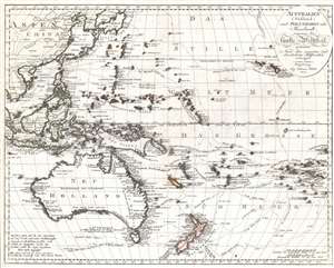
Australien (Südland) auch Polynesien oder Inselwelt, insgemein der fünfte Welttheil genannt: nach den neuesten und bewährtesten Hulfsmitteln entworfen.
sold
- Digital Map Information
- Suitable for large format printing
- Full resolution TIFF file
- ICC color profile embedded
- Delivered instantly via download link
This is Johannes Walch's 1802 map of Australia and Oceania, including the East Indies, the Philippines, China, Korea, and Japan. Overall, Walch presents the whole as a 'Fifth part of the world,' extending further the terminology established by Ptolemy, in which the world - formerly composed of the three parts of Europe, Asia, and Africa - had already been amended with America, the Fourth part of the world. The map extends from Sumatra and Cambodia, eastwards to include Hawaii and the Marquesas Islands. It was printed in order to celebrate the exploration of the region of the prior two centuries, most particularly those of Captain James Cook (1728 - 1779). The map includes the Dutch voyages of the 17th century, notably Abel Tasman's (1603 - 1659) voyage in 1642, and shows the tracks of Captains Marshall, Byron, Wallis, Bougainville. The map is dominated by the tracks of Cook, however, underscoring the achievements of that explorer. The tracks of all three of Cook's great voyages appear here: his 1768-1771 observation of the Transit of Venus at Tahiti; his 1772-5 search for the legendary great southern continent, (during which he crossed the Antarctic Circle three times) and his fatal third expedition to seek the Northwest Passage, during which he met his end in Hawaii. New Zealand is shown as two islands with with its shores charted as per Cook's first voyage. Maori placenames are used, represented with phonetic spellings. Australia is shown complete (albeit with a 'coast never traveled' noted in German.) (more details)