
Dodge, Frank S. (sold)

Frank S. Dodge (1855 - July 17, 1914) was an American engineer and surveyor. Educated at the Massachusetts Institute of Technology and, upon graduation, was recruited by the Hawaiian Government Survey, arriving in the islands in 1880. When he arrived, the job he had been told would be available had been filled, but William DeWitt Alexander, the founding director of the Hawaiian Government Survey, hired him to do some surveying work on Maui. Dodge did such a good job in this assignment that he earned a permanent position on the survey team. He served with the Survey until 1899, eventually rising to be head of the office staff, and surveying many of the cities in the islands. After resigning from the Survey, he became the land agent for the Bishop Estate, a position he held until four years before his death, when he suffered a stroke that caused paralysis. Dodge continued to suffer strokes over the ensuing four years, leaving Hawaii for a sanitarium outside St. Helena, California, in 1912. Dodge had been an active member of the community and supported the Honolulu library, the Social Science Club, the historical society, and other organizations. Dodge was married and had four children.
Most sophisticated 19th century map of Molokai.
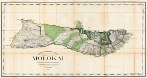
Hawaiian Government Survey. Molokai.
sold
- Digital Map Information
- Suitable for large format printing
- File Size: 154.9 MB
- File Type: ZIP / TIFF
- ICC color profile embedded
- Delivered instantly via download link
This 1897 Christopher Willis map of Molokai is the most sophisticated 19th century mapping of the island. Surveyors from the Hawaiian Government Survey mapped the length and breadth of Molokai and, per Moffat and Fitzpatrick, the map 'represents the final stage in the process of understanding and correctly illustrating the shape of this elongated island between O'ahu and Maui'. (more details)
First scientific survey of Maui.
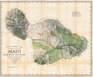
Maui, Hawaiian Islands.
sold
- Digital Map Information
- Suitable for large format printing
- File Size: 310 MB
- File Type: ZIP / TIFF
- ICC color profile embedded
- Delivered instantly via download link
This is the 1903 Frank S. Dodge and John M. Donn map of Maui in the Hawaiian Islands. This map is the first scientific survey of Maui as well as the first map commissioned by U.S. Government after Hawaii's 1898 annexation. (more details)