
Doppelmayr, Johann Gabriel (sold)

Johann Gabriel Doppelmayr (September 27, 1677 - December 1, 1750) was a German mathematician and astronomer active in the first half of the 18th century. Doppelmayr was born in Nuremberg to a merchant family. He attended the Aegidien-Gymnasium and the University of Altdorf where he studied mathematics, physics, and law. His graduating dissertation, a study of the Sun, suggests an early interest in Astronomy. Following his studies in Altdorf, Doppelmayr traveled extensively in Europe and is known to have spent time at the University of Halle, as well as in Utrecht, Leiden, Oxford, and London. He returned to Nuremburg in 1704 to take up a mathematics professorship at his alma mater, the Aegidien-Gymnasium. It may have been here that he developed a relationship with the prominent Nuremburg map publisher J. B. Homann, with whom he prepared a number of important astronomical maps and atlases. The collaboration of over 20 years eventually led to the publication of the Atlas Novus Coelestis in 1742. This astounding work was the most elaborate and detailed astronomical atlas yet published and is today much admired for its rich beautifully engraved plates. Doppelmayr died on 1 December 1750 in Nuremberg, and many later sources claim that his death was caused by the fatal effects of a powerful electrical shock which he had received shortly before while experimenting with a battery of electric capacitors. Other sources, however, suggest that Doppelmayr's electrical experiments were performed several years earlier and were not the cause of his death. Today the Lunar crater Doppelmayr and a minor planetoid are named in his honor.
The first comparative chart of the Moon.
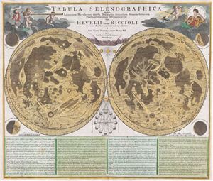
Tabula Selenographica in qua Lunarium Macularum exacta Descriptio secundum Nomenclaturam Praestantissimorum Astronomorum tam Hevelii quam Riccioli Curiosis Rei Sidereae Cultoribus exhibetur Joh. Babr. Doppelmajero Math. P.P. upera Joh. Baptistae Homanni Norinbergae.
sold
- Digital Map Information
- Suitable for large format printing
- DPI: 300
- File Size: 20.87 MB
- File Type: ZIP / TIFF
- ICC color profile embedded
- Delivered instantly via download link
A stunning full color example of J. B. Homann and Johann Gabriel Doppelmayr's important c. 1742 map of the Moon. Essentially a comparative chart, Doppelmayer constructed this map to illustrate the lunar mapping of Johannes Hevelius (left) and Giovanni Battista ... (more details)
New lunar naming conventions.
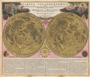
Tabula Selenographica in qua Lunarium Macularum exacta Descriptio secundum Nomenclaturam Praestantissimorum Astronomorum tam Hevelii quam Riccioli Curiosis Rei Sidereae Cultoribus exhibetur Joh. Babr. Doppelmajero Math. P.P. upera Joh. Baptistae Homanni Norinbergae.
sold
- Digital Map Information
- Suitable for large format printing
- File Size: 31.06 MB
- File Type: ZIP / TIFF
- ICC color profile embedded
- Delivered instantly via download link
An example of J. B. Homann and Johann Gabriel Doppelmayr's important 1707/1715 map of the Moon. Essentially a comparative chart, Doppelmayer constructed this map to illustrate the lunar mapping of Johannes Hevelius (left) and Giovanni Battista Riccioli (right). (more details)
The first comparative chart of the Moon from which the names of many lunar features have been derived.
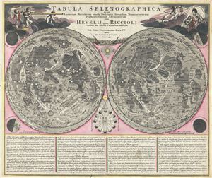
Tabula Selenographica in qua Lunarium Macularum exacta Descriptio secundum Nomenclaturam Praestantissimorum Astronomorum tam Hevelii quam Riccioli Curiosis Rei Sidereae Cultoribus exhibetur Joh. Babr. Doppelmajero Math. P.P. upera Joh. Baptistae Homanni Norinbergae.
sold
- Digital Map Information
- Suitable for large format printing
- Full resolution TIFF file
- ICC color profile embedded
- Delivered instantly via download link
A stunning full color example of J. B. Homann and Johann Gabriel Doppelmayr's important c. 1742 map of the Moon. Essentially a comparative chart, Doppelmayer constructed this map to illustrate the lunar mapping of Johannes Hevelius (left) and Giovanni Battista ... (more details)
Homann's Depiction of Christian Europe Eclipsed by an Eclipse.
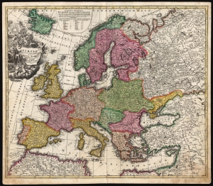
Europa Christiani Orbis Domina in sua Imperia, Regna, et Status exacte divisa per Johan Bapt. Homann Norimbergae.
sold
- Digital Map Information
- Suitable for large format printing
- DPI: 600
- File Size: 70.73 MB
- File Type: ZIP / TIFF
- ICC color profile embedded
- Delivered instantly via download link
This is a scarce early example of Johann Baptist Homann's 1707 map of Europe presenting, in collaboration with mathematician J. Gabriel Doppelmayr, the progress of the May 12, 1706 eclipse of the sun. (more details)
The orbits of the inner planets according to Tycho Brahe.
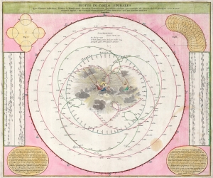
Motus in Coelo Spirales Quos Planetae inferiores Venus et Mercurius secundum Tychonicorum Hypothesin exhibent, pro exemplo ad annum Christi praecipue 1712 et 1713.
sold
- Digital Map Information
- Suitable for large format printing
- DPI: 600
- File Size: 45.52 MB
- File Type: ZIP / TIFF
- ICC color profile embedded
- Delivered instantly via download link
This is the 1742 Atlas Novus Coelestis edition of J. G. Doppelmayr's chart of the orbits of Venus, Mercury, and the Sun following the theory of planetary motion proposed by Tycho Brahe. That 16th-century Danish astronomer's efforts to explain the confusing behavior of the planets while retaining an orderly vision of the cosmos led to the production of many fascinating images, this not least among them. Doppelmayr presented Tycho Brahe's model here in contrast to the Copernican model, declaring the simplicity of the latter to exemplify its superiority over the contortions made necessary by the former. (more details)
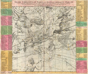
Globi Coelestis in Tabulas Planas Redacti Pars IV.
sold
- Digital Map Information
- Suitable for large format printing
- DPI: 300
- File Size: 18.46 MB
- File Type: ZIP / TIFF
- ICC color profile embedded
- Delivered instantly via download link
Published by J. B. Homann, this is a very nice example of DoppelmayerÂ's map of the constellations. Focuses on the Zodiac constellations of Leo and Virgo, though Bootes, Ursa Major, Chara, Hydra, Libra, and others and also visible. Each constellation is ... (more details)