
Duvotenay, Thunot (sold)

Thunot Duvotenay (1796 - 1875) was a French geographer active in the mid 19th century. Thunot is known to have worked with several other important cartographers of his dayincluding Barbie du Bocage, Vuillemin, Charle, Levassseur and Dufour.
Map showing the ephemeral Republic of Texas.
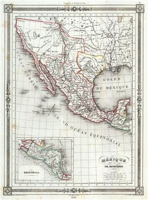
Mexique.
sold
- Digital Map Information
- Suitable for large format printing
- Full resolution TIFF file
- ICC color profile embedded
- Delivered instantly via download link
This is a highly desirable 1846 map of Mexico by Thunot Duvotenay. Duvotenay published several different editions of this Mexico map - this being the most desirable due to its depictions of the ephemeral Republic of Texas. The map covers all of modern day Mexico ... (more details)
Highlights the ephemeral Republic of Texas.
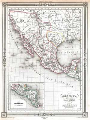
Mexique.
sold
- Digital Map Information
- Suitable for large format printing
- DPI: 300
- File Size: 3.32 MB
- File Type: ZIP / TIFF
- ICC color profile embedded
- Delivered instantly via download link
This is a highly desirable 1846 Thunot Duvotenay map of Mexico. Duvotenay published several different editions of this Mexico map - this being the most desirable due to its depiction of the ephemeral Republic of Texas. Illustrating all of modern day Mexico and ... (more details)
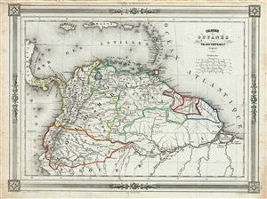
Colombie et Guyanes.
sold
- Digital Map Information
- Suitable for large format printing
- DPI: 300
- File Size: 16.52 MB
- File Type: ZIP / TIFF
- ICC color profile embedded
- Delivered instantly via download link
An uncommon and extremely attractive 1852 map of Colombia and Guyana. The map covers Gran Colombia (modern day Colombia, Venezuela, ecuador, Panama, northern Peru and northwest Brazil) and the British, Dutch and French Guyana from the Caribbean Sea in the north ... (more details)
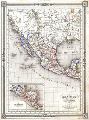
Mexique par Th. Duvotenay.
sold
- Digital Map Information
- Suitable for large format printing
- DPI: 300
- File Size: 4.93 MB
- File Type: ZIP / TIFF
- ICC color profile embedded
- Delivered instantly via download link
An uncommon and extremely attractive 1852 map of the Mexico by Th. Dovotenay. Includes all of modern day Mexico as well as Texas and the territories (Upper California) claimed by Mexico prior to the 1849 Treaty of Guadaloupe-Hildago. Shows the Mexico – ... (more details)
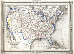
Etats-Unis par Th. Duvotenay.
sold
- Digital Map Information
- Suitable for large format printing
- DPI: 300
- File Size: 4.99 MB
- File Type: ZIP / TIFF
- ICC color profile embedded
- Delivered instantly via download link
An uncommon and extremely attractive 1852 map of the United States by Th. Dovotenay. Depicts the United States at the height of the California Gold Rush and shortly after the annexation of Texas. While most of the eastern United States is well defined the ... (more details)
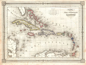
Antilles ou Indes Occidentales par Th. Doutovenay.
sold
- Digital Map Information
- Suitable for large format printing
- DPI: 300
- File Size: 4.66 MB
- File Type: ZIP / TIFF
- ICC color profile embedded
- Delivered instantly via download link
An attractive 1852 map of the West Indies by Th. Duvotenay. Covers from Florida to Venezuela and from Honduras to Barbados. Includes the Bahamas, Cuba, Jamaica, Santo Domingo (Hispaniola), Porto Rico, and the Lesser Antilles or Windward Isles. Throughout, ... (more details)
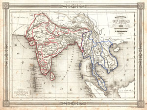
Hindoustan ou Inde en deca du Gange et Inde Transgangetique par V. Levasseur Geographe.
sold
- Digital Map Information
- Suitable for large format printing
- Full resolution TIFF file
- ICC color profile embedded
- Delivered instantly via download link
A beautiful 1852 map of India and Southeast Asia by Victor Levasseur. Features the entire sub-continent as well as all of Southeast Asia. Includes the modern day nations of India, Pakistan, Bangladesh, Nepal, Thailand, Vietnam, Cambodia, Laos, Burma, and ... (more details)