
Ellicott, Andrew (sold)
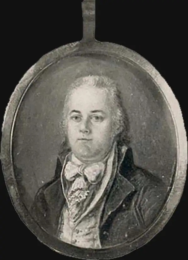
Andrew Ellicott (January 24, 1754 – August 28, 1820) was an American cartographer, surveyor, and statesman active in the late 18th and early 29th centuries. He is best known for his work surveying the boundaries of Washington D.C. and completing Pierre Charles L'Enfant's plan for said city. Ellicott was born to a Pennsylvania Quaker family in Buckingham, Bucks County. He was educated at the local Quaker School where he exhibited an early aptitude for mechanics and mathematics. In 1770 his father, Joseph Ellicott (1732–1780), and uncles Andrew Ellicott (1733 – 1809) and John Ellicott (December 28, 1739 – December 28, 1794), purchased land on the Patapsco River with where they relocated and established a milling business, naming the town Ellicott Mills, today's Ellicott City, Maryland. With the outbreak of the American Revolutionary War, Ellicott joined the Maryland Elk Ridge Battalion as a commissioned Lieutenant. During the course of the war he reached the rank of Major, which he maintained as an honorific even after the war. From 1791 to 1792, at the request of then Secretary of State Thomas Jefferson, Ellicott began to survey the boundaries of the newly established District of Columbia. During this same period, he also surveyed, with French urban planner Pierre Charles L'Enfant (August 2, 1754 – June 14, 1825), the future city of Washington, which then occupied only a small potation of territory reserved for the District of Columbia. In February of 1792 the Commissioners had a falling out with L'Enfant after which L'Enfant refused to submit a copy of his plan for Washington D.C. Ellicott, being familiar with Ellicott's methods and style, completed the plan, creating thus the plan upon the nation's capital was subsequently built. In additional to his work in Washington D.C., Ellicott laid out the plan for the city if Erie, Pennsylvania and from 1796, worked on the Spanish-American border in the Gulf Coast, establishing Ellicott's Line, the modern-day border between Alabama and Florida. In 1803 he mentored Meriwether Lewis, one of the leaders of the Lewis and Clark Expedition, on field survey techniques. From 1813 he taught mathematics at the Military Academy at West Point. The final significant survey he completed was the resurvey of the Collins-Valentine Line between Quebec, New York, and Vermont. Three years later he died from a stroke at West Point.
First official large format plan of Washington D.C.
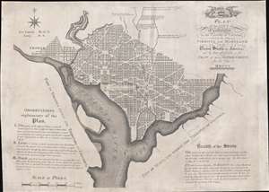
Plan of the City of Washington in the Territory of Columbia, ceded by the States of Virginia and Maryland to the United States of America, and by them established as the Seat of their Government, after the year MDCCC.
sold
- Digital Map Information
- Suitable for large format printing
- Full resolution TIFF file
- ICC color profile embedded
- Delivered instantly via download link
This is Andrew Ellicott's seminal 1792 official large format plan or map of Washington D.C., which would become, 8 years later, the capital of the United States. This is the grandest, most beautiful, and most important official founding plan of Washington D.C. The map illustrates the original urban layout of Washington D.C, then only a small part of the District of Colombia. Centered on the confluence of the Potomac and the Eastern Branch (Anacostia) Rivers, the map covers the Washington D.C. grid as far north as W Street. It also includes the older nearby city of Georgetown. (more details)
The First European Edition of the Seminal Ellicott Plan.
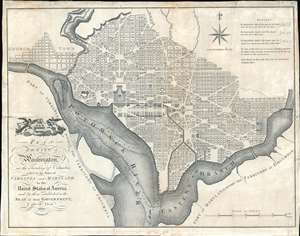
Plan of the City of Washington in the Territory of Columbia ceded by the States of Virginia and Maryland tothe United States of America and by them established as the Seat of their Government after the Year 1800.
sold
- Digital Map Information
- Suitable for large format printing
- DPI: 600
- File Size: 22.36 MB
- File Type: ZIP / TIFF
- ICC color profile embedded
- Delivered instantly via download link
This is the 1795 Russell edition of Andrew Ellicott's seminal plan or map of Washington D.C., published prior to its becoming in 1800 the capital of the United States. The map illustrates the original urban layout of Washington D.C, then only a small part of the District of Columbia. Centered on the confluence of the Potomac and the Eastern Branch (Anacostia) Rivers, the map covers the Washington D.C. grid as far north as W Street. It also includes the older nearby city of Georgetown. (more details)