
Endicott and Company
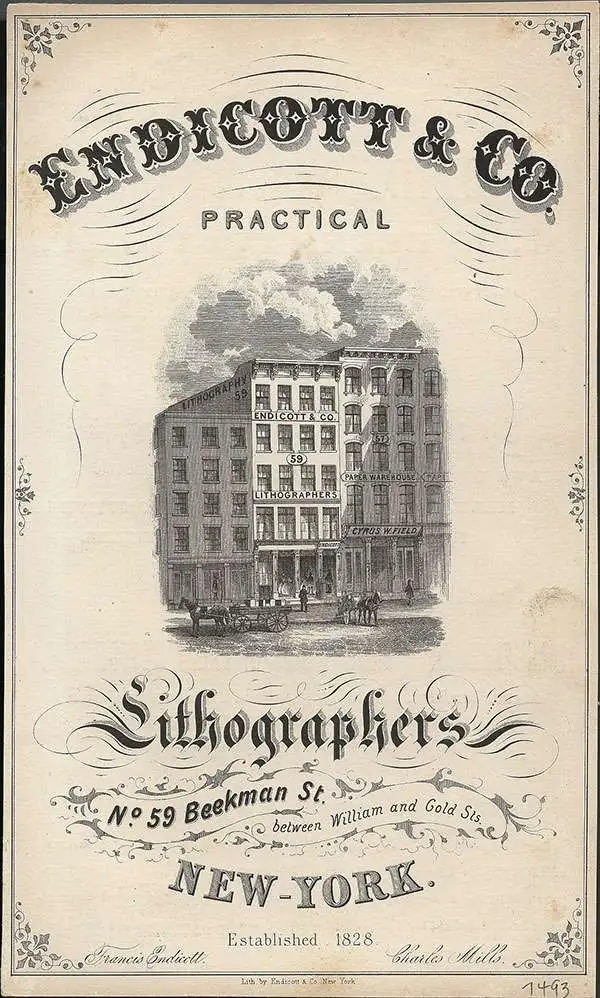
Endicott and Company (fl. c. 1828 - 1891) was a New York based family run lithography firm that flourished throughout the 19th century. The firm was founded by George and William Endicott, brothers who were born in Canton, Massachusetts. George Endicott (June 14, 1802 - 1848) trained as a lithographer under Pendleton Lithography from January 1826. He later worked as superintendent of Senefelder Company until the summer of 1828. Afterwards, in 1830, he relocated to Baltimore and partnered with Moses Swett. Endicott and Swett relocated to New York City in December 1831. They remained partners until July 1834 when the relationship dissolved. George set up shop on his own account at 359 Broadway. William Endicott (1815 - 1851), George's younger brother of 14 years, joined the firm in 1840 and was made a partner in 1845, after which the name of the firm was changed to G. and W. Endicott. George Endicott died shortly afterward, in 1848, but William continued operating the firm as William Endicott and Co. until his own 1851 death at just 35 years old. The firm was carried on by his widow Sara Munroe Endicott until it was taken over by her son, Francis Endicott, who ran the firm from 1852 to 1886. George Endicott, Jr. subsequently ran the firm from 1887 to 1891. Peters, in his important work on American lithography America on Stone writes 'it is hard to summarize the Endicotts. They did everything and did it well... [they] worked with and for Currier and Ives, yet in spite of all that much of their work lacks real individuality.' The Endicott firm was responsible for many 19th century views and plans of New York City and state as well as plans of Sacramento, California, and the Midwest.
An early view of the entrance to Howe Caverns.
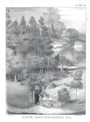
Howe's Cabe Cobleskill N.Y.
$100.00
Acquire
- Digital Map Information
- Suitable for large format printing
- DPI: 300
- File Size: 2.87 MB
- File Type: ZIP / TIFF
- ICC color profile embedded
- Delivered instantly via download link
This is an 1842 William Mather lithograph plate from his Geology of New York, Part I depicting a view of the entrance to Howe's Cave in Cobleskill, New York. A beautiful black and white lithograph, the entrance to the cave is situated in the foreground, with what appears to be stones and beams marking the way in. Trees cover the hillside, creating the image of a wild, untamed wilderness. Today, Howe's Cave is known by another name: Howe Caverns and is located in the town of Howes Cave in Schoharie County. Howe Caverns is the second most visited natural attraction in New York State, following Niagara Falls. (more details)
Border dispute in the Great North Woods.
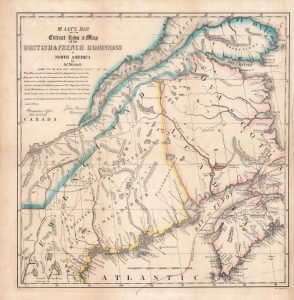
Mr. Jay's map : extract from a map of the British and French dominions in North America.
$900.00
Acquire
- Digital Map Information
- Suitable for large format printing
- Full resolution TIFF file
- ICC color profile embedded
- Delivered instantly via download link
An 1843 map of the U.S.-Canada border region, including portions the states and provinces of Maine, New Hampshire, Quebec, New Brunswick, and Nova Scotia, as it appeared one century prior. This map is a reissue of a portion of a 1755 map by John Mitchell which played an important role in settling the boundary between the American Republic and British North America (Canada) in the late 19th century. It was republished in the aftermath of the 'Aroostook War,' an Anglo-American diplomatic dispute between 1838 and 1842 over the same boundary, appearing in Albert Gallatin's A Memoir on the North-Eastern Boundary, in Connection with Mr. Jay's Map. (more details)
'Duty, Honor, Country'.
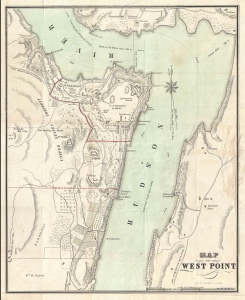
Map of West Point.
$1,250.00
Acquire
- Digital Map Information
- Suitable for large format printing
- Full resolution TIFF file
- ICC color profile embedded
- Delivered instantly via download link
A rare 1844 guide and map of the U.S. Military Academy at West Point, New York by J. H. Colton. The map is centered on the academy grounds and covers from Constitution Island to Garrison, just across the Hudson River. In identifies academy buildings as well as the surrounding terrain. Nearby farms and homeowners are also identified. (more details)
Hippest place on Earth!
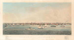
View of Williamsburgh, L. I., from Grand St. N.Y. / Whitefield's Original Views of North American Cities, No. 26.
$2,500.00
Acquire
- Digital Map Information
- Suitable for large format printing
- Full resolution TIFF file
- ICC color profile embedded
- Delivered instantly via download link
A beautiful and rare low oblique chromolithograph city view of Williamsburg, Brooklyn, in 1852, by the English-American artist Edwin Whitefield. When this view was issued, Williamsburg was an independent city, separate from the adjacent cities of Brooklyn and Bushwick. Williamsburg, Greenpoint, and Bushwick were annexed into Brooklyn in 1854, two years after this view was drawn, turning Brooklyn into the second largest city in the United States, after neighboring New York. (more details)
Beautiful View of a Bucolic Boomtown.
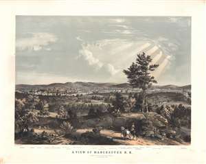
A View of Manchester, N. H., composed from Sketches taken near Rock Raymond by J. B. Bachelder, 1855.
$2,500.00
Acquire
- Digital Map Information
- Suitable for large format printing
- File Size: 80.93 MB
- File Type: ZIP / TIFF
- ICC color profile embedded
- Delivered instantly via download link
This rare, large and beautiful Bachelder / Endicott chromolithograph view illustrates Manchester, New Hampshire at a time when it was a thriving industrial powerhouse, and home to what in 1846 was the largest cotton mill in the world. It is among the earliest depictions of the city, is certainly the largest, and is arguably the most beautiful. The view is oriented to the east. In the middle distance, the thriving mill town is shown, dominated by the factories of the Amoskeag Manufacturing Company: a smoking hive of activity on the east bank of the Merrimack River. At the far left and right, railway trains wind through the countryside and along bridges crossing the River. Beyond the smokestacks of the waterfront, the city's buildings can be seen climbing up the valley and hills to the east.
The view was sketched from life by J. B. Bachelder, and committed to two-color lithograph by the New York lithographic firm of Endicott and Company. Endicott produced three other lithographs of Bachelder's sketches of Manchester, but they were all of a significantly smaller format and intended for inclusion in Endicott's 'Album of New England Scenery.' Bachelder lived in Manchester starting in 1854, so perhaps a certain civic pride in his new home led him to give the city more attention than his other subjects. (more details)
The view was sketched from life by J. B. Bachelder, and committed to two-color lithograph by the New York lithographic firm of Endicott and Company. Endicott produced three other lithographs of Bachelder's sketches of Manchester, but they were all of a significantly smaller format and intended for inclusion in Endicott's 'Album of New England Scenery.' Bachelder lived in Manchester starting in 1854, so perhaps a certain civic pride in his new home led him to give the city more attention than his other subjects. (more details)
Lynn as it transitioned to a resort city.
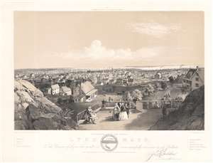
Lynn, Mass. East View from Near High Rock.
$500.00
Acquire
- Digital Map Information
- Suitable for large format printing
- File Size: 13.54 MB
- File Type: ZIP / TIFF
- ICC color profile embedded
- Delivered instantly via download link
One of Bachelder's earliest works, this is an 1856 John Badger Bachelder view of Lynn, Massachusetts. Looking east over the city, houses, churches, and factories are illustrated. Eight locations within the view, including the high school and the residence of the 'Hutchinson Family' vocalists, are numerically identified along the bottom border and correspond with a small index situated to the left and right of the title. The city seal appears below the bottom border as well and Bachelder's printed signature is included to the right. (more details)
Rare steam locomotive promotion.
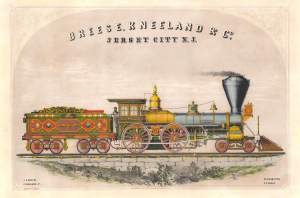
Breese, Kneeland and Co. Jersey City N.J.
$3,800.00
Acquire
- Digital Map Information
- Suitable for large format printing
- Full resolution TIFF file
- ICC color profile embedded
- Delivered instantly via download link
This is a c. 1858 Alexander Lyman Holley chromolithograph of a steam locomotive named 'Young America.' This is something of a holy grail for railroad collectors due to its fine coloration, impressive design, and overall rarity. The broadside was issued as a promotional piece for Breese, Kneeland, and Company, locomotive manufacturers in Jersey City, New Jersey. (more details)
Battle of the Ironclads.

The First Naval Conflict between Iron Clad Vessels. In Hampton Roads, March 9th 1862.
$1,500.00
Acquire
- Digital Map Information
- Suitable for large format printing
- Full resolution TIFF file
- ICC color profile embedded
- Delivered instantly via download link
This is Charles Parsons' 1862 view of the American Civil War (1861 - 1865) naval battle between the USS Monitor and the CSS Virginia, a captured Union ship formerly called Merrimac. Although the battle was inconclusive, this first confrontation between ironclads ushered in a new era of naval warfare. (more details)
Execution of a Desperado observed by U.S. Colored Regiments.

Military Execution Of James Griffin, alias John Thomas Barnett, a Private of the 11th Pa. Calvary, for Desertion and Highway Robbery, At Portsmouth, Va., Sept. 17th, 1863.
$1,800.00
Acquire
- Digital Map Information
- Suitable for large format printing
- File Size: 15.84 MB
- File Type: ZIP / TIFF
- ICC color profile embedded
- Delivered instantly via download link
This rare and rather grisly image is a c. 1863 U.S. Civil War Era hand-tinted Endicott lithograph illustrating the execution of John Thomas Barnett, a Union deserter and highwayman. Also, at left, the image includes a rare illustration of the 1st and 2nd Regiment Colored Troops among the observers. Such images, while scarce, were intended to underscore the severity of military justice. (more details)