
Endicott and Company (sold)
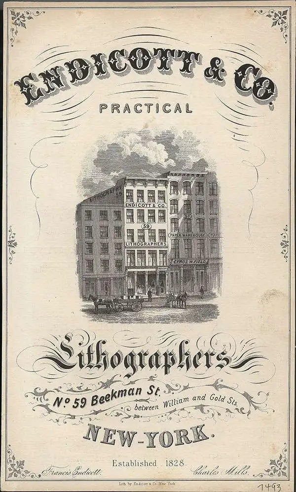
Endicott and Company (fl. c. 1828 - 1891) was a New York based family run lithography firm that flourished throughout the 19th century. The firm was founded by George and William Endicott, brothers who were born in Canton, Massachusetts. George Endicott (June 14, 1802 - 1848) trained as a lithographer under Pendleton Lithography from January 1826. He later worked as superintendent of Senefelder Company until the summer of 1828. Afterwards, in 1830, he relocated to Baltimore and partnered with Moses Swett. Endicott and Swett relocated to New York City in December 1831. They remained partners until July 1834 when the relationship dissolved. George set up shop on his own account at 359 Broadway. William Endicott (1815 - 1851), George's younger brother of 14 years, joined the firm in 1840 and was made a partner in 1845, after which the name of the firm was changed to G. and W. Endicott. George Endicott died shortly afterward, in 1848, but William continued operating the firm as William Endicott and Co. until his own 1851 death at just 35 years old. The firm was carried on by his widow Sara Munroe Endicott until it was taken over by her son, Francis Endicott, who ran the firm from 1852 to 1886. George Endicott, Jr. subsequently ran the firm from 1887 to 1891. Peters, in his important work on American lithography America on Stone writes 'it is hard to summarize the Endicotts. They did everything and did it well... [they] worked with and for Currier and Ives, yet in spite of all that much of their work lacks real individuality.' The Endicott firm was responsible for many 19th century views and plans of New York City and state as well as plans of Sacramento, California, and the Midwest.
An exceptional vivid view of the Holy Land.
The Holy Land. Exhibiting the Places and Cities Mentioned in the Old and New Testament.
sold
- Digital Map Information
- Suitable for large format printing
- DPI: 300
- File Size: 12.32 MB
- File Type: ZIP / TIFF
- ICC color profile embedded
- Delivered instantly via download link
An uncommon view and map of the Holy Land, Israel, or Palestine by Endicott. Focusing on the city of Jerusalem, which is oversized and presented just right of center, this map covers the Holy Land from the Jorden River to the Mediterranean and from Sidon to Zoar. ... (more details)
Geological Foundation for Long Island’s Development in the Second Half of the 19th Century.
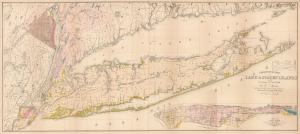
Geological Map of Long and Staten Islands with the Environs of New York.
sold
- Digital Map Information
- Suitable for large format printing
- Full resolution TIFF file
- ICC color profile embedded
- Delivered instantly via download link
The influential 1842 William W. Mather map of Long Island is considered the first comprehensive geological study of the island. Published while the Long Island Rail Road was still under construction, Mather's map captures a landscape that was still overwhelmingly rural, agricultural, and geographically remote from New York City, but whose soils, resources, transportation corridors, and development potential were becoming subjects of intense scientific and commercial interest. Within little more than a decade, the railroad would open vast portions of the island to easier settlement and speculation, initiating a land rush and a process of development that would ultimately transform Long Island into an extension of metropolitan New York. (more details)
A cave in upstate New York which was explored by two ordinary people in the early 1830s.
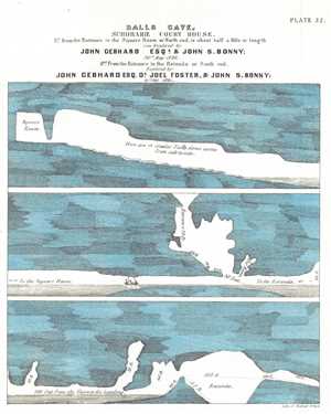
Ball's Cave, Schoharie Court House.
sold
- Digital Map Information
- Suitable for large format printing
- DPI: 300
- File Size: 2.69 MB
- File Type: ZIP / TIFF
- ICC color profile embedded
- Delivered instantly via download link
This is an 1842 William Mather lithograph plate from his Geology of New York, Part I depicting Ball's Cave. Ball's Cave was located in Schoharie County about two miles from the courthouse in Schoharie. It was discovered and explored by John Gebhard and John Bonny ... (more details)
A landmark map of Long Island and the earliest Long Island Wall Map.
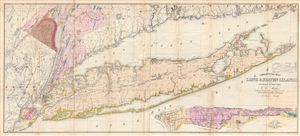
Geological Map of Long & Staten Islands with the Environs of New York.
sold
- Digital Map Information
- Suitable for large format printing
- DPI: 300
- File Size: 36.74 MB
- File Type: ZIP / TIFF
- ICC color profile embedded
- Delivered instantly via download link
Issued prior to the American Civil War and the subsequent Long Island land rush, this is one of the most detailed and attractive large format maps of Long Island to appear in the 19th Century. Covers from New Jersey and Staten Island eastward as Montauk and ... (more details)
A landmark map of Long Island and the earliest Long Island Wall Map.
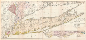
Geological Map of Long & Staten Islands with the Environs of New York.
sold
- Digital Map Information
- Suitable for large format printing
- File Size: 29.38 MB
- File Type: ZIP / TIFF
- ICC color profile embedded
- Delivered instantly via download link
Issued prior to the American Civil War and the subsequent Long Island land rush, this is one of the most detailed and attractive large format maps of Long Island to appear in the 19th Century. It is also the first comprehensivle geological study of Long ... (more details)
A landmark map of Long Island and the earliest Long Island Wall Map.
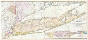
Geological Map of Long & Staten Islands with the Environs of New York.
sold
- Digital Map Information
- Suitable for large format printing
- DPI: 300
- File Size: 28.77 MB
- File Type: ZIP / TIFF
- ICC color profile embedded
- Delivered instantly via download link
Issued prior to the American Civil War and the subsequent Long Island land rush, this is one of the most detailed and attractive large format maps of Long Island to appear in the 19th Century. It is also the first comprehensivle geological study of Long ... (more details)
First geological map of Long Island.
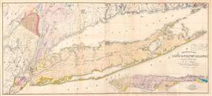
Geological Map of Long and Staten Islands with the Environs of New York.
sold
- Digital Map Information
- Suitable for large format printing
- Full resolution TIFF file
- ICC color profile embedded
- Delivered instantly via download link
A fine example of William W. Mather's 1842 large-scale geographical map of Long Island, New York - the first comprehensive geological study of the island. Issued prior to the completion of the Long Island Railroad and the subsequent Long Island land rush, this one of the largest, most detailed, and attractive maps of Long Island to appear in the 19th century. The map covers from New Jersey and Staten Island eastward as Montauk and Fisher's Island. Includes parts of Westchester, New Jersey, Rockland County, and the Connecticut coastline. A large inset map in the lower right depicts Manhattan with a special focus on geological features and topography. The line of the partially completed Long Island Railroad, which within 15 years would change the demographic of Long Island, is illustrated. Various important Long Island communities including the East Hampton, Bridgehampton, Southampton, Amagansett, Riverhead, and Sag Harbor, among others, are named. In many cases even individual buildings are detailed. The whole is laid out on a grid structure of ten-mile squares. (more details)
Two different locations on Long Island are sketched here - Sands Point and Long Beach Bay.
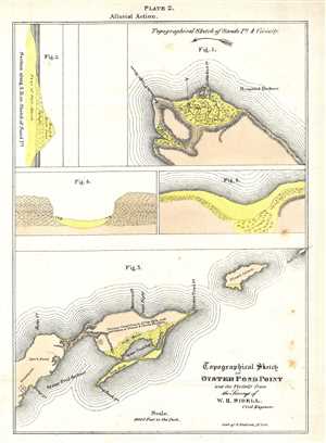
Topographical Sketch of Oyster Pond Point and the Vicinity from the Surveys of W. H. Sidell.
sold
- Digital Map Information
- Suitable for large format printing
- DPI: 300
- File Size: 1.37 MB
- File Type: ZIP / TIFF
- ICC color profile embedded
- Delivered instantly via download link
This is an 1842 William Mather lithograph plate from his Geology of New York, Part I depicting Oyster Pond Point and Sands Point, Long Island. Today, the areas in Figure 3 labeled here as Oyster Pond Harbour and Oyster Pond Bay are known as the Peconic ... (more details)
A north and south view of the geology of the Harlem Railroad tunnel.
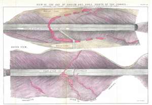
View of the Cut of Harlem Rail Road North of the Tunnel.
sold
- Digital Map Information
- Suitable for large format printing
- DPI: 300
- File Size: 6.22 MB
- File Type: ZIP / TIFF
- ICC color profile embedded
- Delivered instantly via download link
This is an 1842 William Mather lithograph plate from his Geology of New York, Part I depicting a view of the Harlem Railroad tunnel. The view depicts about 400 yards of rail in two views, a north view and a south view. Each view is split into approximately equal distances of 200 yards each. In the views, the cross section of the ground through which the tunnel was cut is illustrated, comprised mostly of layers of diluvial loam and gneiss. Some granite veins run through the gneiss, which are colored red. (more details)
Niagara Falls from the first official Geological Survey of New York.
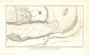
Trigonometrical Survey of the Falls of Niagara. Executed for the Geological Report of the Fourth District.
sold
- Digital Map Information
- Suitable for large format printing
- Full resolution TIFF file
- ICC color profile embedded
- Delivered instantly via download link
This scarce 1843 trigonometrical survey of Niagara Falls accompanied the first official Geological survey of the State of New York. (more details)
Considered to be a landmark map in the field of geology.
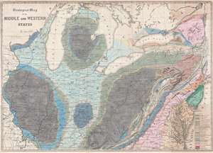
Geological Map of the Middle and Western States.
sold
- Digital Map Information
- Suitable for large format printing
- DPI: 300
- File Size: 17.64 MB
- File Type: ZIP / TIFF
- ICC color profile embedded
- Delivered instantly via download link
This is an 1843 James Hall geological map of the central United States. The map depicts the region from the Mississippi River to the Atlantic Ocean and from the Straits of Michilimackinac (Michillimaoinac) and Montreal, Canada to Virginia, Kentucky, and Missouri. As the first published map to use the 'New York System' of stratigraphic nomenclature, developed by Hall and other members of the New York Geological Survey, Hall's map is considered a landmark map in geological cartography. Rivers, lakes, and other physical features are also illustrated, with four of the five Great Lakes situated along the top. (more details)
'Duty, Honor, Country'.
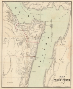
Map of West Point.
sold
- Digital Map Information
- Suitable for large format printing
- File Size: 9.18 MB
- File Type: ZIP / TIFF
- ICC color profile embedded
- Delivered instantly via download link
A rare 1844 map of the U.S. Military Academy at West Point, New York, by J. H. Colton. (more details)
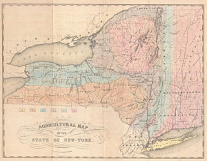
Agricultural Map of the State of New-York.
sold
- Digital Map Information
- Suitable for large format printing
- DPI: 300
- File Size: 17.64 MB
- File Type: ZIP / TIFF
- ICC color profile embedded
- Delivered instantly via download link
This is a rarely seen 1846 thematic of New York by E. Emmons and G. & W. Endicott. Divides the state of New York, as well as neighboring states of Connecticut, Massachusetts, New Hampshire and Vermont, into six distinct agricultural zones. It is ... (more details)
First edition of Hill's iconic 'Launching Print' View of Portland Maine.
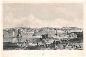
Portland, Me. To the Citizens of Portland, this picture is most respectfully dedicated by the publishers. Smith Brothers and Co.
sold
- Digital Map Information
- Suitable for large format printing
- File Size: 117.05 MB
- File Type: ZIP / TIFF
- ICC color profile embedded
- Delivered instantly via download link
Euphemistically known as the 'Launching Print,' this 1855 first edition view by John William Hill is perhaps the best-known image view of Portland, Maine predating the 1866 Great Fire of Portland and the American Civil War (1861 - 1865). The view looks on Portland from the shores of Cape Elizabeth to the southwest, across the Fore River, with Casco Bay on the right. It reveals a lively city with a bustling port. On the Fore River, just left of center, the steam ship Daniel Webster stands out. At the right-hand side of the print Munjoy Hill land the Observatory are apparent. In the foreground a large ship is in dry dock is nearly ready to launch and spectators line the shore waiting for the event, hence the euphemistic name, 'Launching Print.' (more details)
Where Bachelder mastered viewmaking.
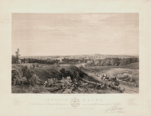
Lewiston, Maine. To the Citizens of Lewiston this picture is most respectfully dedicated by the Publisher John D. Bachelder.
sold
- Digital Map Information
- Suitable for large format printing
- File Size: 14.45 MB
- File Type: ZIP / TIFF
- ICC color profile embedded
- Delivered instantly via download link
An outstanding two-color 1856 lithograph view of Lewiston, Maine, by John D. Bachelder, the famous chronicler of the Battle of Gettysburg. (more details)
First transcontinental railroad.
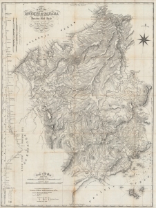
Map of the Isthmus of Panama representing the line of the Panama Rail Road as constructed under the direction of George M. Totten, chief engineer etc.
sold
- Digital Map Information
- Suitable for large format printing
- File Size: 51.16 MB
- File Type: ZIP / TIFF
- ICC color profile embedded
- Delivered instantly via download link
A fascinating 1857 folding map of Panama, highlighting the course of the recently-completed Panama Railroad and the proposed Panama Canal. It was produced by George Totten, the railroad's chief engineer, relying on earlier surveys by Thomas Harrison. (more details)
The most iconic view of the Battle of Gettysburg.
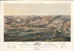
Gettysburg Battle-Field.
sold
- Digital Map Information
- Suitable for large format printing
- File Size: 48.93 MB
- File Type: ZIP / TIFF
- ICC color profile embedded
- Delivered instantly via download link
A remarkable and scarce 1863 proof state of the most iconic view of the American Civil War Battle of Gettysburg printed. This bird's-eye view of the Battle of Gettysburg was issued by John Bachelder just months after the actual event. Within days of the battle, Bachelder arrived in Gettysburg where he spent the subsequent 84 days completing a meticulous study of both the battle and the battlefield. Bachelder walked the field daily, interviewed thousands of recovering soldiers on both sides, both commanders and enlisted men, and reconstructed all three days of the battle. (more details)
A scarce proof state of the most iconic view of the Battle of Gettysburg ever published.
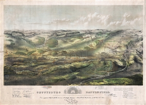
Gettysburg Battle-Field.
sold
- Digital Map Information
- Suitable for large format printing
- File Size: 37.34 MB
- File Type: ZIP / TIFF
- ICC color profile embedded
- Delivered instantly via download link
A remarkable and scarce 1863 proof state of the most iconic view of the American Civil War Battle of Gettysburg printed. This bird's eye view of the Battle of Gettysburg was issued by John Bachelder just months after the actual event. Within days ... (more details)
The most iconic view of the Battle of Gettysburg.
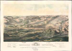
Gettysburg Battle-Field.
sold
- Digital Map Information
- Suitable for large format printing
- File Size: 43.53 MB
- File Type: ZIP / TIFF
- ICC color profile embedded
- Delivered instantly via download link
A remarkable and scarce 1863 proof state of the most iconic view of the American Civil War Battle of Gettysburg printed. This bird's eye view of the Battle of Gettysburg was issued by John Bachelder just months after the actual event. Within days of the battle, Bachelder arrived in Gettysburg where he spent the subsequent 84 days completing a meticulous study of both the battle and the battlefield. Bachelder walked the field daily, interviewed thousands of recovering soldiers on both sides, both commanders and enlisted men, and reconstructed all three days of the battle. (more details)
Turning Point of the Civil War.
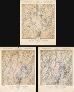
Map of the Battle Field of Gettysburg. July 1st, 2nd, 3rd 1863. First Day's Battle / Second Day's Battle / Third Day's Battle.
sold
- Digital Map Information
- Suitable for large format printing
- Full resolution TIFF file
- ICC color profile embedded
- Delivered instantly via download link
This is John Badger Bachelder's foundational 1876 set of three large-format maps of the Battle of Gettysburg, the definitive turning point of the American Civil War (1861 - 1865). Bachelder had dedicated much of the 13 years since the battle had taken place to researching it, making him the foremost authority on it, resulting in these maps being the definitive contemporaneous account. (more details)