
Fort Dearborn Publishing Company (sold)

The Fort Dearborn Publishing Company (fl. c. 1893 - 1905) was an American publishing firm based in Chicago, Illinois. The firm published atlases, books, cookbooks, and separate maps. John F. Waite served as the president from at the latest 1896 until at least 1903 and the firm operated out of 415 and 417 Dearborn Street in Chicago.
A detailed advertising map of the Philippines published during the Philippine-American War.
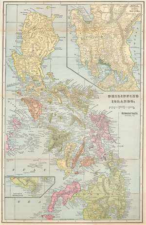
Philippine Islands.
sold
- Digital Map Information
- Suitable for large format printing
- File Size: 21.86 MB
- File Type: ZIP / TIFF
- ICC color profile embedded
- Delivered instantly via download link
This is a rare c. 1899 Fort Dearborn Publishing Company and Northwestern Yeast Company map of the Philippines. The map depicts the entire archipelago, with an inset in the upper right focusing on the Central Luzon region in the vicinity of Manila Bay and a second inset detailing southern Mindanao. (more details)
Red overprinted numbers announcing the size of each state's Congressional delegation provide an interesting look into the history of American representative government.
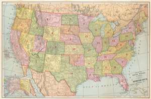
Map of the United States of America.
sold
- Digital Map Information
- Suitable for large format printing
- File Size: 21.62 MB
- File Type: ZIP / TIFF
- ICC color profile embedded
- Delivered instantly via download link
This is a rare c. 1899 Fort Dearborn Publishing Company and Northwestern Yeast Company map of the United States. States and territories are shaded different colors to allow for easy differentiation. The extensive rail network is illustrated, although is completely unlabeled. (more details)