
Gunnison, John Williams (sold)
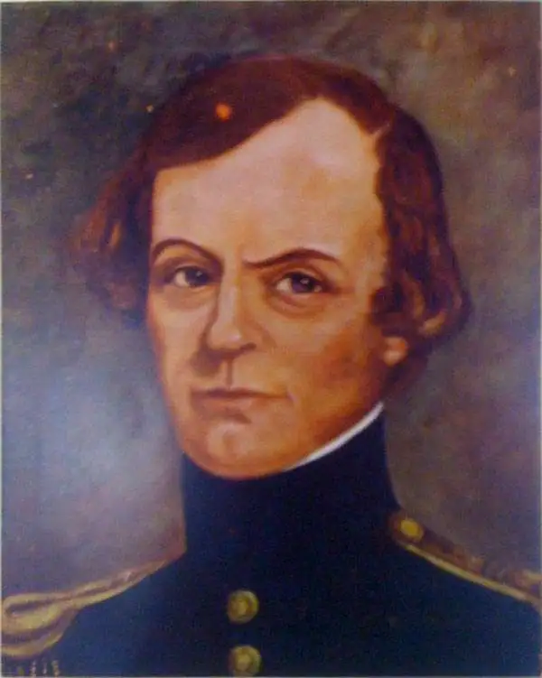
John Williams Gunnison (November 11, 1812 - October 26, 1853) was a surveyor and officer in the U.S. Army. Born in New Hampshire, he attended West Point starting in 1837 and graduated second in his class. After serving as an artillery officer in fighting against the Seminoles in Florida, he was reassigned due to health reasons and joined the Army's Corps of Topographical Engineers. He spent most of the 1840s surveying lands around the Great Lakes, and in 1849 served as second-in-command to Howard Stansbury's expedition to map the Great Salt Lake. In addition to his cartographic work, Gunnison spent considerable time interacting with Mormons and wrote a book about the people and their religion on returning to Washington D.C. After additional surveying work around the Great Lakes in present-day Wisconsin, in 1853 Gunnison was assigned to lead an expedition to survey a railroad route through Utah (the Gunnison–Beckwith Expedition). While doing so, he was killed in a massacre committed by Pahvant Ute Indians, who had likely mistaken his surveying team for a group of Mormons, with whom the Pahvant were fighting a low-level war (the Walker War). In the context of existing tensions between the U.S. Government and Mormon settlers, rumors swirled that Brigham Young had orchestrated the massacre to prevent the railroad's construction, a charge which later investigations found to be baseless, but which nevertheless was widely believed at the time. The incident was one of several that increased mistrust between Mormons and the U.S. Government in the lead up to the Utah War of 1857 - 1858.
1852 Stansbury Map of the Great Salt Lake to Fort Leavenworth Route (Colorado, Utah, Wyoming, Kansas
A seminal mapping of the emigrant roads west.
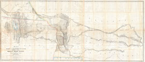
Map of a Reconnoissance between Fort Levenworth and the Missouri River, and the Great Salt Lake in the Territory of Utah, made in 1849 and 1850 …
sold
- Digital Map Information
- Suitable for large format printing
- DPI: 300
- File Size: 51.86 MB
- File Type: ZIP / TIFF
- ICC color profile embedded
- Delivered instantly via download link
It had been a daring feat of exploration, succeeding where the mountain men had all failed, and by means of his map ... Stansbury had painted at least one more bold stroke into the unfinished portrait of the national landscape. - William Goetzmann This ... (more details)
“Scientific cartography of the Territory of Utah may be said to date from the appearance of this map”-C. I. Wheat
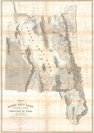
Map of the Great Salt Lake and Adjacent Country in the Territory of Utah.
sold
- Digital Map Information
- Suitable for large format printing
- DPI: 300
- File Size: 41.47 MB
- File Type: ZIP / TIFF
- ICC color profile embedded
- Delivered instantly via download link
It had been a daring feat of exploration, succeeding where the mountain men had all failed, and by means of his map of the western portion of the lake, Stansbury had painted at least one more bold stroke into the unfinished portrait of the national ... (more details)
“Scientific cartography of the Territory of Utah may be said to date from the appearance of this map”-C. I. Wheat
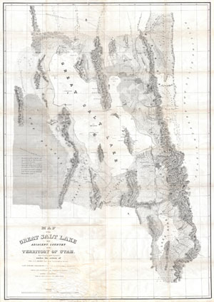
Map of the Great Salt Lake and Adjacent Country in the Territory of Utah.
sold
- Digital Map Information
- Suitable for large format printing
- Full resolution TIFF file
- ICC color profile embedded
- Delivered instantly via download link
It had been a daring feat of exploration, succeeding where the mountain men had all failed, and by means of his map of the western portion of the lake, Stansbury had painted at least one more bold stroke into the unfinished portrait of the national ... (more details)
Surveying the Great Salt Lake.
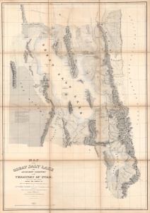
Map of the Great Salt Lake and Adjacent Country in the Territory of Utah.
sold
- Digital Map Information
- Suitable for large format printing
- Full resolution TIFF file
- ICC color profile embedded
- Delivered instantly via download link
An iconic map of the American West, this is a beautiful presentation edition of Howard Stansbury's crucial mapping of the Great Salt Lake, the earliest accurate survey of the region. Originally published in 1852 as part of the Stansbury Report presented to the U.S. Congress that year, the present example is mounted on linen and folds into a case, as it was intended for a member of Congress. This is, hands down, the finest example we've seen of this map, and if you're considering it for your collection, this is the one you want. (more details)
Early surveying expedition to the American West.
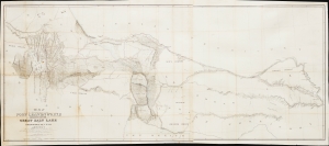
Map of a Reconnaissance between Fort Leavenworth and the Missouri River, and the Great Salt Lake in the Territory of Utah, made in 1849 and 1850…
sold
- Digital Map Information
- Suitable for large format printing
- File Size: 35.01 MB
- File Type: ZIP / TIFF
- ICC color profile embedded
- Delivered instantly via download link
This is Howard Stansbury's seminal 1852 map of the lands between Fort Leavenworth, Kansas, and Pilot Peak (now Nevada), west of the Great Salt Lake. It was published as part of the Stansbury Report presented to the U.S. Congress. (more details)
Early surveying expedition to the American West.
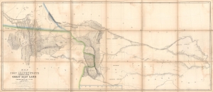
Map of a Reconnaissance between Fort Leavenworth and the Missouri River, and the Great Salt Lake in the Territory of Utah, made in 1849 and 1850…
sold
- Digital Map Information
- Suitable for large format printing
- Full resolution TIFF file
- ICC color profile embedded
- Delivered instantly via download link
A monumental map, matching the landscape it depicts, this is Howard Stansbury's seminal map of the lands between Fort Leavenworth, Kansas, and Pilot Peak (now Nevada), west of the Great Salt Lake. Originally published in 1852 as part of the Stansbury Report presented to the U.S. Congress that year, the present example is mounted on linen and folds into a case, as it was intended for a member of Congress. This is hand-down the finest example we've seen of this map, and if you are considering it for your collection, this is the one you want. (more details)