
Handtke, Friedrich (sold)

Friedrich Handtke (December 7, 1815 - January 25, 1879) was a German engraver and cartographer active in the second half of the 19th century. Handtke was formally trained as a surveyor in the Prussian army. Following his discharge in 1838 he took a position as the head of cartography at the Głogów, Poland, publishing house of Carl Flemming. Initially, Handtke, in an attempt to hide his youth, inscribed his map publications as "Dr. Karl Sohr". From 1838 to 1874, Handtke and Flemming issued some 260 maps, about 168 of which Handke drew himself. Both Flemming and Handke died in 1879 leaving the powerful Flemming publishing house without its heads. Nonetheless, the firm continued to publish, and republish, well into the 20th century. Głogów, where Handtke was based, is currently part of modern day Poland's Lower Silesian Voivodeship.
Important early Civil War Map illustrating the first major Union victory on the Mississippi River at New Madrid or the Kentucky Bend.
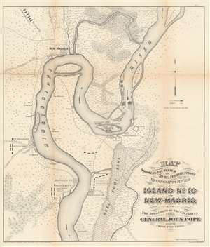
Map showing the system of rebel fortifications on the Mississippi River at Island No. 10 and New Madrid, also the operations of the U.S. forces under General John Pope against these positions.
sold
- Digital Map Information
- Suitable for large format printing
- File Size: 20.91 MB
- File Type: ZIP / TIFF
- ICC color profile embedded
- Delivered instantly via download link
A scarce and important 1862 Civil War map illustrating the course of the Mississippi River in the vicinity of New Madrid, Point Pleasant, Riddles Point, and Tiptonville. This region, collectively known as the Kentucky Bend, is situated at the meeting point of Missouri, Kentucky, and Tennessee. The map was prepared by Major General John Pope, a Union Commander, to illustrate his decisive siege and take over the strategically situated and heavily fortified Island No. 10. Located just upriver from New Madrid, Island No. 10 is situated at a sharp northward curve in the Mississippi. The Confederate Army fortified the island realizing that, if they could control Island No. 10, they could effectively prevent Union forces from using the Mississippi as gateway to the Deep South. (more details)
Important early Civil War Map illustrating the first major Union victory on the Mississippi River at New Madrid or the Kentucky Bend.
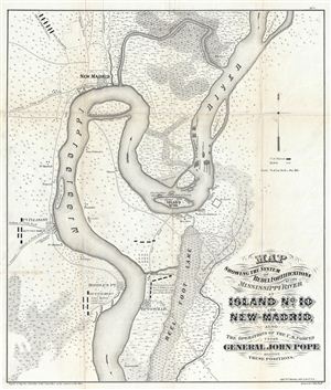
Map showing the system of rebel fortifications on the Mississippi River at Island No. 10 and New Madrid, also the operations of the U.S. forces under General John Pope against these positions.
sold
- Digital Map Information
- Suitable for large format printing
- File Size: 11.68 MB
- File Type: ZIP / TIFF
- ICC color profile embedded
- Delivered instantly via download link
A scarce and important 1862 Civil War map illustrating the course of the Mississippi River in the vicinity of New Madrid, Point Pleasant, Riddles Point, and Tiptonville. This region, collectively known as the Kentucky Bend, is situated at the meeting point of ... (more details)
The Height of the Scramble for Africa.
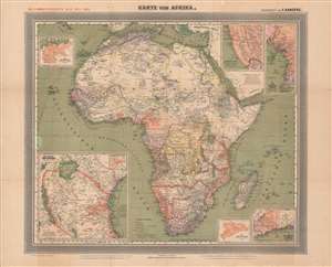
General-Karte von Afrika.
sold
- Digital Map Information
- Suitable for large format printing
- Full resolution TIFF file
- ICC color profile embedded
- Delivered instantly via download link
This is a large-format 1889 German map of Africa from the height of the 'Scramble for Africa' drawn by Friedrich Handtke and published by Carl Flemming. It depicts both European colonies and indigenous kingdoms and confederations, and in particular highlights the recently-established German colonies on the continent. (more details)
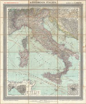
Konigreich Italien.
sold
- Digital Map Information
- Suitable for large format printing
- File Size: 37.2 MB
- File Type: ZIP / TIFF
- ICC color profile embedded
- Delivered instantly via download link
An appealing c. 1890 large format map of Italy issued by Carl Flemming and Friedrich Handtke. The map covers the Italian peninsula in full from the Alps to Sicily, including Malta, Sardinia, Pantelleria, and Corsica. An inset map in the lower left quadrant ... (more details)