
Hardy, John (sold)

John Hardy (September 19, 1835 - December 9, 1913) was born in Scotland on September 19, 1835. At four he, along with his parents, immigrated to the United States and settled in New York City. There he attended public schools and in 1853 graduated from the College of the City of New York, where he studied law. In 1861 he was admitted to the New York Bar and in the same year took a seat on the New York State Assembly. He later was elected to the Board of Alderman of New York City and held this post, on and off, from 1863 to 1869. In 1870 and again in 1871 he held the position of Clerk of the Common Council of New York City. In this position, like Valentine and Shannon before him, he published an annual Manual of the Corporation of the City of New York, which detailed the events of the year, Common Council minutes, offered an assortment of maps, and included political and historical notes on the city. Late, in 1877, he became the Chief Clerk to the Mayor and in 1881 was elected on the Democratic ticket to the United States Congress, a position he held until 1885. He died on December 9, 1913 and is interred in Greenwood Cemetery, Brooklyn.
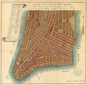
Plan of the City of New York, with the recent and intended Improvements, Drawn from actual survey by William Bridges City Surveyor; AD 1807.
sold
- Digital Map Information
- Suitable for large format printing
- File Size: 6.63 MB
- File Type: ZIP / TIFF
- ICC color profile embedded
- Delivered instantly via download link
An interesting and unusual map, this is William Bridges' 1807 revival or the failed 1801 Mangin-Goerck Plan. Those who know New York's shoreline will pause at the perfect blocks and ridged angles of this plan no more accurate today than it was in 1801 when Mangin ... (more details)
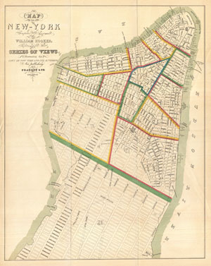
Map of the City of New-York Compiled & Surveyed by William Hooker.
sold
- Digital Map Information
- Suitable for large format printing
- File Size: 5.86 MB
- File Type: ZIP / TIFF
- ICC color profile embedded
- Delivered instantly via download link
This is an unusual map of New York City first issued in 1831 by William Hooker and Peabody. This example is a reissue, apparently from the same plate, dating to the Hardy edition of the Manual of the Corporation of New York , 1871. Perhaps this map's most ... (more details)
Unusual political map of Victorian New York.
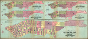
Map of the City of New York, Showing its Political Divisions and Subdivisions November 1870.
sold
- Digital Map Information
- Suitable for large format printing
- File Size: 20.1 MB
- File Type: ZIP / TIFF
- ICC color profile embedded
- Delivered instantly via download link
This large map 1870 map of New York City is actually five maps in one. Each map is drawn to illustrate one aspects of the political terrain of New York City in 1870. The primary map, which stretches through the lower quadrants, details the political ... (more details)
1871 Map of Manhattan Fire Departments.
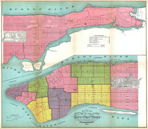
Map of the Boundaries of the Fire Department of the City of New York Made under the direction of the Fire Comissioners.
sold
- Digital Map Information
- Suitable for large format printing
- File Size: 10.31 MB
- File Type: ZIP / TIFF
- ICC color profile embedded
- Delivered instantly via download link
This is large map 1871 map of New York City's fire departments. Covering all of Manhattan, this map defines which fire battalions and brigades are in charge of each area. When Hardy issued this map there were but nine fire battalions in Manhattan. ... (more details)
1871 Map of Manhattan Police Departments.
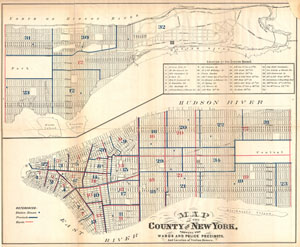
Map of the County of New York, Showing the Wards and Police Precincts, And Location of Station Houses.
sold
- Digital Map Information
- Suitable for large format printing
- File Size: 7.49 MB
- File Type: ZIP / TIFF
- ICC color profile embedded
- Delivered instantly via download link
This is large map 1871 map of New York City's Wards and Police Precincts. Covering all of Manhattan in two sections, this map details the locations of Police Departments, Station Houses, Wards, and Precincts – many of these Police Departments ... (more details)