
Harris, Thaddeus Mason (sold)
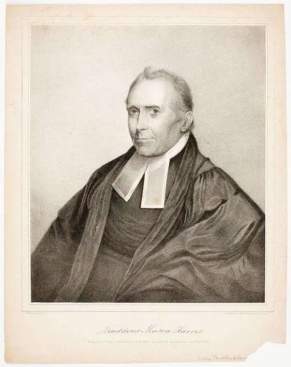
Thaddeus Mason Harris (July 7, 1768 - April 3, 1842) was a Harvard librarian, Unitarian minister and author. He was born in Charlestown, Massachusetts. After his father’s death while fighting on the colonial side in the American Revolutionary War, Harris was sent to live on a farm in Sterling, Massachusetts. Harris studied at Harvard University and graduated in 1787. Following his graduation, Harris spent a year as a school teacher in Worcester, Massachusetts, after which he was offered an appointment as secretary to George Washington. Unfortunately he contracted small-pox, and his lengthly recovery prevented him from taking the post. In 1791, Harris became the librarian at Harvard and was appointed as the minister of the First Unitarian Church on Meeting House Hill in Dorchester, Massachusetts, in 1793. In 1806, he was elected as a Fellow of the American Academy of Arts and Sciences and was also a founding member of the American Antiquarian Society in 1812. He served as corresponding secretary for the Antiquarian Society from 1812-1831, and as secretary of foreign correspondence from 1831-1832.
The earliest sepcific map of Ohio. Depicts the Connecticut Western Reserve, Virginia Military District, and lands of the Ohio Company.
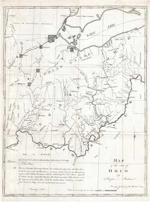
Map of the State of Ohio.
sold
- Digital Map Information
- Suitable for large format printing
- DPI: 300
- File Size: 6.29 MB
- File Type: ZIP / TIFF
- ICC color profile embedded
- Delivered instantly via download link
This is an 1804 Rufus Putnam map of Ohio –the earliest specific map of the fledgling state. The map depicts the Ohio only a year after its statehood, covering from the Detroit District and Lake Erie to Kentucky and Virginia and from the 'Indian Boundary Line' to ... (more details)
Details the relative location of the Marietta Earthworks within the city.
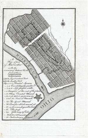
A Plan of part of Marietta with the remains of Antient Works found there.
sold
- Digital Map Information
- Suitable for large format printing
- DPI: 300
- File Size: 1.01 MB
- File Type: ZIP / TIFF
- ICC color profile embedded
- Delivered instantly via download link
This is an 1805 Thaddeus Mason Harris map of part of the town of Marietta, Ohio, the first permanent United States settlement in the Northwest Territory. The map depicts the town of Marietta from the Muskingum River to east of town and from just north of town to ... (more details)
Depicts the course of the Allegheny and Monongahela in detail - labels Morgantown and Pittsburgh!
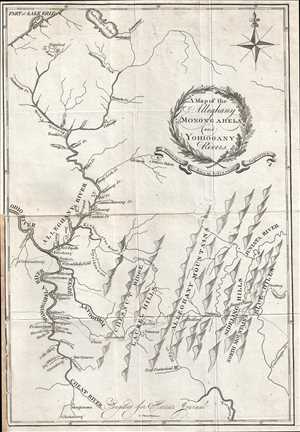
A Map of the Alleghany Monongahela and Yohiogany Rivers.
sold
- Digital Map Information
- Suitable for large format printing
- DPI: 300
- File Size: 2.99 MB
- File Type: ZIP / TIFF
- ICC color profile embedded
- Delivered instantly via download link
This is an extremely scarce 1805 Thaddeus Mason Harris map of his journey through the region surrounding the confluence of the Alleghany and Monongahela Rivers at Pittsburgh (Pittsburg), Pennsylvania. The map depicts the region from the Ohio River to Strasburg, ... (more details)
Incredible view of the Marietta Earthworks - and ancient ceremonial site constructed by the Hopewell Culture.
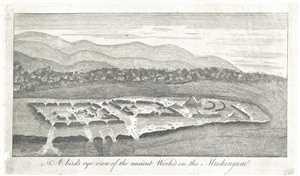
A bird's eye view of the ancient Works on the Muskingum.
sold
- Digital Map Information
- Suitable for large format printing
- DPI: 300
- File Size: 2.67 MB
- File Type: ZIP / TIFF
- ICC color profile embedded
- Delivered instantly via download link
This is an 1805 Thaddeus Mason Harris view of the 'ancient works' along the Muskingum River in Ohio, known today as the Marietta Earthworks. The view depicts the earthworks in some detail, although all that is easily discernable is the different shapes of ... (more details)
Land used by Virginia to pay its American Revolutionary War veterans.
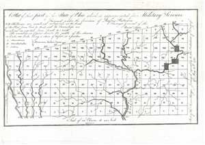
A Plat of theat part of the State of Ohio which is appropriated for Military Services.
sold
- Digital Map Information
- Suitable for large format printing
- DPI: 300
- File Size: 1.48 MB
- File Type: ZIP / TIFF
- ICC color profile embedded
- Delivered instantly via download link
This is an 1805 Rufus Putnam map of the Virginia Military District in present-day Ohio. The map depicts the District from Range I to Range XX and from Township I to Township X within the Plat. Rivers and streams are illustrated within the District, and ... (more details)