
Hayden, Ferdinand Vandeveer (sold)
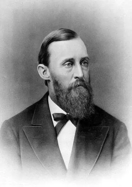
Ferdinand Vandeveer Hayden (September 7, 1829 - December 22, 1887) was an American geologist remembered for leading late 19th century pioneering surveying expedition in the Rocky Mountains and served as a doctor in the Union Army during the U.S. Civil War. Born in Westfield, Massachusetts, and discovered a fascination with nature and wildlife in his youth. He studied at Oberlin College and graduated in 1850, then attended the Albany Medical College and earned his degree in 1853. While at Albany, Hayden garnered the attention of Professor James Hall, then the state geologist of New York. Professor Hall convinced Hayden to join an expedition to the Nebraska Territory, where he collected fossils and studied geology. He accompanied expeditions led by Gouverneur K. Warren in 1856 and 1857 and the Raynolds Expedition of 1860 led by Captain William F. Raynolds. He served as an army surgeon during the U.S. Civil War and rose to become the chief medical officer of the Army of the Shenandoah. After the war, Hayden resumed working on geologic and geographic surveys in the Nebraska and Western Territories and was appointed geologist-in-chief of the United States Geological and Geographical Survey of the Territories in 1867. Hayden led the first federally funded geological survey into the Yellowstone Region in northwestern Wyoming in 1871 under orders from Secretary of the Interior Columbus Delano. The expedition included fifty men, including painter Thomas Moran and Civil War photographer William Henry Jackson. Hayden's report on the expedition, Preliminary Report of the United State Geological Survey of Montana and Portions of Adjacent Territories; Being a Fifth Annual Report of Progress played an instrumental role in persuading Congress to establish Yellowstone as the first U.S. National Park.
Grand map of Grand Teton.
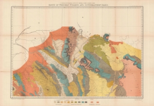
Parts of western Wyoming and southeastern Idaho.
sold
- Digital Map Information
- Suitable for large format printing
- File Size: 46.2 MB
- File Type: ZIP / TIFF
- ICC color profile embedded
- Delivered instantly via download link
A brightly colored, large-format map of Grand Teton and surrounding mountains produced in 1878 by the U.S. Geological and Geographical Survey of the Territories, forerunner to the U.S. Geological Survey. It is among the earliest mappings of this region, and certainly was the most comprehensive at the time of publication. (more details)
Grand map of Grand Teton.
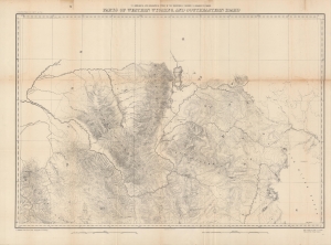
Parts of western Wyoming and southeastern Idaho.
sold
- Digital Map Information
- Suitable for large format printing
- File Size: 43.83 MB
- File Type: ZIP / TIFF
- ICC color profile embedded
- Delivered instantly via download link
A detailed large-format map of Grand Teton and surrounding mountains produced in 1878 by the U.S. Geological and Geographical Survey of the Territories, forerunner to the U.S. Geological Survey. It is among the earliest mappings of this region, and certainly was the most comprehensive at the time of publication. (more details)
Yellowstone's geology.
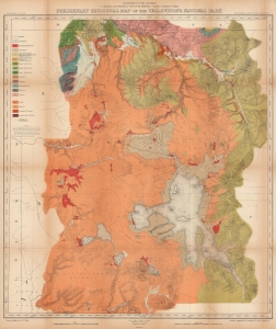
Preliminary Geological Map of the Yellowstone National Park.
sold
- Digital Map Information
- Suitable for large format printing
- File Size: 150.13 MB
- File Type: ZIP / TIFF
- ICC color profile embedded
- Delivered instantly via download link
This is an 1878 Ferdinand V. Hayden geological map of Yellowstone National Park. Published only six years after the park's creation, this map represents one of the great American 19th century survey expeditions. Hayden's work was instrumental in inspiring Congress to create Yellowstone National Park, and the park system as an institution, in 1872. (more details)
Early illustrations of the American West.
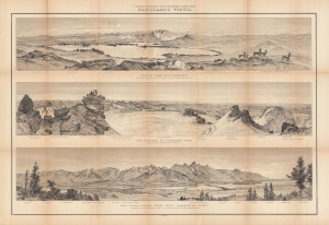
Panoramic views : Glacial lake and moraines on New Fork of Green River - Wind River Mountains ; the glaciers of Fremont's Peak, Wind River Mountains, Wyoming ; the Teton Range from upper Grosventre Butte looking west, with the valley of Snake River in the foreground.
sold
- Digital Map Information
- Suitable for large format printing
- File Size: 57.99 MB
- File Type: ZIP / TIFF
- ICC color profile embedded
- Delivered instantly via download link
A stunning set of views drawn by William Henry Holmes, produced in 1878 by Ferdinand Vandeveer Hayden and the U.S. Geological and Geographical Survey of the Territories (USGGST), the forerunner to the U.S. Geological Survey. They display panoramas of portions of the Wind River and Teton Ranges in Wyoming. (more details)