
H.M. Gousha Company (sold)

H.M. Gousha Company (1926 - 1961) was one of the major publishers of road maps and atlases during the mid-20th century. Founded in Chicago 1926 by former Rand McNally sales executive Harry Mathais Gousha, Gousha quickly became a competitor of Rand McNally thanks to its Touraide, a spiral-bound book with road maps, points of interest, and accommodations that was custom assembled for each client. Gousha moved its headquarters to San Jose, California in 1947. In 1961, the firm was acquired by the Times Mirror Company, and then by Simon and Schuster in 1987. What remained of Gousha was finally acquired by Rand McNally in 1996, and subsequently much of the company's archives were donated to the Newberry Library.
Highlights the Statue of Liberty, the Empire State Building, and Rockefeller Center.
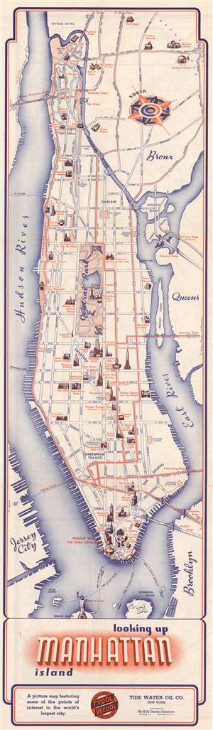
Looking Up Manhattan Island.
sold
- Digital Map Information
- Suitable for large format printing
- File Size: 13.2 MB
- File Type: ZIP / TIFF
- ICC color profile embedded
- Delivered instantly via download link
This is a 1936 H.M. Gousha Company pictorial map of New York City. The map depicts the island of Manhattan from the Hudson River to Queens and from the Poe Cottage in the Bronx to Liberty Island and the Statue of Liberty. Profile illustrations of famous sites dot Manhattan from one end to the other, with the Empire State Building, the Chrysler Building, the Metropolitan Museum of Art, the American Museum of Natural History, and Trinity Church among the highlights. Columbia University, the Met Cloisters, Hamilton Grange, Washington Square and the Arch, and Rockefeller Center are also illustrated. Yankee Stadium, the New York Botanical Garden, and the Bronx Zoo are shown in the Bronx. The newly-opened Triborough Bridge, Queensborough Bridge, Williamsburg Bridge, Manhattan Bridge, and Brooklyn Bridge are all illustrated, as is the Holland Tunnel, although it is marked only by dashed lines. (more details)
Florida's Waterfront Wonderland.
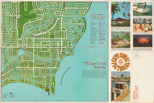
This is an unrecorded c. 1966 Gulf American Land Corporation and H. M. Gousha map of Cape Coral, Florida. It presents the community when it was ground zero for Florida's Postwar population boom, one of the fastest growing areas in one of the fastest growing states in the country. (more details)
Florida travel.
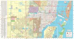
An uncommon 1973 H. M. Gousha travel map of Miami and Miami Beach, Florida. Printed on both recto and verso, this folding pamphlet map covers the area in detail, noting island, communities, causeways, roads, parks, lakes, municipal buildings, and more. The recto (front) covers from North Kendall Drive and Key Biscayne to the La Gorce Country Club. The verso (back) extends the map northward from La Gorce to the Dade / Broward border. (more details)