
Hollar, Wenceslaus (sold)
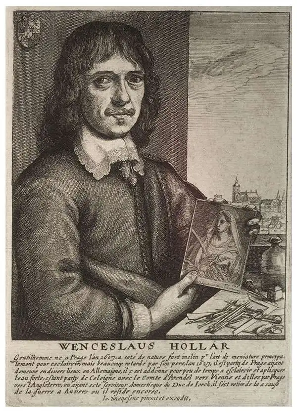
Wenceslaus Hollar (July 23, 1607 - March 25, 1677) was a Czech / Bohemian artist, etcher and engraver, much of whose life was spent in England. He is known primarily for his engravings and etchings, of which nearly 2800 plates are known. These include a number of excellent maps and city views. He was born in Prague where he initially studied law. The 1620 Sack of Prague during the Thirty Years' War (1618 - 1648) ruined his family's fortunes. Hollar came out of the disruption on the path to becoming an artist. His earliest known works are small engravings, one of which was a copy of a Dürer 'Virgin and Child' and the other is very likely a 1625 outline map of Europe. By 1627 he was in Frankfurt, apprenticed to engraver Matthias Merian (1593 - 1650). Following his apprenticeship, he traveled throughout the Rhineland producing views of towns, castles, and landscapes. His work eventually attracted the notice and patronage of nobleman and art collector Thomas Howard, 21st Earl of Arundel (1585 - 1646). Hollar traveled with Howard from 1636 as a draftsman for the Earl's diplomatic mission to the court of Holy Roman Emperor Ferdinand II (1578 - 1637), as well as to Vienna and Prague. He also accompanied Arundel to England in 1637, where he remained for many years attached to the earl's household. He was not exclusively in the Earl's employ, producing work for many authors and publishers. He produced some very famous views of London following the Great Fire, and was sent in 1668 by the King to Tangier in order to produce views of the towns and forts there. He produced a number of maps for Richard Blome's subscription atlas, the first English atlas actually engraved in England. Unfortunately, his ties with the loyalists during the English Civil War (1642 - 1651) sharply affected his sales, and his patronage declined. He appears not to have been a particularly apt businessman: a friend is recorded as having said of him that he was, 'a very friendly good-natured man as could be, but shiftlesse to the world.' It cannot have helped matters that he only charged a shilling an hour for his labors. Despite the quality of his work, he would die in poverty.
Strikingly engraved view of Jerusalem at the time of Solomon's Temple.
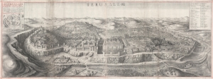
Ierusalem. Hierusalem Veteris Imago Vera.
sold
- Digital Map Information
- Suitable for large format printing
- DPI: 600
- File Size: 124.93 MB
- File Type: ZIP / TIFF
- ICC color profile embedded
- Delivered instantly via download link
A spectacularly engraved large-scale 1660 Wenceslaus Hollar bird's-eye of Jerusalem during the period of the Solomon's Temple. The view is based upon the 1604 writings and drawings of Juan Bautista Villalpando (Villalpandus; 1552 - 1608), a Spanish Jesuit of Sephardic ancestry. The work, although mostly imaginary, proved highly influential. (more details)
One of the First Maps of China engraved in England.
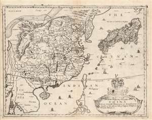
A New Mapp of y Empire of China With its severall Provinces or Kingdomes Together with the adjacent Isles of Japon or Niphon Formosa Hainan etc.
sold
- Digital Map Information
- Suitable for large format printing
- Full resolution TIFF file
- ICC color profile embedded
- Delivered instantly via download link
This is the scarce 1682 Richard Blome map of China, Korea, and Japan. This richly-detailed and surprisingly unique map was engraved in 1669 by the great Bohemian artist and etcher, Wenceslaus Hollar, who for most of his adult life practiced in his adopted England. Although most of the maps appearing in Blome's A Geographical Description of the Four Parts of the World were undisguised renditions of the work of the French geographer Nicolas Sanson, this map is derived from the work of Martino Martini, at least in part, via the atlas of China printed by Joan Blaeu in 1655.
Superficially, the map resembles the 1655 Blaeu Imperii Sinarum Nova Descriptio but this is no slavish copy. First, the area in focus differs: the western limits of this map extend perhaps five degrees less than the Blaeu, ending in the region of Pegu, where the Blaeu continues to Bengal; the southern limit of the Blome is five degrees north, whereas the Blaeu ends just beyond fifteen degrees. As a result, the Blome exchanges Blaeu's western expanses of blank desert for a more complete depiction of the Philippines, and a fuller treatment of the region of Southeast Asia (Siam / Thailand and Cochinchina / Vietnam). (more details)
Superficially, the map resembles the 1655 Blaeu Imperii Sinarum Nova Descriptio but this is no slavish copy. First, the area in focus differs: the western limits of this map extend perhaps five degrees less than the Blaeu, ending in the region of Pegu, where the Blaeu continues to Bengal; the southern limit of the Blome is five degrees north, whereas the Blaeu ends just beyond fifteen degrees. As a result, the Blome exchanges Blaeu's western expanses of blank desert for a more complete depiction of the Philippines, and a fuller treatment of the region of Southeast Asia (Siam / Thailand and Cochinchina / Vietnam). (more details)