
Hughes, William

William Hughes (c. 1818 - May 21, 1876) was a cartographer, engraver, lithographer, printer, and publisher active in London during the middle part of the 19th century. Hughes enjoyed and long and varied cartographic career. He was elected a Fellow of the Royal Geographical Society in 1838 and, from about 1840, taught geography and mapmaking at St. Johns College for Civil Engineers. He later taught the same at both Queens College and Kings College, London. For a time he was employed as a map librarian for the British Museum. Hughes began engraving maps around 1839 and worked with most of the prominent British map and atlas publishers of his era, including but not limited to Charles Knight, A. and C. Black, George Philip, William Cassell, and others.
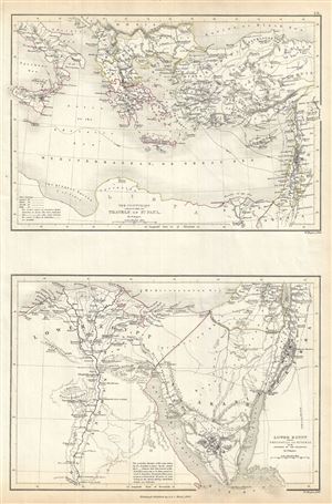
The Countries embraced within the Travels of St. Paul. Lower Egypt with the Peninsula of Mt. Sinai and the Journeys of the Israelites.
$100.00
Acquire
- Digital Map Information
- Suitable for large format printing
- Full resolution TIFF file
- ICC color profile embedded
- Delivered instantly via download link
This is a fine example of Adam and Charles Black's 1844 Biblical reference map of Greece, Italy, Asia Minor and Lower Egypt in antiquity. The map is divided into two parts: The upper map covers the countries traveled by St. Paul, which include Italy, Greece and ... (more details)
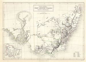
Part of Australia comprising the settled portions of New South Wales and South Australia.
$200.00
Acquire
- Digital Map Information
- Suitable for large format printing
- Full resolution TIFF file
- ICC color profile embedded
- Delivered instantly via download link
This is a fine example of Adam and Charles Black's 1844 map of South Australia, New South Wales and Victoria, Australia. It covers the settled areas of New South Wales and South Australia. Victoria, which became an independent colony separate from New South ... (more details)
Gold regions in New South Wales and Victoria.
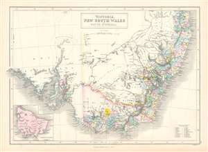
Victoria, New South Wales, and South Australia.
$150.00
Acquire
- Digital Map Information
- Suitable for large format printing
- Full resolution TIFF file
- ICC color profile embedded
- Delivered instantly via download link
This is an 1853 Adam and Charles Black map of New South Wales, Victoria, and South Australia, Australia. Updated because of intense interest surrounding the Australian Gold Rush, the region's gold deposits are highlighted in yellow. Twenty counties in New South Wales are numerically identified and correspond to a reference situated in the lower right corner. A handful of counties appear in South Australia around Adelaide and St. Vincent Gulf. All these counties are concentrated along the coastline with little inland detail, apart from river network in New South Wales. (more details)
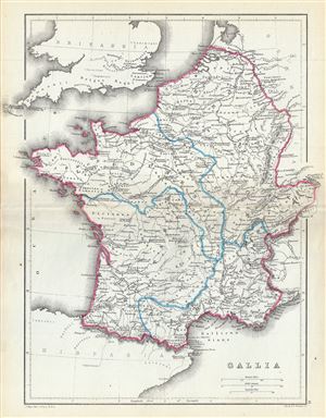
Gallia.
$100.00
Acquire
- Digital Map Information
- Suitable for large format printing
- File Size: 4.41 MB
- File Type: ZIP / TIFF
- ICC color profile embedded
- Delivered instantly via download link
A fine 1867 map of Gaul or Gallia or France by William Hughes. The map covers Gallia during the ancient Roman times and covers from the English Channel south as far as the Pyrenees Mountains and Hispania. It includes the modern day nations of France, ... (more details)
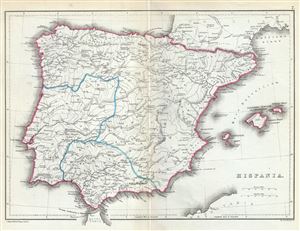
Hispania.
$100.00
Acquire
- Digital Map Information
- Suitable for large format printing
- File Size: 3.53 MB
- File Type: ZIP / TIFF
- ICC color profile embedded
- Delivered instantly via download link
This is a lovely 1867 map of Hispania or Spain and Portugal by William Hughes. The map depicts the Iberian Peninsula under the Roman Empire from the Atlantic Ocean to the Mediterranean Sea, including the Balearic Islands. The Roman provinces of ... (more details)
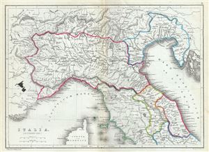
Italia (Northern Part).
$100.00
Acquire
- Digital Map Information
- Suitable for large format printing
- File Size: 3.89 MB
- File Type: ZIP / TIFF
- ICC color profile embedded
- Delivered instantly via download link
This is a fine 1867 William Hughes map of northern Italy during ancient Roman times. The map depicts the northern part of Italy from Lake Geneva in Switzerland to Lake Bolsena in Italy. The map identifies a host of important cities and towns ... (more details)
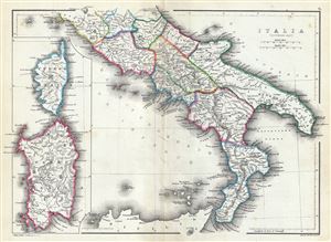
Italia (Southern Part).
$100.00
Acquire
- Digital Map Information
- Suitable for large format printing
- File Size: 4.06 MB
- File Type: ZIP / TIFF
- ICC color profile embedded
- Delivered instantly via download link
This is a fine 1867 William Hughes map of southern Italy during ancient Roman times. The map depicts the southern part of Italy from Lake Bolsena to Reggio in southern Italy. The map does not detail Sicily. An inset along the left border ... (more details)