
Hughes, William (sold)

William Hughes (c. 1818 - May 21, 1876) was a cartographer, engraver, lithographer, printer, and publisher active in London during the middle part of the 19th century. Hughes enjoyed and long and varied cartographic career. He was elected a Fellow of the Royal Geographical Society in 1838 and, from about 1840, taught geography and mapmaking at St. Johns College for Civil Engineers. He later taught the same at both Queens College and Kings College, London. For a time he was employed as a map librarian for the British Museum. Hughes began engraving maps around 1839 and worked with most of the prominent British map and atlas publishers of his era, including but not limited to Charles Knight, A. and C. Black, George Philip, William Cassell, and others.
Important Revolutionary war coastal chart of the Sea Islands in South Carolina, Georgia, and northern Florida.
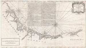
A Draught of South Carolina and Georgia from Sewee to St. Estaca.
sold
- Digital Map Information
- Suitable for large format printing
- DPI: 300
- File Size: 500.78 MB
- File Type: ZIP / TIFF
- ICC color profile embedded
- Delivered instantly via download link
A rare and important 1778 American Revolutionary War era Andrew Hughes nautical chart or maritime map of the coasts of South Carolina, Georgia, and northern Florida. During the early part of the Revolutionary War, this was the best obtainable nautical chart of the ... (more details)
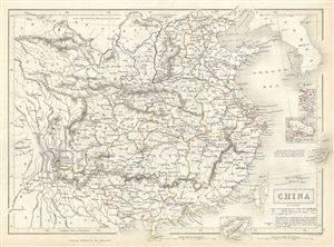
China.
sold
- Digital Map Information
- Suitable for large format printing
- Full resolution TIFF file
- ICC color profile embedded
- Delivered instantly via download link
This is a fine example of Adam and Charles Black's 1844 map of China. The map covers China from the Chinese Tartary to Hainan and from Assam in India to Korea (Corea), inclusive of Formosa or Taiwan. Four inset maps detail Amoy, Hong Kong, Zhoushan and Hainan. ... (more details)
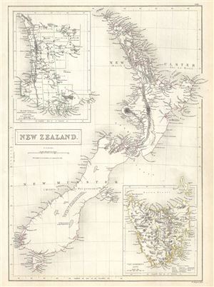
New Zealand.
sold
- Digital Map Information
- Suitable for large format printing
- Full resolution TIFF file
- ICC color profile embedded
- Delivered instantly via download link
This is a beautiful 1844 map of New Zealand by Adam and Charles Black. It covers the entire island country from Cape Reinga (C. Maria Van Diemen) to Stewart Island. An inset in the top left quadrant features the settled portion of Western Australia while ... (more details)
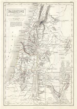
Palestine according to its Ancient Divisions.
sold
- Digital Map Information
- Suitable for large format printing
- Full resolution TIFF file
- ICC color profile embedded
- Delivered instantly via download link
This is a scarce 1844 Adam and Charles Black map of Ancient Palestine, Israel or the Holy Land. It covers the region as it existed in Biblical times with divisions for each of the Twelve Tribes of Israel and includes the modern day nations of Israel, ... (more details)
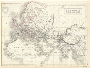
The World as known to the Ancients.
sold
- Digital Map Information
- Suitable for large format printing
- Full resolution TIFF file
- ICC color profile embedded
- Delivered instantly via download link
This is a fine example of Adam and Charles Black's 1844 map of the world of the Roman Empire. The map covers the span of world as known to the ancient Romans, from the Scandinavia south, as far as Sumatra. Includes all of Europe, Arabia, part of ... (more details)
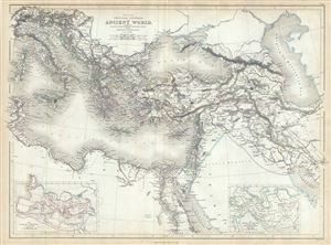
Map of the Principal Countries of the Ancient World extending from The Alps to the Southern Frontier of Egypt and from Carthage to Persepolis.
sold
- Digital Map Information
- Suitable for large format printing
- Full resolution TIFF file
- ICC color profile embedded
- Delivered instantly via download link
This is a scarce example of Adam and Charles Black's 1844 map of the principal counties of the Ancient World. The map depicts part of the Empire of Alexander the Great and covers from modern day Italy south as far as Egypt and from Corsica to ... (more details)
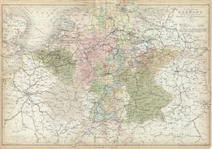
Map of Central Europe embracing Germany, Holland, Belgium, France, Switzerland; showing the Roads, Canals, and Railways.
sold
- Digital Map Information
- Suitable for large format printing
- DPI: 300
- File Size: 19.24 MB
- File Type: ZIP / TIFF
- ICC color profile embedded
- Delivered instantly via download link
This is a fine example of Adam and Charles Black's 1851 map of central europe. The map covers from Hamburg to Lake Geneva, including the modern day countries of Germany, Netherlands, Belgium, France, Poland, the Czech Republic and Austria. ... (more details)
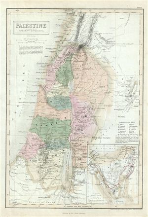
Palestine according to its Ancient Divisions.
sold
- Digital Map Information
- Suitable for large format printing
- DPI: 300
- File Size: 5.79 MB
- File Type: ZIP / TIFF
- ICC color profile embedded
- Delivered instantly via download link
This is a fine example of the Adam and Charles Black's 1851 map of Ancient Palestine, Israel or the Holy Land. It covers the region as it existed in Biblical times with divisions for each of the Twelve Tribes of Israel and includes the ... (more details)
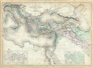
Map of the Principal Countries of the Ancient World extending from The Alps to the Southern Frontier of Egypt and from Carthage to Persepolis.
sold
- Digital Map Information
- Suitable for large format printing
- DPI: 300
- File Size: 19.52 MB
- File Type: ZIP / TIFF
- ICC color profile embedded
- Delivered instantly via download link
This is a fine example of Adam and Charles Black's 1851 map of the principal counties of the Ancient World. The map depicts part of the empire of Alexander the Great and covers from modern day Italy south as far as egypt and from ... (more details)
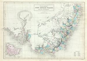
Part of Australia comprising the settled portions of New South Wales and South Australia.
sold
- Digital Map Information
- Suitable for large format printing
- DPI: 300
- File Size: 7 MB
- File Type: ZIP / TIFF
- ICC color profile embedded
- Delivered instantly via download link
This is a fine example of the 1851 Black Map of South Australia, New South Wales and Victoria, Australia. It covers the settled areas of New South Wales and South Australia. Victoria, which became an independent colony separate ... (more details)
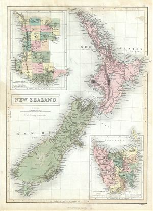
New Zealand.
sold
- Digital Map Information
- Suitable for large format printing
- DPI: 300
- File Size: 7.46 MB
- File Type: ZIP / TIFF
- ICC color profile embedded
- Delivered instantly via download link
This is a fine example of the 1851 Black Map of New Zealand. Various cities, towns, rivers, mountains, bays and several other topographical details are noted with relief shown by hachures. This map was engraved by William ... (more details)
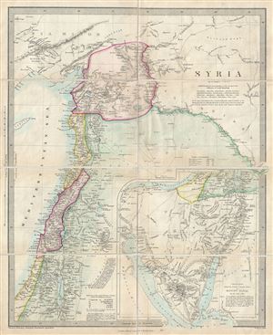
Syria.
sold
- Digital Map Information
- Suitable for large format printing
- File Size: 8.37 MB
- File Type: ZIP / TIFF
- ICC color profile embedded
- Delivered instantly via download link
This is a scarce 1858 map of Syria, Israel and the Holy Land prepared by William Hughes. Centered on Syria, it covers from Asia Minor to the Dead Sea. The map is continued on the same scale, from the Dead Sea to Mount ... (more details)
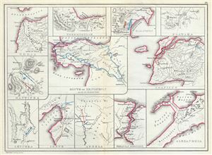
Troja. Thermopylae. Marathon. Plataea. Mantinea. Leuctra. Route of Xenophon and the Ten Thousand Greeks. Granicus. Issus. Arbela. Thracian Bosporus. Alexandria.
sold
- Digital Map Information
- Suitable for large format printing
- File Size: 3.64 MB
- File Type: ZIP / TIFF
- ICC color profile embedded
- Delivered instantly via download link
This is a fascinating 1867 map by William Hughes featuring topographical maps of ancient cities and battle sites. The map essentially contains twelve maps on a single sheet, each focusing on a different city or town, ... (more details)
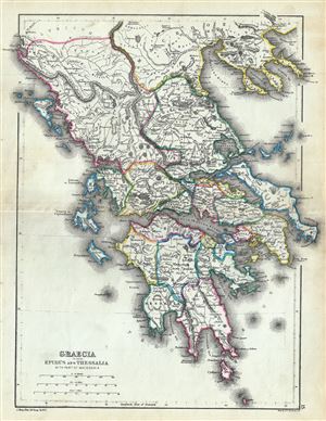
Graecia including Epirus and Thessalia with part of Macedonia.
sold
- Digital Map Information
- Suitable for large format printing
- File Size: 4.51 MB
- File Type: ZIP / TIFF
- ICC color profile embedded
- Delivered instantly via download link
This is a fine 1867 map of ancient Greece by William Hughes. The map focuses on Greece in antiquity, covering from Cythera to Thessaloniea in Macedonia. Ancient Epirus and Thessalia are also included. The map notes ... (more details)
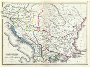
Macedonia Thracia, Illyricum and the Provinces on the Middle and Lower Danube.
sold
- Digital Map Information
- Suitable for large format printing
- File Size: 3.85 MB
- File Type: ZIP / TIFF
- ICC color profile embedded
- Delivered instantly via download link
This is an attractive 1867 map of Macedonia and the Balkans in antiquity by William Hughes. The map depicts Macedonia, Thrace, Illyricum and the provinces on the middle and lower Danube, covering parts of modern day ... (more details)
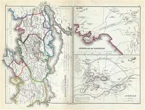
Part of Attica with Boeotia, Phocis Locris, Megaris etc.
sold
- Digital Map Information
- Suitable for large format printing
- File Size: 3.99 MB
- File Type: ZIP / TIFF
- ICC color profile embedded
- Delivered instantly via download link
This is a fascinating 1867 map of Athens along with parts of Attica, including Boeotia and Phocis in ancient Greece, by William Hughes. Essentially three maps on a single sheet, the first map covers Attica in ... (more details)
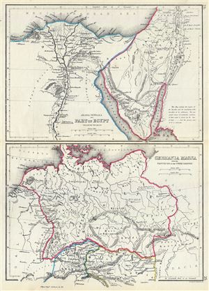
Arabia Petraea and Part of Egypt including the Delta. Germania Magna with the Provinces on the Upper Danube.
sold
- Digital Map Information
- Suitable for large format printing
- File Size: 3.63 MB
- File Type: ZIP / TIFF
- ICC color profile embedded
- Delivered instantly via download link
This is an unusual 1867 map by William Hughes featuring Egypt and Germany in antiquity. Essentially two maps on a single sheet, the top map focuses on Egypt, including the Sinai Peninsula. This map, centered ... (more details)
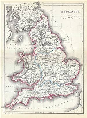
Britannia.
sold
- Digital Map Information
- Suitable for large format printing
- File Size: 3.86 MB
- File Type: ZIP / TIFF
- ICC color profile embedded
- Delivered instantly via download link
This is a scarce 1867 map of England by William Hughes. The map depicts England under Roman rule and covers all of England (Province of Britannia) as well as parts of Scotland. It features contemporary and ... (more details)
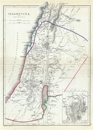
Palaestina with Part of Syria.
sold
- Digital Map Information
- Suitable for large format printing
- File Size: 3.57 MB
- File Type: ZIP / TIFF
- ICC color profile embedded
- Delivered instantly via download link
A scarce 1867 William Hughes Map of Palestine, Israel or the Holy Land in antiquity. Centered on the Jordan River, the map covers the regions between modern day Israel and Lebanon along with parts of Jordan ... (more details)
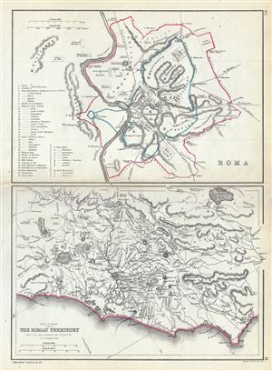
Roma. Part of Italy showing the Roman Territory and the neighbouring country.
sold
- Digital Map Information
- Suitable for large format printing
- File Size: 3.58 MB
- File Type: ZIP / TIFF
- ICC color profile embedded
- Delivered instantly via download link
This is a beautiful 1867 map by William Hughes depicting Rome and the Roman territory in Italy during ancient Roman times. Essentially two maps on a single sheet, the map on top depicts Rome during ancient ... (more details)
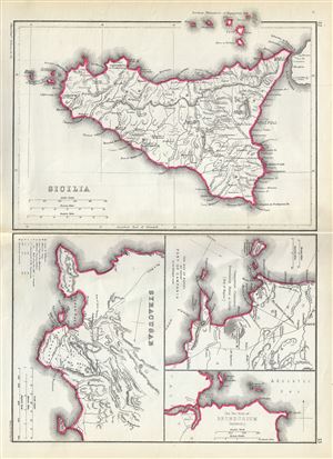
Sicilia. Syracusae. The Bay of Naples and adjacent Part of Campania. The Two Ports of Brundusium (Brindisi).
sold
- Digital Map Information
- Suitable for large format printing
- File Size: 3.68 MB
- File Type: ZIP / TIFF
- ICC color profile embedded
- Delivered instantly via download link
This is a beautiful 1867 map by William Hughes depicting Sicily, Syracuse and important ports in Italy during the Roman period. Essentially four maps on the single sheet, the largest map of Sicily depicts ... (more details)
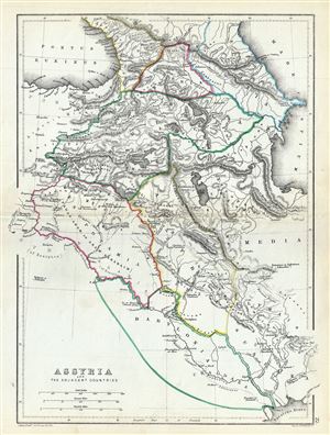
Assyria and the Adjacent Countries.
sold
- Digital Map Information
- Suitable for large format printing
- File Size: 3.85 MB
- File Type: ZIP / TIFF
- ICC color profile embedded
- Delivered instantly via download link
An uncommon 1867 map of ancient Assyria and its neighboring countries by William Hughes. The map focuses on the lands between the Black Sea and the Caspian, commonly known as the Caucuses. It covers the ... (more details)
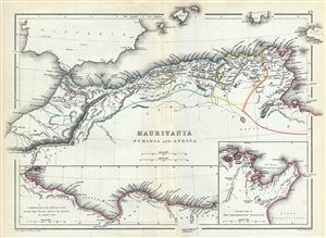
Mauritania Numidia and Africa.
sold
- Digital Map Information
- Suitable for large format printing
- File Size: 3.72 MB
- File Type: ZIP / TIFF
- ICC color profile embedded
- Delivered instantly via download link
This is a beautiful 1867 map of the Barbary Coast or northern Africa in antiquity by William Hughes. The map depicts the ancient empires of Mauritania, Carthage and Numidia or what is today the Barbary ... (more details)
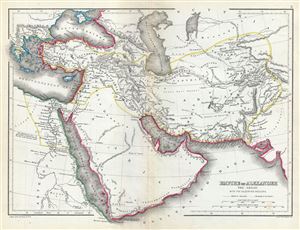
Empire of Alexander the Great with the adjoining regions.
sold
- Digital Map Information
- Suitable for large format printing
- File Size: 3.89 MB
- File Type: ZIP / TIFF
- ICC color profile embedded
- Delivered instantly via download link
This is a fine 1867 map of the Empire of Alexander the Great by William Hughes. The map depicts Alexander's conquests at their fullest extent covering from Alexander's homeland in Macedonia eastwards ... (more details)
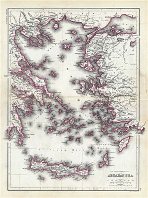
The Coasts and Islands of the Aegean Sea.
sold
- Digital Map Information
- Suitable for large format printing
- File Size: 4.6 MB
- File Type: ZIP / TIFF
- ICC color profile embedded
- Delivered instantly via download link
This is an unusual 1867 map of the islands of the Aegean Sea and the Greek Archipelago, by William Hughes. The map covers the Greek Isles from Thrace south as far as Crete and from the Gulf of ... (more details)
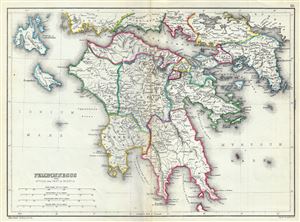
Peloponnesus with Attica and Part of Boeotia.
sold
- Digital Map Information
- Suitable for large format printing
- File Size: 4.41 MB
- File Type: ZIP / TIFF
- ICC color profile embedded
- Delivered instantly via download link
This is a scarce 1867 map of southern Greece during ancient times by William Hughes. The map covers the entire Peloponnese Peninsula including ancient Attica and parts of ancient Boeotia. The ... (more details)
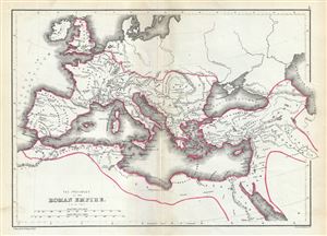
The Provinces of the Roman Empire (A.D. 119).
sold
- Digital Map Information
- Suitable for large format printing
- File Size: 3.5 MB
- File Type: ZIP / TIFF
- ICC color profile embedded
- Delivered instantly via download link
This is a beautiful 1867 map of the Roman Empire by William Hughes. The map shows the extent of the Roman Empire in AD 119, covering most of Europe, the Middle East, Asia Minor and parts of ... (more details)
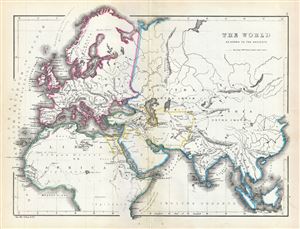
The World as known to the Ancients.
sold
- Digital Map Information
- Suitable for large format printing
- File Size: 3.79 MB
- File Type: ZIP / TIFF
- ICC color profile embedded
- Delivered instantly via download link
This is an interesting 1867 map of the ancient World by William Hughes. The map covers Europe, Asia and Africa during the time of the Ancient Roman Empire. It depicts the world of ... (more details)
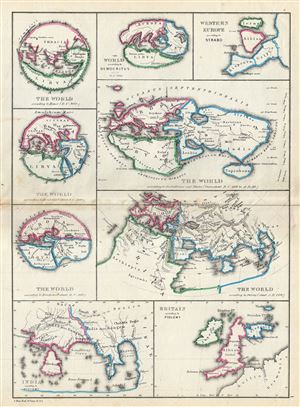
The World According to Homer (B.C. 900). The World According to Hecataeus (about B.C. 500). The World According to Herodotus (about B.C. 440). The World According to Democritus about B.C. 300. The World According to Eratosthenes and Strabo (from about B.C. 200 to A. D. 20). Western Europe According to Strabo. The World According to Ptolemy (about A.D. 160). India According to Ptolemy. Great Britain According to Ptolemy.
sold
- Digital Map Information
- Suitable for large format printing
- File Size: 3.55 MB
- File Type: ZIP / TIFF
- ICC color profile embedded
- Delivered instantly via download link
A fascinating 1867 map by William Hughes featuring the world according to ancient Greek astronomers, poets, historians and geographers. This map includes nine maps on a single ... (more details)
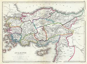
Asia Minor and the Northern Part of Syria.
sold
- Digital Map Information
- Suitable for large format printing
- File Size: 3.97 MB
- File Type: ZIP / TIFF
- ICC color profile embedded
- Delivered instantly via download link
This is a beautiful 1867 map of Turkey or Asia Minor in antiquity by William Hughes. It covers from the Aegean Sea to Mesopotamia and from the Black Sea (Pontus Euxinus) to ... (more details)