
Humphreys, Andrew Atkinson (sold)

Andrew Atkinson Humphreys (November 2, 1810 - December 27, 1883) was a career U.S. Army officer. Born in Philadelphia, Pennsylvania, Humphreys came from an illustrious family. His grandfather is remembered as the 'Father of the American Navy', because he served as the chief naval constructor from 1794 - 1801, and designed the first U.S. warships, including the USS Constitution. Samuel Humphreys, Andrew's father, designed the USS Pennsylvania, the largest and most heavily armed ship at the time. Humphreys graduated from Nazareth Hall (modern day Moravian College and Theological Seminary), then entered the United States Military Academy at West Point. Humphreys graduated on July 1, 1831, was commissioned as a second lieutenant, and joined the Second Artillery Regiment. in South Carolina. In the summer of 1836, Humphreys and his regiment went to Florida to fight in the Seminole Wars. Disgusted by the war's mismanagement, Humphreys resigned his commission on September 30, 1836, and became a civil engineer. Nearly two years later, on July 7, 1838, Humphreys rejoined the U.S. Army as a 1st lieutenant in the Corps of Topographical Engineers. In 1844, Humphreys was put in charge of the Central Office of the U.S. Coast Survey in Washington, D.C. He received a promotion to captain in 1848. Humphreys began an extensive survey of the Mississippi River Delta in 1850, a project that lasted ten years. He also worked on the Pacific Railroad Surveys from 1853 - 1857. During these years just before the American Civil War, Humphreys earned a glowing reputation as a scientist both nationally and abroad. Humphreys was promoted to major at the beginning of the American Civil War and became the Army of the Potomac's chief topographical engineer. During the war, Humphreys fought beside McClellan during the Peninsula Campaign, when he was prmoted to brigadier general, given command of a division, and saw combat at the Battle of Antietam, the Battle of Fredericksburg, and the battle of Chancellorsville. He was transferred to a different division just before the Battle of Gettysburg, where, because of poor command decisions by his immediate superior, his division was annihilated. Humphreys was promoted to major general after the Battle of Gettysburg and consented to becoming General Meade's chief of staff, a position he had been offered in the days before Gettysburg. He served in this position until November 1864, when he was given command of the II Corps during the Siege of Petersburg. He held this command until the end of the war and his corps played a part in the Appomattox Campaign. After the war, Humphreys became Chief of Engineers in 1866, a position he held until he retired on June 30, 1879.
First edition of this incredible chart w/ original mailer.
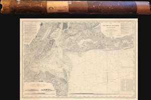
Map of New-York Bay and Harbor and the Environs.
sold
- Digital Map Information
- Suitable for large format printing
- DPI: 600
- File Size: 139.91 MB
- File Type: ZIP / TIFF
- ICC color profile embedded
- Delivered instantly via download link
This is the 1845 first edition of the U.S. Coast Survey nautical chart or maritime map of New York Bay and Harbor and its environs - uniquely accompanying its original mailing tube. The chart depicts from Newark to South Oyster Bay and from the City of New York to Sandy Hook and Black Point. (more details)
Illustrates Newark and Elizabeth.
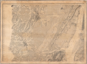
Sheet. No. 5. [Newark]
sold
- Digital Map Information
- Suitable for large format printing
- DPI: 600
- File Size: 138.94 MB
- File Type: ZIP / TIFF
- ICC color profile embedded
- Delivered instantly via download link
This is a c. 1846 U.S. Coast Survey chart or map of part of New York Bay, the Hudson River, Newark Bay, and Kill van Kull. Also includes the Hackensack River, Newark, Elizabethtown, and Jersey City. Bergen Neck's topography is brilliantly illustrated, and the Morris Canal is labeled. Farms and homesteads in eastern New Jersey are marked by small black boxes. (more details)
Definitive moment in the American understanding of rivers.
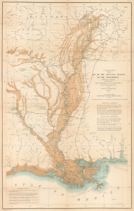
U.S. Miss. Delta Survey. Plate II. Map of the Alluvial Region of the Mississippi.
sold
- Digital Map Information
- Suitable for large format printing
- File Size: 20.75 MB
- File Type: ZIP / TIFF
- ICC color profile embedded
- Delivered instantly via download link
This is Andrew A. Humphreys and Henry L. Abbot 1861 map of the Mississippi River alluvial region, from Cape Girardeau through New Orleans and into the Gulf of Mexico. Produced on the eve of the American Civil War (1861 - 1865), the map marks a major advancement in the understanding of rivers and their flows, particularly the Mississippi River. (more details)
Definitive moment of the American understanding of Rivers.
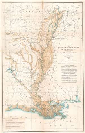
U.S. Miss. Delta Survey. Plate II. Map of the Alluvial Region of the Mississippi.
sold
- Digital Map Information
- Suitable for large format printing
- File Size: 23.97 MB
- File Type: ZIP / TIFF
- ICC color profile embedded
- Delivered instantly via download link
This is an 1861 Andrew A. Humphreys and Henry L. Abbot map of the Mississippi River alluvial region. Depicting from Jonesboro, Illinois, south to the Gulf of Mexico and from Fort Smith, Missouri, east to Clarksville, Tennessee, the region's river network is depicted in detail. Blue hand coloring highlights major rivers, including the Mississippi, Ohio, Arkansas, and Red Rivers, along with numerous lakes. Smaller rivers and creeks are marked by thin black lines. Overflow areas are shaded brown. Railways, such as the Memphis and Little Rock Railroad, the Shreveport and Texas Railroad, and the Cairo and Fulton Railroad, are illustrated and labeled. (more details)