
Institut Géographique National (sold)

Institut Géographique National (1940 - present) is a French state administrative establishment organized to produce and maintain geographical information for France and its overseas departments and territories. The Institut Géographique is the successor organization to the Service Géographique de L’Armée (1887 – 1940), which was officially closed in 1940, and its maps shuttled to other organizations, with more than half going to the newly formed Institut Géographique National. When Nazi Germany invaded the IGN became a part of the hidden resistance, where it became famous for counterfeiting fake identify papers to frustrate the German controlled Vichy Regime. In secret, they brought a complete set of their maps to England, most covering France and North Africa, in order to replace maps destroyed in the bombardment of London. Today the organization has been folded into the larger Institut National de L’Information Géographique et Forestière.
Rare highly detailed map of Senegal's Capital, Dakar!
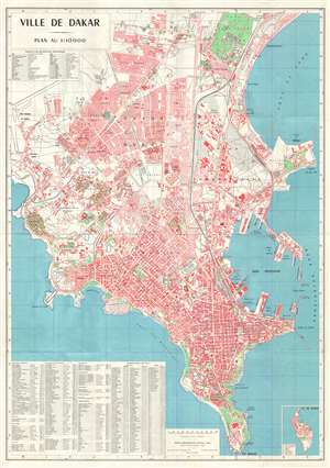
Ville de Dakar.
sold
- Digital Map Information
- Suitable for large format printing
- Full resolution TIFF file
- ICC color profile embedded
- Delivered instantly via download link
This is an uncommon first edition 1964 map of Dakar, capital of Senegal. The map was prepared by the Institut Géographique National, which maintained a West African office in Dakar. The map is beautiful produced on a large scale, covering the Dakar Plateau from ... (more details)
Senegal's Capital, Dakar.
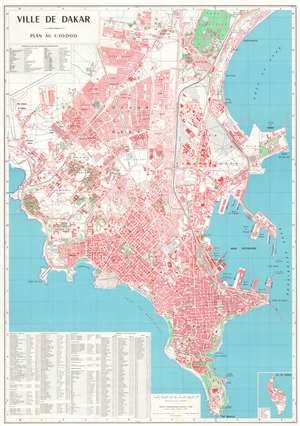
This is a visually striking uncommon first edition 1964 Institut Géographique National map of Dakar, capital of Senegal. The map is beautifully produced on a large scale, depicting the Dakar Plateau from Cape Manuel to the Parc Forestier de Hann (Parc Hann). It meticulously details roads, parks, individual buildings, important facilities, and more. An inset in the lower right focuses on the island of Gorée. When it was issued, this was the finest and most highly detailed map of Dakar yet produced. (more details)