
Jackson, William Henry (sold)
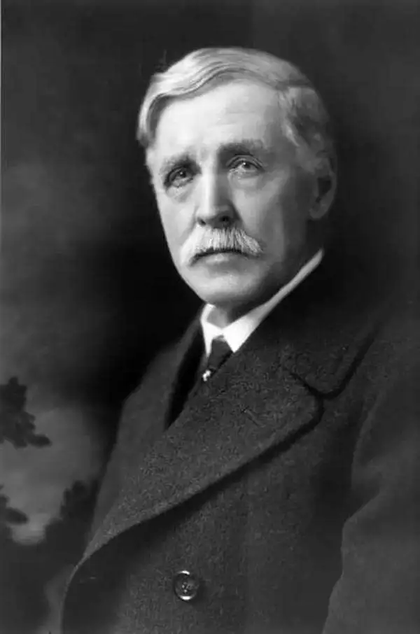
William Henry Jackson (April 4, 1843 - June 30, 1942) was an American painter, geological survey photographer, explorer, and American Civl War veteran. Born in Keeseville, New York, Jackson found a passion for painting from a young age (his mother was a talented watercolorist) and was said to be an excellent painter by the age of 19. At 19, in October 1862, Jackson enlisted in Company K of the 12th Vermont Infantry of the Union Army during the American Civil War as a private. Jackson served in the Union Army for nine months and was at the Battle of Gettysburg, but spent most of his nine months on garrison duty. Jackson boarded a Union Pacific train in 1866 and rode it to the end of the line, which at the time was about 100 miles west of Omaha, Nebraska. He then joined a wagon train heading to the Great Salt Lake along the Oregon Trail. He and his brother Edward Jackson decided to settle down in Omaha in 1867 and opened a photography business. It was while he was in Omaha that Jackson made is now famous series of photographs of the Native Americans. He won a commission from the Union Pacific in 1869 to photograph scenery along their rail routes to be used in promotional materials. Jackson was a member of the Hayden Geological Survey of 1871, which led to the establishment of Yellowstone National Park. Jackson continued working on the Hayden Surveys until the last one in 1878. Jackson continued working as a photographer, painter, and publisher well into the 1910s, although it was during World War I when sales of photographs and postcards began to decline that his publishing business began to suffer. His company, the Detroit Publishing Company went into receivership in 1924 and all its assets were liquidated in 1932. Jackson moved to Washington, D.C. in 1924 and painted murals in the new Department of the Interior building and served as a technical advisor during the filming of Gone with the Wind. He attended the July 1938 75th anniversary commemoration of the Battle of Gettysburg and when he died in 1942 he was recognized as one of the last surviving Civil War veterans and was buried in Arlington National Cemetery.
Astoria as a railroad town.
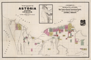
Whitney's Map of Astoria and Environs, Oregon.
sold
- Digital Map Information
- Suitable for large format printing
- Full resolution TIFF file
- ICC color profile embedded
- Delivered instantly via download link
This is the rare 1890 W. H. Whitney and Henry Jackson map of Astoria, Oregon. The map illustrates the early days of Astoria as it attempted to build railroad connections to the Northern Pacific. The route of the South Coast Railway towards Warrenton and Seaside is noted. Another line, the Albany and Astoria Railway, was a proposed route southward through the Grand Konde Indian Reservation. The line met with considerable opposition both from the tribe and from congress and was never authorized. It combines the function of a real estate map and a railroad map. (more details)
Highlights the historic achievement of the Pony Express and illustrates some of the incredible landscapes along the route.
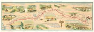
Pony Express Route April 3, 1860 - October 24, 1861.
sold
- Digital Map Information
- Suitable for large format printing
- File Size: 20.12 MB
- File Type: ZIP / TIFF
- ICC color profile embedded
- Delivered instantly via download link
This is a c. 1951 William Henry Jackson and Howard Roscoe Driggs pictorial map of the Pony Express. The map depicts the region from the Pacific Ocean to Kansas City, Missouri and from Platte Bridge, Wyoming to San Francisco Bay. The route itself is highlighted in red and most of the 190 stations along the way are identified. It covered approximately 1,900 miles and began in St. Joseph, Missouri. From there the route followed the Oregon and California Trails to Fort Bridger in Wyoming, then the Mormon Trail to Salt Lake City, Utah, and finally the Central Nevada Route to Carson City in the Nevada Territory before finally crossing the Sierra Nevada Mountains to Sacramento. Mail traveling both directions took ten days to reach its destination. The record, however, was set after the 1860 presidential election, when William Russell, a senior partner of Russell, Majors, and Waddell, a major investor in the Pony Express, decided to use the election as a way to promote the Pony Express. He hired additional riders and horses to be stationed along the route to ensure that fresh riders and horses were available, and the news of Lincoln's victory reached California papers only 7 days and 17 hours after a Pony Express rider left Fort Kearny in the Nebraska Territory. Vignettes of waypoints along the route are included both above and below it here, illustrating Courthouse Rock, Chimney Rock, Old Fort Kearny, a gigantic herd of buffalo, a relay station in the Utah desert, and the Great Salt Lake, among others. (more details)
Frontier Imagery and the Pony Express.
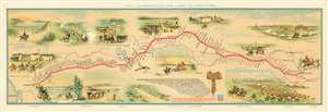
Pony Express Route April 3, 1860 - October 24, 1861.
sold
- Digital Map Information
- Suitable for large format printing
- File Size: 25.6 MB
- File Type: ZIP / TIFF
- ICC color profile embedded
- Delivered instantly via download link
This is a 1951 first edition of the William Henry Jackson and Howard Roscoe Driggs pictorial map of the Pony Express. The map depicts the region from the Pacific Ocean to Kansas City, Missouri, and from Platte Bridge, Wyoming to San Francisco Bay. The Pony Express Route itself is highlighted in red and most of the 190 stations along the way are identified. (more details)