
Jättnig, Wilhelm (sold)

Wilhelm Jättnig (fl. c. 1830 - 1840) was a German engraver based in Berlin. He is one of the lesser-known scions of Carl Friedrich August Jättnig (1794 – 1849), the youngest son of the engraving dynasty’s founder, Carl Jättnig (1766 – 1819). Wilhelm worked with his father to engrave maps for Daniel Gottlob Reymann’s (1759 – 1837) monumental Geographischer Specialatlas von Deutschland. When Reymann died, the project was passed to Heinrich Karl Wilhelm Berghaus (1797 – 1884). Wilhelm continued to work with Berghaus on the atlas of Germany as well as on Berghaus’ important Atlas von Asien. His uncle, Carl Christian Ferdinand Jättnig (1789 - 1847), and many nephews of the Jättnig name, were also a prominent engravers.
Sumatra during the pepper trade.
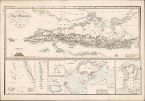
Karte von der Insel Sumatra.
sold
- Digital Map Information
- Suitable for large format printing
- DPI: 600
- File Size: 97.9 MB
- File Type: ZIP / TIFF
- ICC color profile embedded
- Delivered instantly via download link
This is a striking 1837 Heinrich Berghaus map of Sumatra with important insets of Singapore and the Maldives. It was issued for Berghaus' looseleaf Atlas von Asien, the best informed general cartographic work on Asia to appear in the mid-19th century. (more details)