
Kitchin, Thomas

Thomas Kitchin (August 4, 1718 – June 23, 1784) was a London based engraver, cartographer, and publisher. He was born in London to a hat-dyer of the same name. At 14, Kitchin apprenticed under Emanuel Bowen, under whom he mastered the art of engraving. He married Bowen daughter, Sarah Bowen, and later inherited much of his preceptor's prosperous business. Their son, Thomas Bowen Kitchin, also an engraver joined the family business, which thereafter published in Thomas Kitchin and Son. From 1858 or so Kitchin was the engraver to the Duke of York, and from about 1773 acquired the title, 'Royal Hydrographer to King George III.' He is responsible for numerous maps published in the The Star, Gentleman's Magazine, and London Magazine, as well as partnering with, at various times, with Thomas Jefferys, Emmanuel Bowen, Thomas Hinton, Issac Tayor, Andrew Dury, John Rocque, Louis de la Rochette, and Alexander Hogg, among others. Kitchin passed his business on to his son, Thomas Bowen Kitchin, who continued to republish many of his maps well after his death. Kitchin's apprentices included George Rollos, Bryant Lodge, Thomas Bowen Kitchin, Samuel Turner Sparrow, John Page, and Francis Vivares.
Eastern Polish-Lithuanian Commonwealth Prior to Partition.
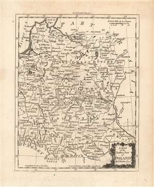
A Map of the Eastern Part of Poland By T. Kitchin Geogr.
$400.00
Acquire
- Digital Map Information
- Suitable for large format printing
- Full resolution TIFF file
- ICC color profile embedded
- Delivered instantly via download link
This is an attractive and scarce 1764 map of the eastern half of the Polish-Lithuanian Commonwealth, by the British cartographer Thomas Kitchin. It spans from Warsaw in the west to the Dnieper River, including Kiev, in the east; and from the Gulf of Riga in the north to Hungary, Transylvania and Moldavia in the south. Important towns, rivers, roads, cities and some topographic features are noted, with mountains rendered in profile and forests shown pictorially. The swampy areas of Polesia along the Pripyat River are shown in hachure. (more details)
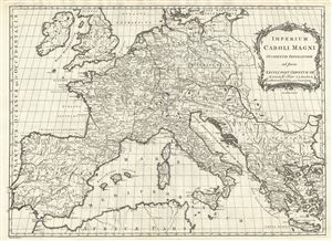
Imperium Caroli Magni Occidentis Imperatoris ad finem Saeculi Post Christum VIII.VI
$300.00
Acquire
- Digital Map Information
- Suitable for large format printing
- DPI: 300
- File Size: 12.9 MB
- File Type: ZIP / TIFF
- ICC color profile embedded
- Delivered instantly via download link
This is a beautiful example of a 1768 Thomas Kitchin map of the Empire of Charlemagne. It covers Europe and the European empire of Charles the Great from Scotland south as far as Africa and from Portugal to the Black Sea in the east. The map is highly detailed, ... (more details)
The British Colonies on the cusp of Revolution.
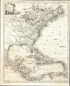
British Empire in North America with the West India Isles.
$2,400.00
Acquire
- Digital Map Information
- Suitable for large format printing
- File Size: 15.2 MB
- File Type: ZIP / TIFF
- ICC color profile embedded
- Delivered instantly via download link
This is Thomas Kitchin's 1770 map of the British Empire in North America, presenting the state-of-the-art mapping of the Colonies on the cusp of the American Revolutionary War (1775 - 1783). It combines the foundational cartography of John Mitchell (north) with the still-authoritative work of Jean-Baptiste Bourguignon d'Anville (south). (more details)
Most important map of the Mississippi during the Revolutionary War.
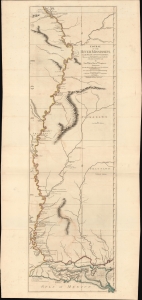
Course of the River Mississipi, from the Balise to Fort Chartres; Taken on an Expedition to the Illinois, in the latter end of the Year 1765.
$7,500.00
Acquire
- Digital Map Information
- Suitable for large format printing
- File Size: 36.6 MB
- File Type: ZIP / TIFF
- ICC color profile embedded
- Delivered instantly via download link
A scarce, important, and dramatic map of the Mississippi River Valley from the Gulf of Mexico to Fort Chartres (Illinois). This was the best map of the Mississippi to appear before the American Revolutionary War (1775 - 1783) and remained significant even after the war when it was the best demarkation of the western boundary of the United States. (more details)
Copper Capital of the World.
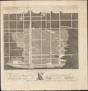
To Francis Basset Esq. this Parallel Section of Bullen Garden Mine in the Parish of Camborne, Cornwall...
$300.00
Acquire
- Digital Map Information
- Suitable for large format printing
- File Size: 22.89 MB
- File Type: ZIP / TIFF
- ICC color profile embedded
- Delivered instantly via download link
This is a scarce 1778 cross-section schematic of the Bullen Garden copper mine in Cornwall, England, prepared for William Pryce's Mineralogia cornubiensis. At this time, Cornwall was the 'Copper Capital of the World' and Bullen Garden was among the largest and most productive mines in the region. (more details)
A time of increasing tensions between expansionist Russia and Qing China.
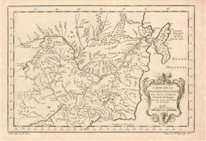
Carte de la Tartarie Orientale Pour Servir a l'Histoire Générale des Voyages Tirée des Cartes Levees par les P.P. Jesuites.
$225.00
Acquire
- Digital Map Information
- Suitable for large format printing
- Full resolution TIFF file
- ICC color profile embedded
- Delivered instantly via download link
This is a 1749 Bellin map of the frontier between Russia and China, during a period of increasing pressure between the expanding Russian Empire and the Qing dynasty. The map covers the Chinese provinces of Jilin and Heilongjiang, and the Russian Amur Oblast, Khabarovsk Krai, Primorsky Krai and Sakhalin Island. (more details)
North America following the American Revolution.
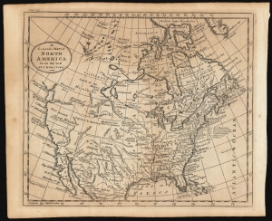
A General Map of North America from the Best Authorities.
$350.00
Acquire
- Digital Map Information
- Suitable for large format printing
- DPI: 600
- File Size: 11.12 MB
- File Type: ZIP / TIFF
- ICC color profile embedded
- Delivered instantly via download link
This is Thomas Kitchin's 1787 map of North America. Although it does not name the United States prominently - possibly a deliberate oversight for the benefit of British audiences still smarting from their defeat - the map provides a fair reflection of the situation in North America following the Revolution. (more details)
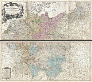
Map of the Empire of Germany, Including All the States Comprehended under that Name: with the Kingdom of Prussia, &c.
$1,850.00
Acquire
- Digital Map Information
- Suitable for large format printing
- DPI: 300
- File Size: 80.78 MB
- File Type: ZIP / TIFF
- ICC color profile embedded
- Delivered instantly via download link
An absolutely stunning and monumental two panel 1794 wall map of Germany, Bohemia, Austria and Prussia by Louis Stanislas d'Arcy Delarochette. Covers Germanic territories in full from the Baltic Sea to the Gulf of Venice. Includes Germany, Austria, Bohemia ... (more details)
Featuring the Guif of Mexico and Lake Ontario!
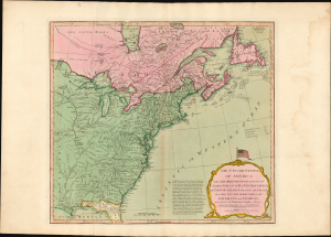
The United States of America with The British Possessions of Canada, Nova Scotia, New Brunswick, and Newfoundland divided with The French, also the Spanish Territories of Louisiana and Florida according to the Preliminary Articles of Peace Signed at Versailles the 20th of Jany. 1783.
$3,500.00
Acquire
- Digital Map Information
- Suitable for large format printing
- Full resolution TIFF file
- ICC color profile embedded
- Delivered instantly via download link
A striking 1794 Laurie and Whittle map of the newly independent United States, capturing North America's transformation in the turbulent decades between the American Revolution (1775 - 1783) and the War of 1812 (1812 - 1815). Most remarkable is its magnificent title cartouche, surmounted by one of the earliest printed representations of the thirteen-star American flag - a bold visual declaration of the new republic's place on the world stage. (more details)
Best English Wall Map of Asia of the 18th Century.
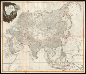
Asia and its Islands According to d'Anville; Divided into Empires, Kingdoms, States, Regions, and ca. with the European possessions and settlements in the East Indies and an exact delineation of all the discoveries made in the eastern parts by the English under Capt. Cook.
$1,500.00
Acquire
- Digital Map Information
- Suitable for large format printing
- Full resolution TIFF file
- ICC color profile embedded
- Delivered instantly via download link
A monumental 1794 wall map of Asia by Laurie and Whittle. Following the cartography of French mapmaker Jean Baptiste Bourguignon d'Anville, this is the best general map of Asia to be issued by a British cartographer in the 18th century. (more details)
Stunning wall map of Ireland!
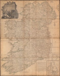
A Map of the Kingdom of Ireland, Divided into Provinces, Counties, and Baronies...
$1,200.00
Acquire
- Digital Map Information
- Suitable for large format printing
- DPI: 600
- File Size: 229.16 MB
- File Type: ZIP / TIFF
- ICC color profile embedded
- Delivered instantly via download link
A stunning 1794 Jean Rocque wall map of Ireland, here dissected on linen in a separate issue. (more details)
'Captain Hook discovered these islands' - no kidding.
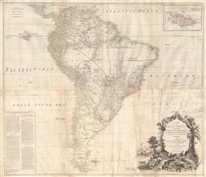
A Map of South America containing Tierra-Firma, Guayana, New Granada, Amazonia, Brasil, Peru, Paraguay, Chaco, Tucuman, Chili and Patagonia from M. D'Anville with Several Improvements and Additions, and The Newest Discoveries.
$1,000.00
Acquire
- Digital Map Information
- Suitable for large format printing
- DPI: 300
- File Size: 56.86 MB
- File Type: ZIP / TIFF
- ICC color profile embedded
- Delivered instantly via download link
This is probably the most important large format wall map of South America produced in the 18th century. Largely based upon the earlier D'Anville map, this map has been enlarged and expanded by the English publishing house of Laurie and Whittle. Depicts the continent in full with an inset of the Falkland Islands. This map is unique in that it is a serious attempt to compile all of the accurate scientific knowledge of the South American continent available at the time, this offering a smorgasbord of factual, speculative, and historical detail. (more details)