
Kitchin, Thomas (sold)

Thomas Kitchin (August 4, 1718 – June 23, 1784) was a London based engraver, cartographer, and publisher. He was born in London to a hat-dyer of the same name. At 14, Kitchin apprenticed under Emanuel Bowen, under whom he mastered the art of engraving. He married Bowen daughter, Sarah Bowen, and later inherited much of his preceptor's prosperous business. Their son, Thomas Bowen Kitchin, also an engraver joined the family business, which thereafter published in Thomas Kitchin and Son. From 1858 or so Kitchin was the engraver to the Duke of York, and from about 1773 acquired the title, 'Royal Hydrographer to King George III.' He is responsible for numerous maps published in the The Star, Gentleman's Magazine, and London Magazine, as well as partnering with, at various times, with Thomas Jefferys, Emmanuel Bowen, Thomas Hinton, Issac Tayor, Andrew Dury, John Rocque, Louis de la Rochette, and Alexander Hogg, among others. Kitchin passed his business on to his son, Thomas Bowen Kitchin, who continued to republish many of his maps well after his death. Kitchin's apprentices included George Rollos, Bryant Lodge, Thomas Bowen Kitchin, Samuel Turner Sparrow, John Page, and Francis Vivares.

A Map of Western Tartary Drawn from the Survey of the Jesuits and Mr. Kyrillow's Map of the Russian Empire.
sold
- Digital Map Information
- Suitable for large format printing
- DPI: 300
- File Size: 2.25 MB
- File Type: ZIP / TIFF
- ICC color profile embedded
- Delivered instantly via download link
A fascinating 1747 European mapping of the Gobi Desert and the eastern portion of the Silk Route region by Thomas Kitchin. Covers from Lake Baikal in the north as far south as Beijing, east to the Gulf of Lyau-tong (Yellow Sea), and west as far as Chan-tong. ... (more details)
Labels the Eastern Sea, though as part of the East China Sea.
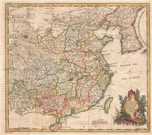
China as Surveyed by the Jesuit Missionaries between the Years 1708 and 1717 with Korea and the ajoining Parts of Tartary.
sold
- Digital Map Information
- Suitable for large format printing
- DPI: 300
- File Size: 3.7 MB
- File Type: ZIP / TIFF
- ICC color profile embedded
- Delivered instantly via download link
This is a 1747 Thomas Kitchin map of China. The map depicts the region from Yunnan to the East China Sea and from Mongolia and Korea to Hainan. Exquisitely engraved, myriad cities, towns, and villages throughout China are labeled, including Beijing (Peking), Guangzhou (Canton), and Nanjing (Nan-King). The Great Wall of China is also illustrated traversing northern China near Beijing. Cartographically, the map is based on early maps by Jean Baptiste Bourguignon d'Anville, note in particular D'Anville's characteristic shaping of the Korean Peninsula. The Kingdom of Korea is also labeled Lau-Li-Qua, which is quite unusual. The body of water east of Korea remains unlabeled, which is significant as there is a debate between naming it the East Sea, the Sea of Korea, or the Sea of Japan. Curiously, here the Eastern Sea is labeled, but further to the south as part of the East China Sea, which today is not part of this dispute. (more details)
Revealing the newly-mapped Silk Road regions of the Gobi Desert.
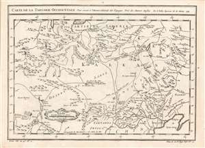
Carte de la Tartarie Occidentale, Pour servir à l'Histoire Générale des Voyages Tirée des Auteurs Anglois. Par N. Bellin Ingenieur de la Marine 1749.
sold
- Digital Map Information
- Suitable for large format printing
- Full resolution TIFF file
- ICC color profile embedded
- Delivered instantly via download link
This is a 1749 Bellin map of the Gobi Desert and the eastern portion of the Silk Route region 'Tirée des Auteurs Anglois.' For 'Auteurs Anglois' read 'Thomas Kitchin', who produced the 1747 A Map of Western Tartary which the present map copies faithfully, and translates. Kitchin's map, itself, was drawn from Jesuit Missionary reports and the monumental 1734 Kirilov map of the Russian Empire. (more details)
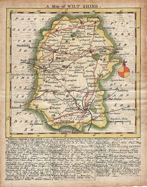
A Map of Wilt Shire.
sold
- Digital Map Information
- Suitable for large format printing
- DPI: 300
- File Size: 1.85 MB
- File Type: ZIP / TIFF
- ICC color profile embedded
- Delivered instantly via download link
This is a scarce 1749 example of Thomas Kitchin and Thomas Jefferys map of the County of Wiltshire, England. It features a detailed map of the County of Wilts or Wiltshire in elaborate detail including the city of Salisbury. Several roads, rivers, towns, ... (more details)
Detailed Map of a County Famed for its Barley and Beer
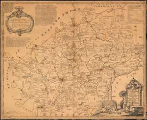
A New Improved Map of Hartfordshire from the Best Surveys.
sold
- Digital Map Information
- Suitable for large format printing
- DPI: 600
- File Size: 42.61 MB
- File Type: ZIP / TIFF
- ICC color profile embedded
- Delivered instantly via download link
A beautifully engraved 1749 Kitchin map of Hertfordshire, with a humorous decorative cartouche celebrating the region’s famed production of barley, malt, and beer. The map, based on the 1724 Payler Smith map of Middlesex, Hertfordshire and Essex, offers granular detail. Vicarages and Rectories, charity schools and religious houses are shown; post stages, parks, mills, and roads of varying quality are all identified. Beyond showing physical features, the map also notes the market days for each town, and notes the distances between market towns. Towns are also annotated to indicate their attachment to various noble titles, and to indicate particularly important trade goods. For example, the note for Hitchen explains:
it was formerly a place of great note for the Woolen Manufacture, but now that Trade is quite lost. However their Market for Grain, especially Malt is still much frequented.The cartouche alludes to the Gin Craze - an epidemic of unchecked gin consumption afflicting Great Britain in the first half of the 18th century. It depicts a man and woman bellying up to a bar with a devil-headed spigot pouring gin into the man's outstretched hat. This is intended to be in sharp contrast to the adjoining picnic-scene of men and women, reclining on the ground next to a barley field, with a loaf of bread and a rack of ribs, guzzling beer directly from a keg. The gin-drinkers are dressed in slatternly tatters, while the beer-drinkers are neatly clothed and rosy-cheeked. Beer, after all, was considered to be the healthy alternative to the cheap gin flooding the London market, which was not infrequently flavored with turpentine. (more details)
An important early map of the Gambia River.
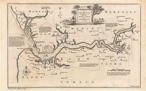
A map of the River Gambra from it's mouth to Eropina.
sold
- Digital Map Information
- Suitable for large format printing
- DPI: 600
- File Size: 16.8 MB
- File Type: ZIP / TIFF
- ICC color profile embedded
- Delivered instantly via download link
This is an excellent example of Thomas Kitchin's c. 1752 map and chart of the Gambia River, based on the descriptions of John Leach, an agent of the Royal African Company. It highlights knowledge gained from Leach's travels, which were recounted in several works in the years afterwards, eliciting considerable interest among the British public. (more details)
A Guide for the River Gambia.
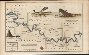
A Map of the River Gambia from Eropina to Barrakunda.
sold
- Digital Map Information
- Suitable for large format printing
- Full resolution TIFF file
- ICC color profile embedded
- Delivered instantly via download link
A fine example of Thomas Kitchin's 1752 map of the middle portion of the Gambia River, based on the description of John Leach, an agent of the Royal African Company. It highlights reconnaissance from Leach's travels, which were recounted in several works in the years afterwards, eliciting popular interest among the British public. (more details)
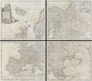
A Correct Map of Europe Divided into its Empires Kingdoms & c.
sold
- Digital Map Information
- Suitable for large format printing
- DPI: 300
- File Size: 38.71 MB
- File Type: ZIP / TIFF
- ICC color profile embedded
- Delivered instantly via download link
A curious and uncommon three panel 1755 wall map of europe by the english publisher M. Postlethwayte. Postlethwayte commissioned the well-known engraver Thomas Kitchen to compile this map based upon earlier maps by Vaugondy, d'Anville, and others. A ... (more details)
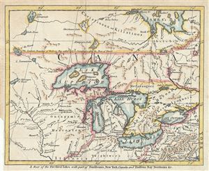
A Map of the Five Great Lakes, with Part of Pensilvania, New York, Canada and Hudson's Bay Territories &c.
sold
- Digital Map Information
- Suitable for large format printing
- DPI: 300
- File Size: 3.67 MB
- File Type: ZIP / TIFF
- ICC color profile embedded
- Delivered instantly via download link
An interesting and uncommon 1755 French and Indian War Era map of the Great Lakes issued for the London Magazine . Centered on Lake Michigan, this map covers from St. James Bay to Pennsylvania and from the Mississippi River to New York, including all ... (more details)
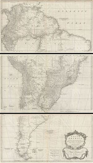
South America. Performed Under the Patronage of Louis Duke of Orleans First Prince of the Blood.
sold
- Digital Map Information
- Suitable for large format printing
- DPI: 300
- File Size: 57.7 MB
- File Type: ZIP / TIFF
- ICC color profile embedded
- Delivered instantly via download link
A curious and uncommon three panel 1755 wall map of South America by the English publisher M. Postlethwayte. A derivative of D'Anville's earlier map, Postlethwayte's map covers the entire continent from the Lesser Antilles and Panama to Cape Horn. ... (more details)
Staggering wall map of India.
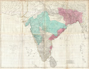
The East Indies, with the Roads.
sold
- Digital Map Information
- Suitable for large format printing
- DPI: 300
- File Size: 71.28 MB
- File Type: ZIP / TIFF
- ICC color profile embedded
- Delivered instantly via download link
This is a staggering wall size map of India and Ceylon issued in 1768 by Thomas Jeffreys. Covers the Indian subcontinent from Mekran in the west to Assam and Aracan in the east, and from Bhutan in the north, south to Ceylon and the Maldives. Offers ... (more details)
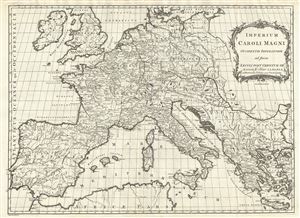
Imperium Caroli Magni Occidentis Imperatoris ad finem Saeculi Post Christum VIII.VI
sold
- Digital Map Information
- Suitable for large format printing
- DPI: 300
- File Size: 12.9 MB
- File Type: ZIP / TIFF
- ICC color profile embedded
- Delivered instantly via download link
This is a beautiful example of a 1768 Thomas Kitchin map of the Empire of Charlemagne. It covers Europe and the European empire of Charles the Great from Scotland south as far as Africa and from Portugal to the Black Sea in the east. The map is ... (more details)
Significant pre-Revoutionary War map of Manhattan.
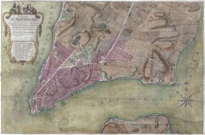
To His Excellency Sr. Henry Moore, Bart. Captain General and Governour in Chief in and over the Province of New York and the Territories depending thereon in America Chancellor and Vice admiral of the same, This Plan of the City of New York, is most HUmbly INscribed, by His Excellency's Most Obedient Servant, Bernd. Ratzen.
sold
- Digital Map Information
- Suitable for large format printing
- DPI: 300
- File Size: 28.36 MB
- File Type: ZIP / TIFF
- ICC color profile embedded
- Delivered instantly via download link
Known as the 'Ratzen Plan,' this is one of the most important, beautiful, and iconic colonial era maps of New York City, offered here in its rare first state. It is the among the most important pre-Revolutionary War maps of Manhattan. (more details)
Beers / Colton edition of the most important printed map of New York compiled during the Pre-Amercian Revolutionary War colonial period.
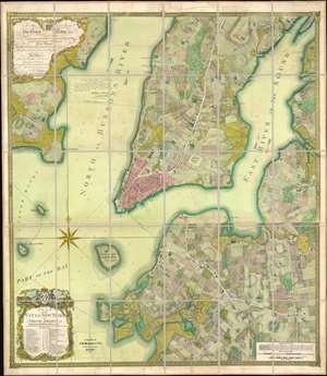
To his excellency Sr. Henry Moore, bart., captain general and governour in chief, in and over his majesty's province of New York and the territories depending thereon in America, chancellor and vice admiral of the same : This plan of the city of New York and its environs, survey'd and laid down ; is most humbly dedicated by his excellency's most obedt. humble servant B. Ratzer.
sold
- Digital Map Information
- Suitable for large format printing
- File Size: 111.61 MB
- File Type: ZIP / TIFF
- ICC color profile embedded
- Delivered instantly via download link
Known as the 'Ratzer Plan,' this is one of the most important, beautiful, and iconic colonial era maps of New York City, offered here in a stunning 1874 Colton / Beers restrike. This map was originally surveyed in 1767 by Bernard Ratzer, a lieutenant in the 'Royal American' regiment at the behest of Sir George Moore, governor of New York, who is sited in the cartouche. The map, which covers the southern part of Manhattan to about modern day 57th street, is a revision and expansion upon the flawed John Montresor plan of 1767. Across East River, a portion of Long Island is depicted, including most of Brooklyn and Parts of Long Island City. (more details)
North America between the French and Indian War and the American Revolution.
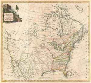
North America, Drawn and Engraved from the best Maps and Charts.
sold
- Digital Map Information
- Suitable for large format printing
- DPI: 600
- File Size: 13.35 MB
- File Type: ZIP / TIFF
- ICC color profile embedded
- Delivered instantly via download link
This is a c. 1770 Thomas Kitchin map of North America issued after the French and Indian War but before the American Revolution. Depicting the continent from the Atlantic to Pacific and from Baffin's Bay to Mexico, Kitchin's map provides an overview (although slightly flawed) of the state of affairs on the North American continent at the pivotal point in world history. (more details)
First depiction of South America south of the Rio de la Plata based on Exploration
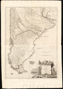
A New Map of the Southern Parts of America.
sold
- Digital Map Information
- Suitable for large format printing
- File Size: 55.22 MB
- File Type: ZIP / TIFF
- ICC color profile embedded
- Delivered instantly via download link
This is a beautiful example of Thomas Kitchin and English Jesuit Missionary Thomas Falkner's huge 1772 map of South America below the Rio de la Plata. The map is the fruit of some forty years of exploration, providing the first glimpse of the interior regions of Patagonia based on firsthand experience. (more details)
Possibly the first map to show the 'Circuit of the Penny Post'
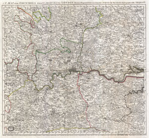
A Map of the Countries Thirty Miles Round London.
sold
- Digital Map Information
- Suitable for large format printing
- DPI: 300
- File Size: 18.68 MB
- File Type: ZIP / TIFF
- ICC color profile embedded
- Delivered instantly via download link
An exceptional example of Thomas Kitchin's 1773 map of the area 30 miles around London. This map was issued to accompany John Norrthouck's 1773 New History of London . Centered on metropolitan London, this map covers from Berkshire to Canvey ... (more details)
The first English map of the Mississippi River.
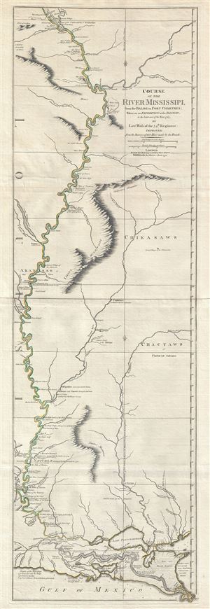
Course of the River Mississipi, from the Balise to Fort Chartres; Taken on an Expedition to the Illinois, in the latter end of the Year 1765.
sold
- Digital Map Information
- Suitable for large format printing
- DPI: 300
- File Size: 15.95 MB
- File Type: ZIP / TIFF
- ICC color profile embedded
- Delivered instantly via download link
A scarce, important, and dramatic map of the Mississippi River Valley from the Gulf of Mexico to Fort Chartres (Illinois). Set on the meridian of New Orleans, this map covers the Mississippi Valley from the Delta of the Mississippi where it ... (more details)
Unusual map of the Great Lakes region at the start of the American Revolutionary War.
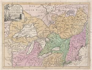
An accurate Map of the present Seat of War, between Great-Britain and her Colonies in North America.
sold
- Digital Map Information
- Suitable for large format printing
- DPI: 300
- File Size: 6.69 MB
- File Type: ZIP / TIFF
- ICC color profile embedded
- Delivered instantly via download link
An uncommon and attractive 1776 map of the northern British Colonies (the United States and Canada) at the start of the American Revolutionary War. Published by John Hinton for his Universal Magazine , this map centers on the Great Lakes ... (more details)
The Caribbean Theater of the Revolutionary War.
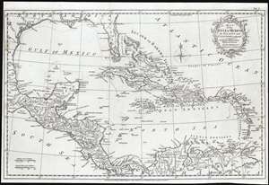
Map of the Gulf of Mexico, the Islands and Countries Adjacent.
sold
- Digital Map Information
- Suitable for large format printing
- Full resolution TIFF file
- ICC color profile embedded
- Delivered instantly via download link
This is an attractive 1777 map of the West Indies and the adjacent coasts of North, Central and South America, by the British cartographer Thomas Kitchin. The map includes Florida and the Gulf of Mexico in the north and west, the Central American coastline and the northern parts of South America extending to the mouth of the Orinoco River. Florida is unusually long, breaking into an archipelago at its tip, and with the St. John River extending almost its full length. Major towns and ports are marked throughout. New Orleans is shown and named. La Salle's settlement on Matagorda Bay - here named 'B. de St. Bernard' - is shown and dated 1685. A Spanish Presidio is also marked on the bay. (more details)
A British perspective on America at the close of the American Revolutionary War.
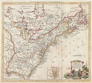
A New Map of the British Empire in Nth. America.
sold
- Digital Map Information
- Suitable for large format printing
- DPI: 300
- File Size: 9.32 MB
- File Type: ZIP / TIFF
- ICC color profile embedded
- Delivered instantly via download link
An uncommon and attractive 1776 map of the northern British Colonies (the United States and Canada) at the start of the American Revolutionary War. Published by John Hinton for his Universal Magazine , this map centers on the Great Lakes ... (more details)
One of the earliest obtainable English maps to name and recognize the newly created United States.
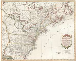
Map of the United States in North America: with the British, French and Spanish Dominions adjoining, according to the Treaty of 1783.
sold
- Digital Map Information
- Suitable for large format printing
- DPI: 600
- File Size: 19.55 MB
- File Type: ZIP / TIFF
- ICC color profile embedded
- Delivered instantly via download link
After nine years of war between the mother country and its American colonies, this first edition 1783 Thomas Kitchin map of the United States is one of the earliest obtainable English printed maps that names and recognizes the newly independent United States of America. The map depicts the nascent country from just west of the Mississippi River to the Atlantic Ocean and from Hudson Bay to New Orleans and the Gulf of Mexico. Unique geography catches the viewer's attention, with Pennsylvania occupying a fair portion of southern New York and Virginia, North Carolina, South Carolina, and Georgia stretching from the Atlantic coast to the Mississippi River. Myriad cities, towns, and villages are labeled, including Philadelphia, New York, Boston, Newport, Baltimore, Charleston, and Savannah. Native American tribes are referenced, including the Iroquois, Miami, Cherokee, Creek, Chickasaw, and Choctaw. Important coastal locations, such as Cape Cod, Boston Harbor, Delaware Bay, Chesapeake Bay, Cape May, Cape Hatteras, and Cape Fear are also identified. All five Great Lakes are labeled and rivers, lakes, and mountains are noted. (more details)
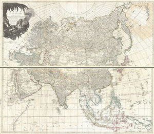
Asia and its Islands According to d'Anville; Divided into Empires, Kingdoms, States, Regions, &ca. with the European possessions and settlements in the East Indies and an exact delineation of all the discoveries made in the eastern parts by the English under Captn. Cook.
sold
- Digital Map Information
- Suitable for large format printing
- DPI: 300
- File Size: 67.68 MB
- File Type: ZIP / TIFF
- ICC color profile embedded
- Delivered instantly via download link
An absolutely stunning and monumental two panel 1794 wall map of Asia by J. B. B. D'Anville. Covers the entire continent of Asia, including Arabia, the Indian subcontinent, and the East Indies. Names countless cities, caravan routes, ... (more details)
Scarce early map detailing river navigation in Sweden!
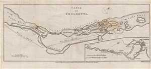
Canal of Trolhaetta.
sold
- Digital Map Information
- Suitable for large format printing
- DPI: 300
- File Size: 3.09 MB
- File Type: ZIP / TIFF
- ICC color profile embedded
- Delivered instantly via download link
This is a 1784 Thomas Kitchin map or plan of the proposed route for the Trollhätte Canal in Sweden. The map depicts the Gotha River (Göta älv) south from Trolhaetta (Trollhättan) and through the cataracts or rapids south of the ... (more details)
Presents geographical thought from between the French and Indian War and the American Revolution.
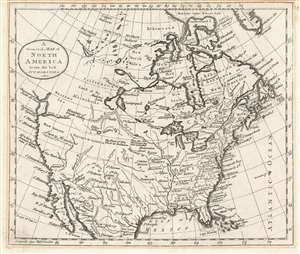
A General Map of North America from the best Authorities.
sold
- Digital Map Information
- Suitable for large format printing
- DPI: 600
- File Size: 5.1 MB
- File Type: ZIP / TIFF
- ICC color profile embedded
- Delivered instantly via download link
This is a c. 1785 William Guthrie map of North America that is based upon a c. 1770 Thomas Kitchin map of North America after the French and Indian War and before the American Revolution. Depicting the continent from the Pacific Ocean to the Atlantic Ocean and from Baffin's Bay to Mexico, and the Gulf of Mexico, the map provides an overview (although slightly flawed) of the state of affairs on the North American continent at the pivotal point in world history. (more details)
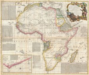
Africa, with all its States, Kingdoms, Republics, Regions, Islands, & cca. Improved and Inlarged form D’Anville’s Map to which has been added A Particular Chart of the Gold Coast wherein are Distinguished all the European Forts, and Factories by S. Boulton and also A Summary Description relative to the Trade adn Natural Produce, Manners and Customs of the African Continent and Islands.
sold
- Digital Map Information
- Suitable for large format printing
- DPI: 300
- File Size: 69.71 MB
- File Type: ZIP / TIFF
- ICC color profile embedded
- Delivered instantly via download link
This is probably the most important map of Africa produced in the 18th century. Largely based upon the earlier D'Anville map, this map has been enlarged and expanded by Samuel Boulton. Depicts the continent in full with insets of ... (more details)
One of the largest and most impressive maps of Scotland to appear in the 18th century.
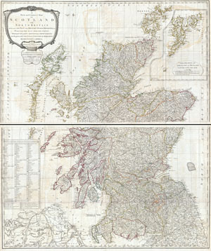
A New and Correct Map of Scotland or North Britain with all the Post and Military Roads, Divisions, and ca.
sold
- Digital Map Information
- Suitable for large format printing
- DPI: 300
- File Size: 70.98 MB
- File Type: ZIP / TIFF
- ICC color profile embedded
- Delivered instantly via download link
An absolutely stunning and monumental 1794 wall map of Scotland by Lieutenant Campbell. Covers Scotland in full with extraordinary detail throughout. Notes every town, hamlet, bishopric, country, forest, castle swam and road. ... (more details)
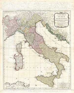
A New Map of Italy with the Islands of Sicily, Sardinia & Corsica. From Monsr. d'Anville: to which have been added the post roads and several other improvements.
sold
- Digital Map Information
- Suitable for large format printing
- DPI: 300
- File Size: 21.22 MB
- File Type: ZIP / TIFF
- ICC color profile embedded
- Delivered instantly via download link
An rare and beautiful 1794 map of Italy by J. B. B. d'Anville. Covers Italy from Switzerland south to Sicily including Corsica, Sardinia, and parts of North Africa and Dalmatia. Italy itself is divided into various states, ... (more details)
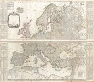
Europe Divided into its Empires, Kingdoms, States Republics, & c.
sold
- Digital Map Information
- Suitable for large format printing
- DPI: 300
- File Size: 78.51 MB
- File Type: ZIP / TIFF
- ICC color profile embedded
- Delivered instantly via download link
A large and dramatic 1794 wall map of Europe on two panels. Published by Laurie and Whittle based the work of the important cartographer J. B. B. D'Anville. Upper sheet covers from Iceland to Russia and from the Arctic to ... (more details)
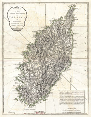
A New Map of the Island and Kingdom of Corsica.
sold
- Digital Map Information
- Suitable for large format printing
- DPI: 300
- File Size: 17.48 MB
- File Type: ZIP / TIFF
- ICC color profile embedded
- Delivered instantly via download link
An extraordinary 1794 map of the Island and Kingdom of Corsica. Covers the entire island in extraordinary detail offering both topographical and political information. With its unique blend of dramatic mountains and ... (more details)
Impressive wall map of India.
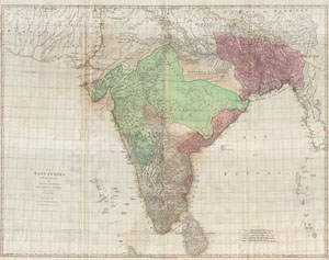
The East Indies, with the Roads.
sold
- Digital Map Information
- Suitable for large format printing
- DPI: 300
- File Size: 90.75 MB
- File Type: ZIP / TIFF
- ICC color profile embedded
- Delivered instantly via download link
This is a staggering wall size map of India and Ceylon originally issued in 1768 by Thomas Jeffreys. Covers the Indian subcontinent from Mekran in the west to Assam and Aracan in the east, and from Bhutan in the ... (more details)
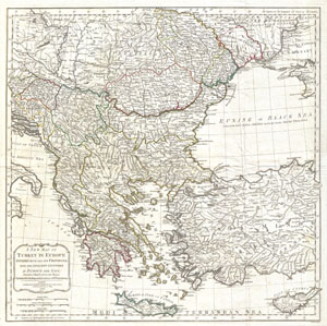
A New Map of Turkey in Europe Divided into all its Provinces' with the Adjacent Countries in Europe and Asia: Drawn Chiefly from the Maps Published by the Imperial Academy of St. Petersburg.
sold
- Digital Map Information
- Suitable for large format printing
- DPI: 300
- File Size: 22.18 MB
- File Type: ZIP / TIFF
- ICC color profile embedded
- Delivered instantly via download link
An extraordinary large format 1794 map of Greece, Turkey in Europe, the Balkans and adjacent regions by Laurie and Whittle. Map covers from the Gulf of Taranto, Italy, eastward as far as the Crimea, extend ... (more details)
A beautifully detailed map of Turkey, Greece, and the Balkans.
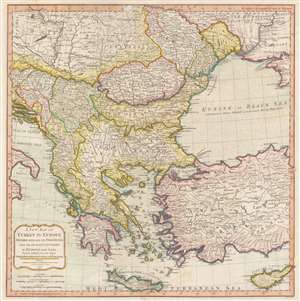
A New Map of Turkey in Europe Divided into all its Provinces' with the Adjacent Countries in Europe and Asia: Drawn Chiefly from the Maps Published by the Imperial Academy of St. Petersburg.
sold
- Digital Map Information
- Suitable for large format printing
- Full resolution TIFF file
- ICC color profile embedded
- Delivered instantly via download link
An extraordinary large format 1794 map of Greece, Turkey in Europe, the Balkans and adjacent regions by Laurie and Whittle. The map depicts the region from the Gulf of Taranto, Italy, to the Crimea, and from Transylvania and Moldova to Crete and Cyprus. The modern-day nations of Greece, Turkey, Cyprus, Bosnia, Croatia, Albania, Serbia, Macedonia, Bulgaria, Hungary, Rumania, Bulgaria, and Moldova, as well as parts of Italy, Austria and the Ukraine are illustrated. Extraordinary detail is evident throughout, noting cities, roads, geographical features, and sub-states. (more details)
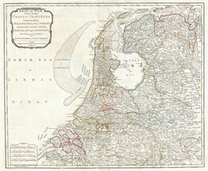
Seat of War in the Seven United Provinces, Comprehending Holland, Zeeland, Utrecht, Gelders, Over-Yssel, Frieseland and Groningen; with The Land of Drent, also Dutch Flanders and Dutch Brabant.
sold
- Digital Map Information
- Suitable for large format printing
- DPI: 300
- File Size: 16.37 MB
- File Type: ZIP / TIFF
- ICC color profile embedded
- Delivered instantly via download link
An extraordinary 1794 map of Holland or the Netherlands by Laurie and Whittle. Covers from Zeeland eastward as far as the Circle of Westphalia, north to the mouth of the Ems River, and south as far as the ... (more details)
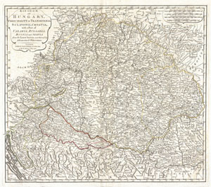
Kingdom of Hungary, Principality of Transilvania, Sclavonia, Croatia, with a Part of Valakla, Bulgaria, Bosnia and Servia from the Latest Surveys ascertained by Astronomical Observations.
sold
- Digital Map Information
- Suitable for large format printing
- DPI: 300
- File Size: 16.11 MB
- File Type: ZIP / TIFF
- ICC color profile embedded
- Delivered instantly via download link
An rare and attractive 1794 map of the Kingdom of Hungary by Laurie and Whittle. Covers the Kingdom of Hungary and its surrounding states, including Transylvania (modern day Romania), Bulgaria, Bosnia, ... (more details)
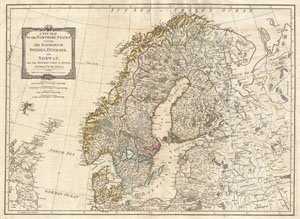
A New Map of the Northern States containing The Kingdoms of Sweden, Denmark and Norway, with The Western Parts of Russia, Livonia, Courland and Ca.
sold
- Digital Map Information
- Suitable for large format printing
- DPI: 300
- File Size: 17.21 MB
- File Type: ZIP / TIFF
- ICC color profile embedded
- Delivered instantly via download link
An extraordinary 1794 map of Scandinavia by Laurie and Whittle. Covers from the Faroe Islands east as far as Moscow, north as far as the Arctic, and south as far as Prussia. Includes the modern day ... (more details)
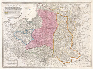
A New Map of the Kingdom of Poland, with its Dismembered Provinces and the Kingdom of Prussia.
sold
- Digital Map Information
- Suitable for large format printing
- DPI: 300
- File Size: 19.62 MB
- File Type: ZIP / TIFF
- ICC color profile embedded
- Delivered instantly via download link
This important 1794 map by Thomas Kitchin depicts the Kingdom of Poland during the brief transitional period between the second and third partitions. Covers from Brandenburg to Russia and from the ... (more details)
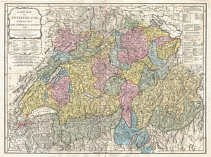
A New Map of Switzerland Divided into the Thirteen Cantons with their Allies and their Subjects.
sold
- Digital Map Information
- Suitable for large format printing
- DPI: 300
- File Size: 23.49 MB
- File Type: ZIP / TIFF
- ICC color profile embedded
- Delivered instantly via download link
An extraordinary 1794 map of the Switzerland. Covers the entire country in extraordinary detail offering both topographical and political information. Color coded according to canton. With its ... (more details)
The New British Frontier
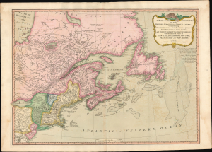
A New And Correct Map Of The British Colonies In North America.
sold
- Digital Map Information
- Suitable for large format printing
- Full resolution TIFF file
- ICC color profile embedded
- Delivered instantly via download link
A significant 1794 Laurie and Whittle map of the northeastern United States and eastern Canada, capturing North America at a pivotal moment between the American Revolutionary War (1775 - 1783) and the War of 1812 (1812 - 1815). The map reflects the geopolitical order created by American Independence: the 1783 Treaty of Paris boundary divides the United States from British Canada, while Vermont, admitted to the Union only three years earlier, appears in one of its earliest dated cartographic representations. The map offers a striking cartographic portrait of redrawn political boundaries that remained far from settled. (more details)
Outstanding wall map of the Russian Empire.
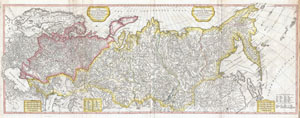
The European Part of the Russian Empire, from Maps Published by the Imperial Academy at St. Petersburg, with the New Provinces on the Black Sea. - The Asiatic Part of the Russian Empire from the Maps Published by the Imperial Academy of St. Petersburg, with the New Discoveries of Captian Cook & co.
sold
- Digital Map Information
- Suitable for large format printing
- DPI: 300
- File Size: 38.79 MB
- File Type: ZIP / TIFF
- ICC color profile embedded
- Delivered instantly via download link
A rare and magnificently proportioned 1794 wall map of the Russian Empire by Laurie and Whittle. Extends from the North Sea and the Black Sea eastward as far as Siberia and the Behring Strait. ... (more details)
An early, rarely seen, wall map of North America.
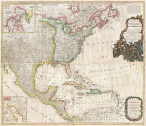
A New Map of North America with the West India Islands, divided according to the Preliminary Articles of Peace, Singed at Versailles, 20, jan 1783, wherein are particularly Distinguished The United States, and the Several Provinces, Governments & ca which Compose the British Dominions, Laid down according to the Latest Surveys, and Corrected from teh Original Materials of Goverr. Pownall, Membr. of Parlimt.
sold
- Digital Map Information
- Suitable for large format printing
- DPI: 300
- File Size: 62.52 MB
- File Type: ZIP / TIFF
- ICC color profile embedded
- Delivered instantly via download link
An extraordinary monumentally proportioned 1794 map of North American by Governor Pownell. Issued shortly after the end of the American Revolutionary War, this map details the newly formed ... (more details)
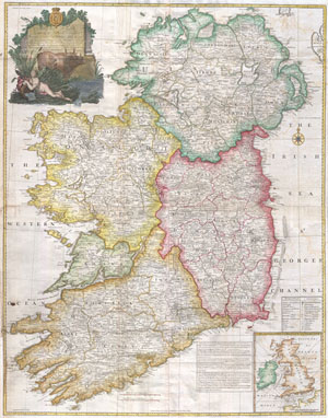
A map of the Kingdom of Ireland, divided into provinces, counties and baronies. Southern section. Shewing the archbishopricks, bishopricks, cities, boroughs, market towns, villages, barracks, mountains, lakes, bays, rivers, bridges, ferries, passes, also the great, the branch & the by post roads together with the inland navigation, by J. Rocque, Chorographer to His Majesty.
sold
- Digital Map Information
- Suitable for large format printing
- Full resolution TIFF file
- ICC color profile embedded
- Delivered instantly via download link
An absolutely stunning and monumental 1794 wall map of Ireland by Jean Rocque. Covers Ireland in full with extraordinary detail throughout. Notes every town, hamlet, bishopric, country, ... (more details)
Stunning wall map of Ireland!
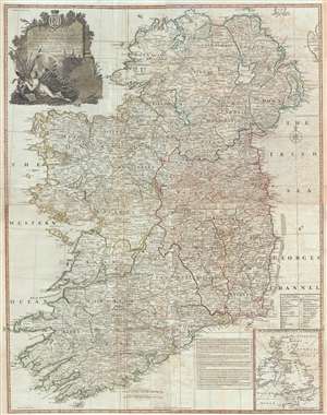
A Map of the Kingdom of Ireland, divided into provinces, counties and baronies. Southern section. Shewing the archbishopricks, bishopricks, cities, boroughs, market towns, villages, barracks, mountains, lakes, bays, rivers, bridges, ferries, passes, also the great, the branch & the by post roads together with the inland navigation, by J. Rocque, Chorographer to His Majesty.
sold
- Digital Map Information
- Suitable for large format printing
- DPI: 300
- File Size: 52.1 MB
- File Type: ZIP / TIFF
- ICC color profile embedded
- Delivered instantly via download link
An absolutely stunning and monumental 1794 wall map of Ireland by Jean Rocque. Covers Ireland in full with extraordinary detail throughout. Notes every town, hamlet, bishopric, country, ... (more details)
A most impressive 18th century wall map of the world.
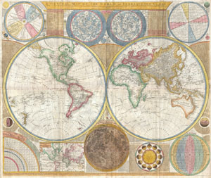
A General Map of the World, or Terraqueouis Globe with all the New Discoveries and Marginal Delineations, Containing the Most Interesting Particulars in the Solar, Starry and Mundane System.
sold
- Digital Map Information
- Suitable for large format printing
- DPI: 300
- File Size: 78.36 MB
- File Type: ZIP / TIFF
- ICC color profile embedded
- Delivered instantly via download link
An absolutely stunning and monumental double hemisphere wall map of the world by Samuel Dunn dating to 1794. This extraordinary map is so large and so rich in detail that it is ... (more details)
A most impressive 18th century wall map of the world.
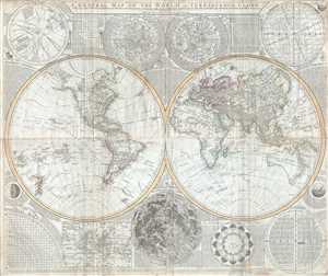
A General Map of the World, or Terraqueous Globe with all the New Discoveries and Marginal Delineations, Containing the Most Interesting Particulars in the Solar, Starry and Mundane System, by Sam. Dunn, Mathematician.
sold
- Digital Map Information
- Suitable for large format printing
- DPI: 300
- File Size: 77.85 MB
- File Type: ZIP / TIFF
- ICC color profile embedded
- Delivered instantly via download link
An absolutely stunning and monumental double hemisphere wall map of the world by Samuel Dunn dating to 1794. This extraordinary map is so large and so rich in detail that it is ... (more details)
A most impressive 18th century wall map of the world.
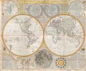
A General Map of the World, or Terraqueous Globe with all the New Discoveries and Marginal Delineations, Containing the Most Interesting Particulars in the Solar, Starry and Mundane System, by Sam. Dunn, Mathematician.
sold
- Digital Map Information
- Suitable for large format printing
- Full resolution TIFF file
- ICC color profile embedded
- Delivered instantly via download link
An absolutely stunning and monumental double hemisphere wall map of the world by Samuel Dunn dating to 1794. This extraordinary map is so large and so rich in detail that it is ... (more details)
Important decorative wall map of South America. Identifies Manoa or El Dorado.
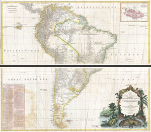
A Map of South America containing Tierra-Firma, Guayana, New Granada, Amazonia, Brasil, Peru, Paraguay, Chaco, Tucuman, Chili and Patagonia from M. d'Anville with Several Imporvements and Additions, and The Newest Discoveries.
sold
- Digital Map Information
- Suitable for large format printing
- DPI: 300
- File Size: 61.87 MB
- File Type: ZIP / TIFF
- ICC color profile embedded
- Delivered instantly via download link
This is probably the most important two panel wall map of South America produced in the 18th century. Largely based upon the earlier D'Anville map, this map has been enlarged ... (more details)
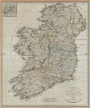
Charte von Ireland Nach den Original-Charten von Kitchin, Jefferys, und Beaufort, und den neuesten Ortsbestimmungen entworfen.
sold
- Digital Map Information
- Suitable for large format printing
- DPI: 300
- File Size: 19.79 MB
- File Type: ZIP / TIFF
- ICC color profile embedded
- Delivered instantly via download link
An uncommon map of Ireland dating to 1804. Though published by the German Geographical Institute, this map references the earlier work of Thomas Kitchin, Thomas Jefferys, and ... (more details)
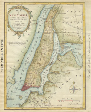
New York in 1778 or Map of New York I.
sold
- Digital Map Information
- Suitable for large format printing
- File Size: 1.38 MB
- File Type: ZIP / TIFF
- ICC color profile embedded
- Delivered instantly via download link
This is an unusual map of New York City in 1778, reduced and reprinted in 1869. The original map was drawn by Thomas Kitchin in his capacity as Hydrographer to His Majesty. ... (more details)