
Ludwig, Pablo (sold)

Pablo Ludwig (fl. c. 1890 - c. 1962) was cartographer active in Buenos Aires in the late 19th and early 20th centuries. His office, the Oficina Cartográfica de Pablo Ludwig, published maps of Buenos Aires, regional maps of Argentina, and maps of Argentina as a whole. We have been unable to discover anything about his personal life or a detailed history of his firm.
To the Ends of the Continent.
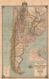
Nuevo Mapa de la República Argentina, Chile, Uruguay y Paraguay.
sold
- Digital Map Information
- Suitable for large format printing
- File Size: 82.81 MB
- File Type: ZIP / TIFF
- ICC color profile embedded
- Delivered instantly via download link
A vividly-colored large-format 1911 folding map of southern South America (Argentina, Chile, Uruguay, and Paraguay), published in Buenos Aires by Pablo Ludwig. It depicts the region in the wake of large-scale immigration and expansion of infrastructure, especially in the vicinity of Buenos Aires and in the regions to the city's south. (more details)
A City for the People.
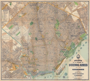
Nuevo Plano de la Ciudad de Buenos Aires y sus Alrededores / Plano de la Ciudad de Buenos Aires y Alrededores.
sold
- Digital Map Information
- Suitable for large format printing
- Full resolution TIFF file
- ICC color profile embedded
- Delivered instantly via download link
An impressive 1953 large-format city plan or map of Buenos Aires, Argentina, published by Oficina Cartográfica Ludwig. It highlights the tremendous growth of the city in the preceding decades, as working and middle-class areas cropped up around its historic core. (more details)