
Massa, Isaac Abrahamszoon (sold)
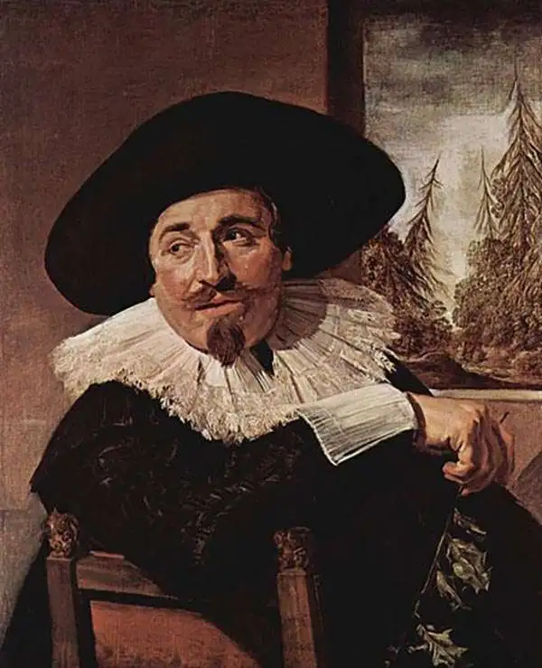
Isaac Abrahamszoon Massa (1586 - 1643) was a Dutch merchant, traveller and diplomat, and the envoy to Muscovy. His writings represent among the best primary sources Russia's Time of Troubles (Смутное время) and he produced some of the first maps of Eastern Europe and Siberia based on actual exploration. His cartographic contributions were quickly absorbed by the Dutch mapmaking trade, and can be seen in the works of Hessel Gerritz, Blaeu, Hondius and their descendants in the trade. Massa was born into a wealthy silk merchant's family, possibly Huguenot in origin. He first traveled to Russia in 1601 to further his family's trade interests there; during his time there he saw the latter half of Boris Godunov's reign and the outbreak of the Time of Troubles. He escaped a far more tumultuous Russia than the one to which he arrived in 1609. Massa's account of these events, which he presented to Stadtholder Maurice, were astonishingly not committed to print until the nineteenth century. He did, in 1612–1613, published two articles on Russian events and the geography of the Land of Samoyeds, accompanied by a map of Russia, which were published in a volume edited by Gerritsz. Massa's rendition of the Siberian coast, in particular, represented an advance in geography which was unsurpassed for decades, and consequently was widely copied. In 1614 Massa returned to Moscow as an official envoy of States-General of the Netherlands to obtain exclusive trade agreements and to investigate the trade routes into Persia. Following an abortive attempt to become an agent for Moscovia in 1624, he was able to find a place supporting the Swedish Gustaf II Adolf in pursuit of grain trade with Russia, for which efforts he was knighted by the Swedish King in 1625.
A beautifully excecuted and detailed map of the Dutch trade routes into Russia.
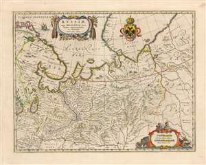
Russiae, vulgo Moscovia dictae, Partes Septentrionalis et Orientalis.
sold
- Digital Map Information
- Suitable for large format printing
- DPI: 600
- File Size: 23.05 MB
- File Type: ZIP / TIFF
- ICC color profile embedded
- Delivered instantly via download link
This is a beautiful example of Blaeu's 1640 map of Muscovy north of the Volga, and the Northernmost parts of Russia. It was derived primarily from the geographical information of the Dutch trader and diplomat Isaac Massa, whose experience in Russia during the Time of Troubles remained the best firsthand source on Russian society and Geography well into the 17th century. The granular detail for the trade route from Archangel on the White Sea to Yaroslavl testifies to Massa's years in the region, working to secure trade for textiles and grain both for the Netherlands and for Sweden. The whole of this route, following the Dvina to the Sukhona Rivers and on to the portage between Vologda and Yaroslavl on the Volga shows more than a hundred towns which would have been familiar way stations on the long river journey. (more details)
Rise of French cartography.
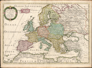
L'Europe par le Sr. Sanson d'Abbeville Geographe du Roy A Paris Chez l'Autheur et Chez Pierre Mariette Rue St. Iacques a L'Esperamnce Avec privil. du Roy Pour 20 Ans.
sold
- Digital Map Information
- Suitable for large format printing
- File Size: 25.15 MB
- File Type: ZIP / TIFF
- ICC color profile embedded
- Delivered instantly via download link
This is Nicolas Sanson's 1650 map of Europe, in a beautiful original color example. Sanson's maps signaled the development of a French positivist tradition in cartography. (more details)
Most Visually Engaging Seventeenth Century Map of Russia.
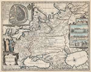
A Map of Russia.
sold
- Digital Map Information
- Suitable for large format printing
- DPI: 600
- File Size: 65.3 MB
- File Type: ZIP / TIFF
- ICC color profile embedded
- Delivered instantly via download link
This is John Speed's scarce 1676 map of Russia, one of the first English maps of Russia and certainly the most decorative. The map is scarce, having appeared only in the latter, Basset and Chiswell edition of the Speed atlas. Centered on Moscow, the map covers from the North Sea to the Caspian Sea and from Nova Zembla to Trabzon (Black Sea south coast). There is a large and impressive inset map of Moscow: this is centered on the Kremlin, Belygorod, and the Kityagorod. Five inset views depict the Emperor's Court in the Kremlin, the vital port of Archangel, the Russian fort at Narva (in modern Estonia and a crucial stronghold on Russia’s western border), bathhouses and a mill. Above the cartouche are figures dressed in 'The Habit of Russians,' one of whom carries the Russian coat of arms. (more details)