
Mather, William W. (sold)
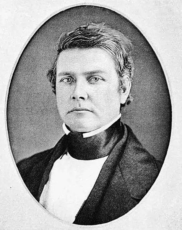
William W. Mather (May 24, 1804 - February 26, 1859) was an important American geologist and natural historian. Mather was born in Brooklyn, Connecticut to an old New England family. In 1823, as a young man, he entered the West Point military academy after which he served as a 2nd Lieutenant in the Seventh Infantry. His interest in Chemistry and mineralogy soon called him back to West Point where he acted as an Assistant Professor of Geology. After resigning from the Army in 1834 with a rank of 1st Lieutenant, Mather accepted a position as Professor of Chemistry at the University of Louisiana. Later he was employed as Professor of Natural History and Sciences at the University of Ohio, was appointed Geologist of the First Geological District of New York for Governor William H. Seward, and was the State Geologist of both Ohio and Kentucky. In 1847 Mather became president of the University of Ohio. During his long career Mather made copious notes regarding his geological explorations, published profusely, and had a lively and extensive correspondence - much of which remains accessible to this day. Mather reports on one humorous incident in Long Island where, while collecting rock specimens, he had a run-in with a local farmer. The famer, observing the care with which Mather collected and cataloged his rock specimens, assumed that Mather had, in fact, discovered gold! Mather died in Columbus, Ohio on February 26, 1859. Today the W.W. Mather Medal is an important Geologic Reserach commendation. (Collections of the Minnesota Historical Society, p. 133.)
Geological Foundation for Long Island’s Development in the Second Half of the 19th Century.
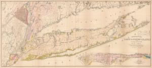
Geological Map of Long and Staten Islands with the Environs of New York.
sold
- Digital Map Information
- Suitable for large format printing
- Full resolution TIFF file
- ICC color profile embedded
- Delivered instantly via download link
The influential 1842 William W. Mather map of Long Island is considered the first comprehensive geological study of the island. Published while the Long Island Rail Road was still under construction, Mather's map captures a landscape that was still overwhelmingly rural, agricultural, and geographically remote from New York City, but whose soils, resources, transportation corridors, and development potential were becoming subjects of intense scientific and commercial interest. Within little more than a decade, the railroad would open vast portions of the island to easier settlement and speculation, initiating a land rush and a process of development that would ultimately transform Long Island into an extension of metropolitan New York. (more details)
A cave in upstate New York which was explored by two ordinary people in the early 1830s.
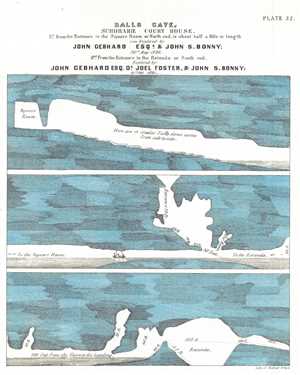
Ball's Cave, Schoharie Court House.
sold
- Digital Map Information
- Suitable for large format printing
- DPI: 300
- File Size: 2.69 MB
- File Type: ZIP / TIFF
- ICC color profile embedded
- Delivered instantly via download link
This is an 1842 William Mather lithograph plate from his Geology of New York, Part I depicting Ball's Cave. Ball's Cave was located in Schoharie County about two miles from the courthouse in Schoharie. It was discovered and explored by John Gebhard and John Bonny ... (more details)
A landmark map of Long Island and the earliest Long Island Wall Map.
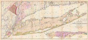
Geological Map of Long & Staten Islands with the Environs of New York.
sold
- Digital Map Information
- Suitable for large format printing
- DPI: 300
- File Size: 36.74 MB
- File Type: ZIP / TIFF
- ICC color profile embedded
- Delivered instantly via download link
Issued prior to the American Civil War and the subsequent Long Island land rush, this is one of the most detailed and attractive large format maps of Long Island to appear in the 19th Century. Covers from New Jersey and Staten Island eastward as Montauk and ... (more details)
A landmark map of Long Island and the earliest Long Island Wall Map.
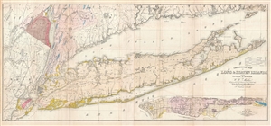
Geological Map of Long & Staten Islands with the Environs of New York.
sold
- Digital Map Information
- Suitable for large format printing
- File Size: 29.38 MB
- File Type: ZIP / TIFF
- ICC color profile embedded
- Delivered instantly via download link
Issued prior to the American Civil War and the subsequent Long Island land rush, this is one of the most detailed and attractive large format maps of Long Island to appear in the 19th Century. It is also the first comprehensivle geological study of Long ... (more details)
A landmark map of Long Island and the earliest Long Island Wall Map.
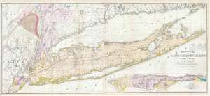
Geological Map of Long & Staten Islands with the Environs of New York.
sold
- Digital Map Information
- Suitable for large format printing
- DPI: 300
- File Size: 28.77 MB
- File Type: ZIP / TIFF
- ICC color profile embedded
- Delivered instantly via download link
Issued prior to the American Civil War and the subsequent Long Island land rush, this is one of the most detailed and attractive large format maps of Long Island to appear in the 19th Century. It is also the first comprehensivle geological study of Long ... (more details)
First geological map of Long Island.
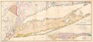
Geological Map of Long and Staten Islands with the Environs of New York.
sold
- Digital Map Information
- Suitable for large format printing
- Full resolution TIFF file
- ICC color profile embedded
- Delivered instantly via download link
A fine example of William W. Mather's 1842 large-scale geographical map of Long Island, New York - the first comprehensive geological study of the island. Issued prior to the completion of the Long Island Railroad and the subsequent Long Island land rush, this one of the largest, most detailed, and attractive maps of Long Island to appear in the 19th century. The map covers from New Jersey and Staten Island eastward as Montauk and Fisher's Island. Includes parts of Westchester, New Jersey, Rockland County, and the Connecticut coastline. A large inset map in the lower right depicts Manhattan with a special focus on geological features and topography. The line of the partially completed Long Island Railroad, which within 15 years would change the demographic of Long Island, is illustrated. Various important Long Island communities including the East Hampton, Bridgehampton, Southampton, Amagansett, Riverhead, and Sag Harbor, among others, are named. In many cases even individual buildings are detailed. The whole is laid out on a grid structure of ten-mile squares. (more details)
Two different locations on Long Island are sketched here - Sands Point and Long Beach Bay.
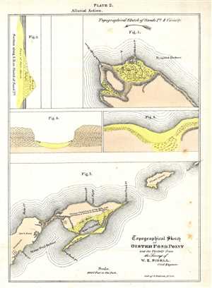
Topographical Sketch of Oyster Pond Point and the Vicinity from the Surveys of W. H. Sidell.
sold
- Digital Map Information
- Suitable for large format printing
- DPI: 300
- File Size: 1.37 MB
- File Type: ZIP / TIFF
- ICC color profile embedded
- Delivered instantly via download link
This is an 1842 William Mather lithograph plate from his Geology of New York, Part I depicting Oyster Pond Point and Sands Point, Long Island. Today, the areas in Figure 3 labeled here as Oyster Pond Harbour and Oyster Pond Bay are known as the Peconic ... (more details)
A north and south view of the geology of the Harlem Railroad tunnel.
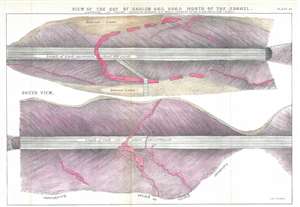
View of the Cut of Harlem Rail Road North of the Tunnel.
sold
- Digital Map Information
- Suitable for large format printing
- DPI: 300
- File Size: 6.22 MB
- File Type: ZIP / TIFF
- ICC color profile embedded
- Delivered instantly via download link
This is an 1842 William Mather lithograph plate from his Geology of New York, Part I depicting a view of the Harlem Railroad tunnel. The view depicts about 400 yards of rail in two views, a north view and a south view. Each view is split into approximately equal distances of 200 yards each. In the views, the cross section of the ground through which the tunnel was cut is illustrated, comprised mostly of layers of diluvial loam and gneiss. Some granite veins run through the gneiss, which are colored red. (more details)