
Maverick, Peter (sold)
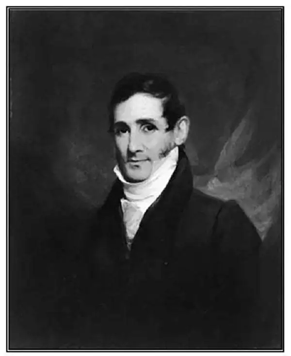
Peter Maverick (October 22, 1780 – June 7, 1831) was a New York City engraver active in the early part of the 19th century. Peter Maverick is best known engraving several seminal maps of New York City, including the Mangin-Goerck plan of 1803, the Bridges Plan of 1807, and Commissioner's Plan of 1811. Maverick mastered engraving under the tutelage of his father, Peter Rushton Maverick (1755 – 1811), a well known New York engraver in his own right. He was active as an engraver from roughly 1802, when he married Mary Griffin and graduated from his apprenticeship, to 1817. Maverick took his own apprentice, Asher Brown Durand, from 1812 to 1817. Once Durand graduated form his apprenticeship, five years later, he and Maverick established a partnership which lasted until about 1820. Maverick's first shop was located at 68 Beekman Street, New York. He later recoated to Frankfort Street and then to successive locations on Nassau Street. Peter Maverick died of a heart attack on June 7th of 1831.
The earliest obtainable example of the influential Goerck-Mangin Plan of New York City - published while it was still relevant.
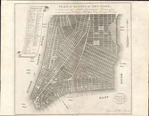
PLAN of the CITY OF NEW-YORK, with the recent and intended Improvements. New York, 1807.
sold
- Digital Map Information
- Suitable for large format printing
- DPI: 600
- File Size: 12.92 MB
- File Type: ZIP / TIFF
- ICC color profile embedded
- Delivered instantly via download link
This is a highly unusual piece with a confused and complex history. The map was published in 1807 by Isaac Riley, William Bridges, and Peter Maverick. It depicts lower Manhattan from roughly Bank Street (current West Village) to the Bowery, but is cartographically unusual as it follows the Mangin-Goerck Plan, a much larger c. 1801 map also engraved by Peter Maverick. That, plan, like the present map, proposed extensive landfill projects and new streets intended to generate clean neat lines and sharp right angles throughout. It is of note that this map pre-dates the 1811 Commissioner's Plan, and thus represents the definitive plan of New York City at the time of publication. This map is thus the only obtainable examples of one of the most important founding cartographic documents relating to the development of New York's street grid, publishing while the Mangin-Goerck map was still relevant. (more details)