
Mawman, Joseph (sold)

Joseph Mawman (fl. 1797 - 1827) was an English general interest publisher active in London during the early 19th century. Mawman published travel guides and narratives, classical works, natural history books, and literary editions as well as producing contract work for both individuals and institutions. Mawman's offices were established in the Poultry, London where he took over the established publishing firm of Edward and Charles Dilly in 1800. The offices were later relocated to Ludgate Street, also in London. Mawman, who nurtured friendships with various period luminaries, was well known and highly respected intelligence and publishing acumen. Mawman died in 1827.
Proto-Discovery of Great Salt Lake?
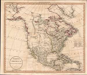
North America, Drawn from the Best Authorities by J. Russell.
sold
- Digital Map Information
- Suitable for large format printing
- Full resolution TIFF file
- ICC color profile embedded
- Delivered instantly via download link
A most fascinating 1811 John Russell map of North America with an intriguing mapping of Great Salt Lake issued just prior the development of the Western Fur Trade and the seminal explorations of Zebulon Pike (1779 - 1813), Stephen Harriman Long (1874 - 1864), and Jedidiah Smith (1799 - 1831). The map postdates the Lewis and Clark Expedition (1803 - 1806), but reconnaissance from that voyage is nowhere in evidence. Instead, the map details the dubious voyage of 'Mr. Lawrence' (see below). Coverage from the Pacific Ocean to the Atlantic Ocean and from Baffin Bay and northern Canada to the extreme northern reaches of South America. The extreme northern portion of North America, above the Arctic Circle, is incomplete, but the Arctic coast is slowing being filled in. The map further identifies the first two European overland expeditions to the North American Arctic, those of Herne and Mackenzie. The United States, still limited to the lands east of the Mississippi and north of Florida, has 15 states, reflecting the addition of Vermont (1791) and Kentucky (1792). (more details)
One of the most beautiful maps of Italy to emerge in the 19th century.
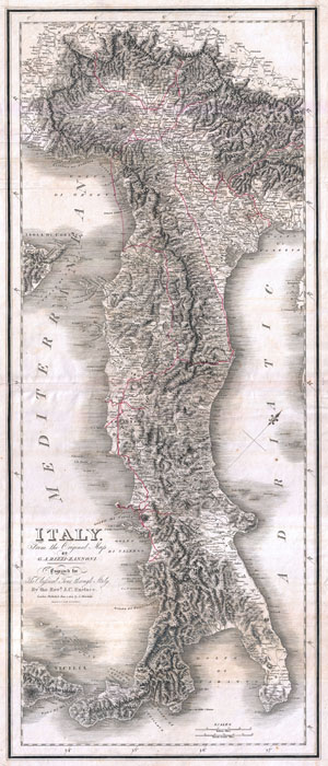
Italy from the Original Map by G. A. Rizzi-Zannoni.
sold
- Digital Map Information
- Suitable for large format printing
- DPI: 300
- File Size: 28.69 MB
- File Type: ZIP / TIFF
- ICC color profile embedded
- Delivered instantly via download link
One of the most attractive maps of Italy to appear in the 19th century, this is the 1814 Mawman and Smith re-engraving of G. A. Rizzi-Zannoni's magnificent 1802 Nuova Carta dell'Italia . Only slightly smaller than Rizzi-Zannoni's map in the vertical dimension, ... (more details)