
Mayer, Merkel and Ottmann (sold)

Mayer, Merkel and Ottmann (1869 - 1901) was a New York City based lithography firm founded in New York by the German immigrants Vincent Mayer and August Merkel. Merkel and Mayer initially worked under 'Ferdinand Mayer and Company', before founding their own publishing partnership in 1869 as 'Mayer and Markel.' The Prussian immigrant Jacob Ottmann (1849 - 1890) joined the firm shortly thereafter and, when he had built up enough equity, became a partner. The firm officially changed to 'Mayer, Merkel and Ottmann' in 1874. The concern specialized in highly graphic color printed trade cards, and, by the 1800s, were a major American lithographic firm. Mayer and Merkel retired in 1885, leaving the firm to Ottmann, who renamed it 'J. Ottmann Lithographic' and in 1886 relocated to the Puck Building at 39 E. Houston Street. Around this time, he began to publish the weekly magazine Puck, known for graphically intense and witty political satire. After Ottmann's death in 1890, the firm was taken over by his son, William Ottmann, who shunted day to day management to Frank A. Bloom (1855 - 1901). Bloom ran the firm until his death in 1901, when it was acquired and became part of the United States Printing and Lithographing Company.
Extraordinary early map of the Upper West Side of Manhattan.
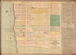
Map showing all the Farm and Boundary Lines of the Estates as they existed when in possession of the Apthorpe's, Vanderheuvel's, Sommeridike's, Lawrence's, Harsen's, Cadel's, Dykeman's and c.
sold
- Digital Map Information
- Suitable for large format printing
- File Size: 64.81 MB
- File Type: ZIP / TIFF
- ICC color profile embedded
- Delivered instantly via download link
One of only 3 known examples of John Bute Holmes's c. 1874 cadastral map of the Upper West Side of Manhattan. The map covers from 70th street to 84th street and from the Hudson River to Central Park, including Manhattan Square, where the American Museum of Natural History would be constructed in 1874. This area comprises the earliest developed part of the Upper West Side and, with the construction of Central Park, flourished as one of Manhattan's most desirable neighborhoods. (more details)
Extraordinary early map of the Upper West Side of Manhattan.
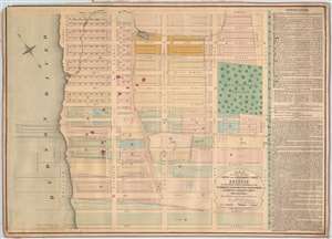
Map showing all the Farm and Boundary Lines of the Estates as they existed when in possession of the Apthorpe's, Vanderheuvel's, Sommeridike's, Lawrence's, Harsen's, Cadel's, Dykeman's and c.
sold
- Digital Map Information
- Suitable for large format printing
- File Size: 62.81 MB
- File Type: ZIP / TIFF
- ICC color profile embedded
- Delivered instantly via download link
One of only 3 known examples of John Bute Holmes's c. 1874 cadastral map of the Upper West Side of Manhattan. The map covers from 70th street to 84th street and from the Hudson River to Central Park, including Manhattan Square, where the American Museum of Natural History would be constructed in 1874. This area comprises the earliest developed part of the Upper West Side and, with the construction of Central Park, flourished as one of Manhattan's most desirable neighborhoods. (more details)
Robber Barons carving up the country.
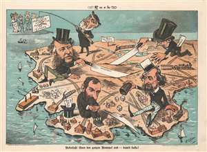
Überlässt ihnen den ganzen Rummel - und damit basta!
sold
- Digital Map Information
- Suitable for large format printing
- Full resolution TIFF file
- ICC color profile embedded
- Delivered instantly via download link
This is an 1882 Frederick Opper Puck political cartoon map of the United States being carved up by Gilded Age millionaires. Published in a German language edition of Puck magazine, the cartoon features robber barons Jay Gould, William Henry Vanderbilt, Russell Sage, and Cyrus West Field dividing the country for personal gain. Vanderbilt physically cuts his slice of the country with a large knife, while Sage taunts European monarchs with proposals for buying Europe. Field and Gould play dice in the Northeast, likely rolling to see who would control what. Railroads, which played a critical role in building these four men's (and others like them) incredible fortunes, appear across the country. (more details)
'The largest, best-known and most useful Nantucket map.' -Crosby
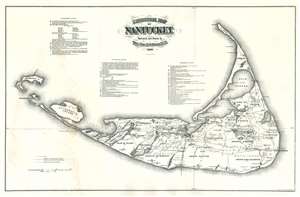
Historical Map of Nantucket.
sold
- Digital Map Information
- Suitable for large format printing
- File Size: 30.56 MB
- File Type: ZIP / TIFF
- ICC color profile embedded
- Delivered instantly via download link
An impressive c. 1886 large scale wall map of Nantucket, Massachusetts. This map is a later, much-enlarged Joseph B. Swain issue of Reverend Ferdinand Cartwright Ewer's (1826 - 1883), seminal 1869 map of Nantucket. It was likely made to promote the Nantucket Hotel, which opened 2 years earlier. According to Nantucket historian, Everett U. Crosby, this is 'The largest, best-known and most useful Nantucket map.' The map is richly detailed and expressive of Nantucket's topography, road system, railroad lines, and even political breakdown. It shows swamps, ponds, important hotels and lighthouses, hills, and more. Some references are dated and correspond to a table located at center. (more details)