
Merian, Matthäus
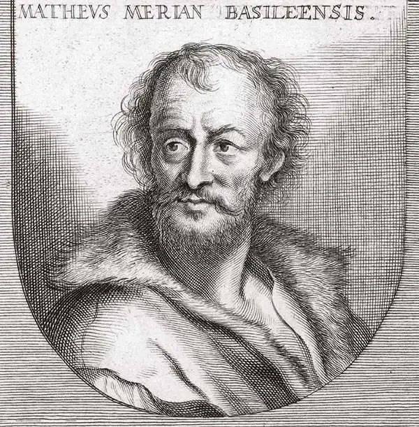
Matthäus Merian (September 22, 1593 - June 19, 1650), sometimes referred to as 'the Elder' to distinguish from his son, was an important Swiss engraver and cartographer active in the early to mid 17th century. Merian was born in Basel and studied engraving in the centers of Zurich, Strasbourg, Nancy and Paris. In time Merian was drawn to the publishing mecca of Frankfurt, where he met Johann Theodor de Bry, son of the famed publisher Theodor de Bry (1528 - 1598) . Merian and De Bry produced a number of important joint works and, in 1617, Merian married De Bry's daughter Maria Magdalena. In 1623 De Bry died and Merian inherited the family firm. Merian continued to publish under the De Bry's name until 1626. Around this time, Merian became a citizen of Frankfurt as such could legally work as an independent publisher. The De Bry name is therefore dropped from all of Merian's subsequent work. Of this corpus, which is substantial, Merian is best known for his finely engraved and highly detailed town plans and city views. Merian is considered one of the grand masters of the city view and a pioneer of the axonometric projection. Merian died in 1650 following several years of illness. He was succeeded in the publishing business by his two sons, Matthäus (1621 - 1687) and Caspar (1627 - 1686), who published his great works, the Topographia and Theatrum Europeaum, under the designation Merian Erben (Merian Heirs). Merian's daughter, Anna Maria Sibylla Merian, became an important naturalist and illustrator. Today the German Travel Magazine Merian is named after the famous engraver.
Leipzig Besieged!
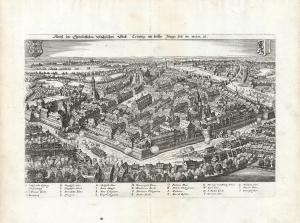
Abriß der Churfürstlichen Sächsischen Statt Leÿptzig, wie diselbe Jetziger Zeit im Wesen ist.
$450.00
Acquire
- Digital Map Information
- Suitable for large format printing
- DPI: 600
- File Size: 23.14 MB
- File Type: ZIP / TIFF
- ICC color profile embedded
- Delivered instantly via download link
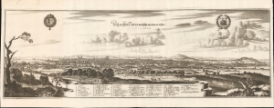
This is Matthäus Merian's superbly detailed 1638 bird's-eye view of the city of Leipzig, under siege during the preliminaries to the 1631 Thirty Years' War Battle of Breitenfeld. Included in Merian's 1638 Archontologia cosmica sive imperiorum, its title suggests it was drawn closer to the battle itself and may have been separately issued closely on the heels of the fight. (more details)
Dubrovnik and Chalcis.
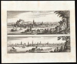
Ragusa / Negroponte.
$550.00
Acquire
- Digital Map Information
- Suitable for large format printing
- File Size: 10.54 MB
- File Type: ZIP / TIFF
- ICC color profile embedded
- Delivered instantly via download link
This is a 1638 Matthias Merian engraving of two city views: Ragusa (Dubrovnik, Croatia) and Negroponte (Chalcis, Greece). Each city is viewed as if from a high point, with its harbor in the foreground. Then, as now, grand medieval walls surround each, but within both church steeples and minarets are apparent, underscoring how each city frequently changed hands in the ongoing wars between the Ottoman Empire and the Venetian Republic. (more details)
Besieged.
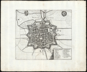
Franckenthal.
$250.00
Acquire
- Digital Map Information
- Suitable for large format printing
- DPI: 600
- File Size: 20.76 MB
- File Type: ZIP / TIFF
- ICC color profile embedded
- Delivered instantly via download link
This is Matthäus Merian's superbly detailed 1638 plan of the fortress city of Franckenthal, as it stood during the Thirty Years' War (1618 - 1648). Included in Merian's 1638 Archontologia cosmica sive imperiorum, it accompanied views and plans of other fortresses and battles pertinent to the long war. (more details)
Leipzig Besieged AGAIN!
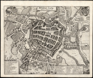
Die Statt Leipzig Sampt der Belagerung. Ao. 1637.
$450.00
Acquire
- Digital Map Information
- Suitable for large format printing
- DPI: 600
- File Size: 31.78 MB
- File Type: ZIP / TIFF
- ICC color profile embedded
- Delivered instantly via download link
This is Matthäus Merian's superbly detailed 1639 plan of the city of Leipzig, under siege by the Swedish army during the Thirty Years' War (1618 - 1648). The plan captures the walled and moated city and its suburbs in the midst of battle. Whole neighborhoods are in flames with Swedish positions around the city revealed, presenting the most desperate point of the siege: the Swedes had blown a huge breach at the Grimma Gate, and were on the verge of taking the town. (more details)
Bold example of a scarce map of China, Japan and Korea.
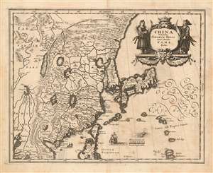
China Veteribus Sinarum Regio nunc Incolis Tame dicta.
$900.00
Acquire
- Digital Map Information
- Suitable for large format printing
- DPI: 600
- File Size: 10.63 MB
- File Type: ZIP / TIFF
- ICC color profile embedded
- Delivered instantly via download link
This is a scarce 1638 Matthais Merian map of China and Japan with an insular Korea. The map is beautifully engraved, decorated with a Chinese junk, a Dutch sailing ship, and a sea monster; the elegant cartouche is flanked by a man and woman in (presumably) Chinese robes. The Great Wall features prominently. The Philippine island of Luzon is shown, as is Formosa (Taiwan.) (more details)
The state of the art of Western Cartography in Russia during the Time of Troubles.
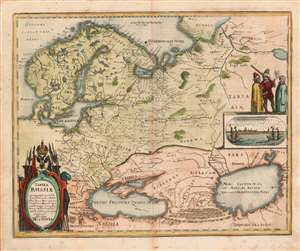
Tabula Russiae ex autographo, quod delineandum curavit Foedor filius Tzaris Boris desumta et ad fluvios Dwinam, Zuchanaw aliaque loca quandum ex tabulis et notitijs ad nos delatis fieri potuit amplificaca alias dicta Moscovia.
$850.00
Acquire
- Digital Map Information
- Suitable for large format printing
- DPI: (600.12890625, 600.12890625)
- File Size: 10.05 MB
- File Type: ZIP / TIFF
- ICC color profile embedded
- Delivered instantly via download link
This is a scarce 1638 Matthias Merian map of Russia. Though an intermediary source may have been Hessel Gerritz, the map is believed to have been ultimately derived from a Russian survey prepared at the orders of the Czar of Muscovy, Boris Godunov. Although this map's information dates to the end of the 16th century, the onset of the Time of Troubles following the death of Boris Godunov would curtail much reliable contact with this part of the world, and so well into the 17th century this map would remain the most up-to-date mapping of Muscovy available. (more details)
Pre-Смутное время plan of Moscow.
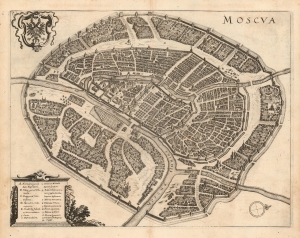
Moscva.
$1,900.00
Acquire
- Digital Map Information
- Suitable for large format printing
- DPI: 600
- File Size: 12.97 MB
- File Type: ZIP / TIFF
- ICC color profile embedded
- Delivered instantly via download link
This is a scarce 1638 Matthais Merian city plan or map of Moscow. Apart from the Braun and Hogenberg, this is the earliest full-sheet edition of the plan, which pre-dates by more than 20 years the version included by Joan Blaeu in his Atlas Maior. (more details)
Bucolic Panorama of Paris and her Countryside.
Prosp. der Statt Parys wie solche an ietzo an zusehen.
$2,200.00
Acquire
- Digital Map Information
- Suitable for large format printing
- DPI: 600
- File Size: 493.15 MB
- File Type: ZIP / TIFF
- ICC color profile embedded
- Delivered instantly via download link
This is a 1655 Caspar Merian view of Paris, France - a superbly executed view showing that in artistry, Caspar was indeed his father's son. The view is oriented to the west-south-west, from a perspective both farther from the city and more to the east than the elder Merian's 1638 view. Rather than border the view with stylized or fanciful floral decoration, Caspar Merian has - following the lead of his father - chosen to frame the panorama in realistic semi-wild trees and bracken akin to that of the hillside from which the view was drawn, which has the effect of emphasizing that it was drawn from life. (more details)
Rare, large-format view of Seville.
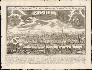
Hispalis Vulgo Sevilliae Urbis Toto Orbe Celeberrimae Primariae Effigies Hispaniae Que Seville.
$2,000.00
Acquire
- Digital Map Information
- Suitable for large format printing
- File Size: 27.84 MB
- File Type: ZIP / TIFF
- ICC color profile embedded
- Delivered instantly via download link
This is a rare, separately-issued c. 1685 François Jollain panoramic map of the Spanish city of Seville or Sevilla. It is an expanded version of the 1638 Merian view, here presented on a much larger scale. (more details)