
Montero, Captain D. Claudio (sold)

Captain D. Claudio Montero (1824-1885) was a Spanish naval officer, and head of the Hydrographic and Scientific departments of the Spanish Navy. Upon entering the navy in 1839 at the age of 15, he was promptly tasked with hydrographic projects, clearly being groomed for position as a navigator and chartmaker. In 1845 he was made a Lieutenants, and assigned to the Philippines, where he would remain for a significant part of his military career. In 1856 he was appointed head of the newly-formed Comisión Hidrográfica de Filipinas. Both under his direction, and following it - between 1856 and 1899 - the Comisión published thirty-five nautical charts of the Philippine archipelago. By 1868, he had been appointed major general of the Philippine station, a position he retained until his return to the Spain to receive his 1869 appointment as head Hydrography and Science in the Ministry of the Navy.He continued to focus on Philippine affairs: in 1871, he joined the Philippine Council, of which he would become vice president - and in 1877, he returned to the Philippine Islands, this time as governor of Mindanao and commander of the Naval Division of the South of the Philippines. However, in early 1878, just a few months after his appointment, health problems forced him to submit his resignation in both positions. He returned to sea after his recovery for a time, and held positions as Rear Admiral in Spain and in Havana prior to his death.
Includes the city of Iloilo, the third most active port in the Philippines.
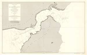
Archipiélago Filipino. Plano del Estrecho de Ilo - Ilo.
sold
- Digital Map Information
- Suitable for large format printing
- File Size: 53.29 MB
- File Type: ZIP / TIFF
- ICC color profile embedded
- Delivered instantly via download link
This is an 1875 Direccion de Hidrografia and D. Claudio Montero nautical chart or maritime map of the Iloilo Strait in the Philippines. The Iloilo Strait separates Panay Island from Guimaras Island and connects the Panay Gulf with the Guimaras Strait. Depth soundings are indicated throughout, as are banks and shoals. Points along the coast are labeled, as is the port city of Iloilo, which is today the third busiest port in the Philippines with regard to number of ships. A manuscript anchor in drawn near Iloilo, indicating the presence of a safe harbor. (more details)
Manila Harbor Charted in Fine Detail
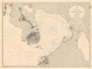
Philippines, Luzon Island, Manila Bay Surveyed by the Spanish Phillipine Hydc. Commission under the direction of Captain Claudio Montero 1861 with Corrections and Additions to 1885.
sold
- Digital Map Information
- Suitable for large format printing
- File Size: 50.78 MB
- File Type: ZIP / TIFF
- ICC color profile embedded
- Delivered instantly via download link
A large, richly detailed 1886 navigational map of Manila Bay in the Philippines, one of the largest available in the English language. Published and updated by the British Admiralty, it was made in cooperation with the Spanish/ Philippine hydrographer D. Claudio Montero, who oversaw Spanish navigational charting of the Philippines directly for more than a decade. This chart shows significant updating even since its 1876 issue: topographical hachures are much more extensive and detailed; Subic Bay shows improved soundings; Manila bay's soundings have considerably multiplied. Tentative attempts to chart the river systems emptying into the north of the Bay are evident. Manila has been re-engraved, reflecting the rebuilding of the city after the 1863 earthquake. The charting of Punta de Kalumpan and Port Limbones shows significant improvement over the 1876 edition of the map as well. (more details)