
Murphy, John F. (sold)

John F. Murphy (fl. c. 1880 - 1920) was a news agent and businessman active in the Boston area during the late 19th century and early 20th century. Murphy managed numerous successful businesses in Boston and the surrounding area, including a number of news stands in railroad stations across the state. He is best known for his publication "Birds Eye Views of Boston Harbor", a tourist oriented map series focusing on Boston Harbor, Cape Cod, the South Shore and Provincetown.
Pre-Columbian Discovery of America, or an Elaborate Hoax?
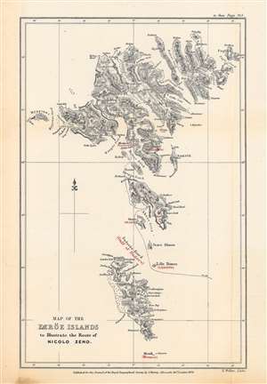
Map of the Færöe Islands, to Illustrate the Route of Nicolo Zeno.
sold
- Digital Map Information
- Suitable for large format printing
- File Size: 10.7 MB
- File Type: ZIP / TIFF
- ICC color profile embedded
- Delivered instantly via download link
This is Edward Weller's map of the Faroe Islands, published in 1873 in the Journal of the Royal Geographical Society, outlining the presumed route of Nicolò Zeno, a Venetian mariner who may have visited the islands in the late 14th century. The potential travels of Nicolò and his brother Antonio, including a possible discovery of the New World a century before Columbus, have been one of the most enduring debates in the history of cartography. (more details)
Spectacular view of Boston and Cape Cod.
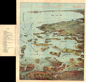
Bird's Eye View of Boston Harbor and South Shore to Provincetown Showing Steamboat Routes.
sold
- Digital Map Information
- Suitable for large format printing
- File Size: 16.52 MB
- File Type: ZIP / TIFF
- ICC color profile embedded
- Delivered instantly via download link
A remarkable chromolithograph map and view of Boston Harbor from Boston to Provincetown. Includes all of Cape Cod Bay, Quincy Bay and Dorchester Bay with the communities of Boston, East Boston, South Boston, Dorchester, Quincy, Hough's Neck, Mingham, Nantasket, ... (more details)
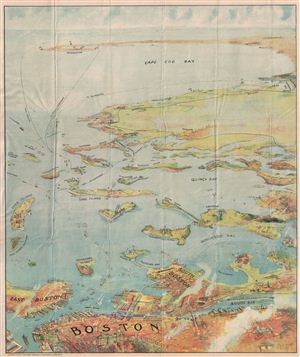
Bird's Eye View of Boston Harbor and South Shore to Provincetown Showing Steamboat Routes.
sold
- Digital Map Information
- Suitable for large format printing
- File Size: 14.08 MB
- File Type: ZIP / TIFF
- ICC color profile embedded
- Delivered instantly via download link
A remarkable chromolithograph map and view of Boston Harbor from Boston to Provincetown. Includes all of Cape Cod Bay, Quincy Bay and Dorchester Bay with the communities of Boston, east Boston, South Boston, Dorchester, Quincy, Hough's Neck, Mingham, Nantasket, ... (more details)
A classic view of Boston.
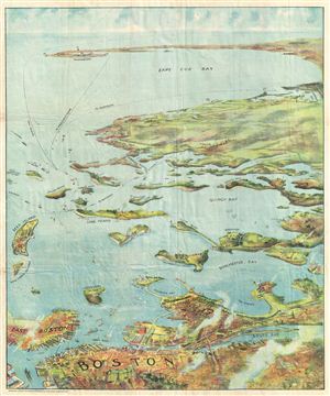
Bird's Eye View of Boston Harbor and South Shore to Provincetown Showing Steamboat Routes.
sold
- Digital Map Information
- Suitable for large format printing
- File Size: 8.41 MB
- File Type: ZIP / TIFF
- ICC color profile embedded
- Delivered instantly via download link
A remarkable chromolithograph map and view of Boston Harbor from Boston to Provincetown. The view includes all of Cape Cod Bay, Quincy Bay and Dorchester Bay with the communities of Boston, East Boston, South Boston, Dorchester, Quincy, Hough's Neck, Mingham, ... (more details)
A classic view of Boston.
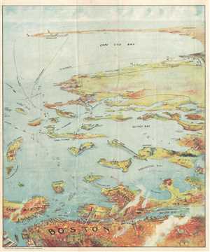
Bird's Eye View of Boston Harbor and South Shore to Provincetown Showing Steamboat Routes.
sold
- Digital Map Information
- Suitable for large format printing
- File Size: 11.68 MB
- File Type: ZIP / TIFF
- ICC color profile embedded
- Delivered instantly via download link
A remarkable chromolithograph map and view of Boston Harbor from Boston to Provincetown. The view includes all of Cape Cod Bay, Quincy Bay and Dorchester Bay with the communities of Boston, East Boston, South Boston, Dorchester, Quincy, Hough's Neck, Mingham, ... (more details)
A classic view of Boston, Boston Harbor, and Cape Cod.
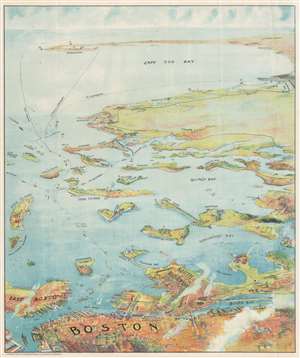
Bird's Eye View of Boston Harbor and South Shore to Provincetown Showing Steamboat Routes.
sold
- Digital Map Information
- Suitable for large format printing
- Full resolution TIFF file
- ICC color profile embedded
- Delivered instantly via download link
A remarkable chromolithograph map and view of Boston Harbor from Boston to Provincetown - issued for sale on steamships and passenger terminals on the Boston-Provincetown line. The view includes all of Cape Cod Bay, Quincy Bay, and Dorchester Bay, with the communities of Boston, East Boston, South Boston, Dorchester, Quincy, Hough's Neck, Mingham, Nantucket, Duxbury, Plymouth, Cohasset, Scituate, and Provincetown noted. Also notes many of the islands in Boston Harbor including Moon Island, Spectacle Island, Thomson's Island, Long Island, Governor's Island, and many others. Ferry and steamboat routes are noted. Smoke rises from Boston's many manufactories. Today such might be construed as symbol of pollution and urban defilement, but when this view was printed, busy smokestacks were symbols of commercial prosperity and industrial optimism. (more details)
The only known example of the Murphy and Olmstead View of the Catholic University of America, Washington D.C.
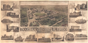
Proposed Plan. The Catholic University of America Washington D.C.
sold
- Digital Map Information
- Suitable for large format printing
- File Size: 15.07 MB
- File Type: ZIP / TIFF
- ICC color profile embedded
- Delivered instantly via download link
An impressive and rare 1914 photo gelatin view of the campus of the Catholic University of America in Washington, D.C. The view presents proposed improvements by the Washington D.C. architects Murphy and Olmsted. The print consists of a general view of the ... (more details)