
Olney, Jesse (sold)

Jesse Olney (1798 - 1872) was an American geographer, primarily active and successful in the production of school textbooks on that subject. His sales were second only to thos of Webster's American Spelling Book. He was educated in Whitesboro, New York, and would work as a teacher both there and in Binghamton. From 1819 to 1831 he served as principal of the Stone School in Hartford, Connecticut. In 1828 he published A Geography and Atlas, which for thirty years would be the standard geographical text used throughout the United States. It was many times enlarged and revised, and ran through 98 editions. While prior geographies opened with a description of astronomy and the solar system - a convention harkening back to Ptolemy, and the discipline of cosmography - Olney chose instead to center his pedagogy on the student's home town, expanding instead from there. The intention was to guide the student in study of the Earth by moving from that which was near and familiar to what was distant and abstract. He would later expand his repertoire of textbooks to include readers, arithmetic books, and United States history. He would enter the Connecticut legislature, using his position to influence the development of that state's schools. A Unitarian, he would be also active in advocacy for the liberal religious movements in New England.
By a Congressman's Daughter.
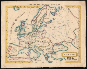
Europe 1834. Lucy Durfee.
sold
- Digital Map Information
- Suitable for large format printing
- DPI: 600
- File Size: 40.03 MB
- File Type: ZIP / TIFF
- ICC color profile embedded
- Delivered instantly via download link
This is a beautifully executed schoolgirl map of Europe, drawn in 1834 by Lucy Durfee (conjecturally the daughter of legislator and congressman Job Durfee). (more details)
By a Congressman's Daughter.
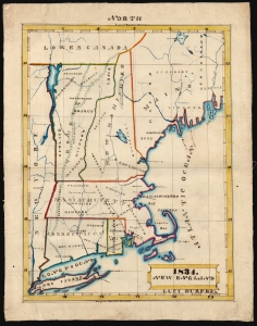
1834. New England Lucy Durfee's.
sold
- Digital Map Information
- Suitable for large format printing
- DPI: 600
- File Size: 33.81 MB
- File Type: ZIP / TIFF
- ICC color profile embedded
- Delivered instantly via download link
This is a beautifully executed schoolgirl map of New England, drawn in 1834 by Lucy Durfee (conjecturally the daughter of legislator and congressman Job Durfee). (more details)
Fascinating American School Map of the World.
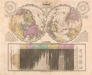
The World on a Globular Projection.
sold
- Digital Map Information
- Suitable for large format printing
- DPI: 600
- File Size: 14.39 MB
- File Type: ZIP / TIFF
- ICC color profile embedded
- Delivered instantly via download link
This is a fascinating 1841 Jesse Olney polar projection world map reflecting the educational, geographical, and religious values of mid-19th century America. (more details)