
Galaup, Jean François de, Comte de La Pérouse
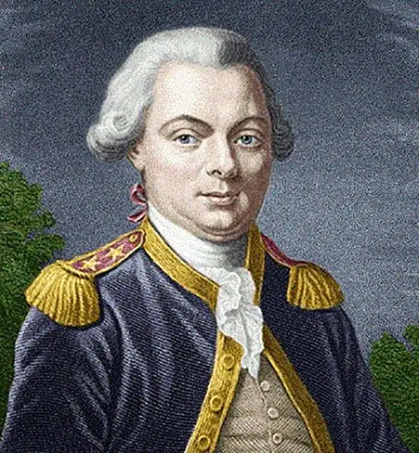
Jean François de Galaup, Comte de La Pérouse (August 23, 1741 - 1788) was a French naval officer, navigator, and explorer active in the later part of the 18th century. Born into a noble family of Albi, France, La Perouse entered the navel college of Brest at just 15. At seventeen La Perouse made his first naval voyage, a supply expedition to the fort of Louisbourg in New France. He later participated in a number of naval battles, mostly against the English, and eventually rose to the rank of Commodore. In 1782 he captured the English forts Prince of Wales and York, making a name for himself back in France. Following the British defeat at the end of the American Revolutionary War, La Perouse was appointed by Louis XVI to lead an expedition of discovery circumnavigating the globe. The goal of the expedition was to complete and correct the maps of the Pacific drawn by Captain Cook. La Perouse's two frigates, the Astrolabe and the Boussole rounded Cape Horn and entered the Pacific in 1785. Crisscrossing the Pacific from Macau and Japan to Alaska, Vancouver, and the Hawaiian Islands Perouse made numerous discoveries and adding considerably to the cartographic corpus, particularly along the coast of British Columbia and around Japan. In Australia La Perouse sent his last letter back to France containing all of his maps and research. Tragically, on the return voyage La Perouse ran into a violent storm which left both of his frigates shipwrecked on the Polynesian island of Vanikoro, part of the Santa Cruz Group. Some of the survivors of the shipwrecks seem to have managed to live on the island for years afterwards. As late as 1790 the English Captain Edward Edwards saw smoke signals coming from Vanikoro but foolishly declined to investigate. Expeditions in 2005 and in 2008 identified the remains of both ships and retuned numerous artifacts from the ill-fated expedition to France. The importance of La Perouse's discoveries was, unfortunately, not seriously appreciated until many years later because, when the La Perouse maps were finally published in 1797, newer more accurate maps of the region were already in circulation. Nonetheless, La Perouse remains of the titans of Pacific exploration and he work paved the path forward for all future expeditions to the region.
An early map of one of the world's most treacherous bays.
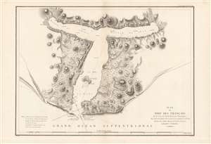
Plan du Port des Francais.
$900.00
Acquire
- Digital Map Information
- Suitable for large format printing
- DPI: 600
- File Size: 95.32 MB
- File Type: ZIP / TIFF
- ICC color profile embedded
- Delivered instantly via download link
This is a fine example of La Perouse's important 1786 mapping of Lituya Bay, which he named 'Port des Français,' on the southern portion of the Alaska coastline. When drawn in 1786, La Perouse's map was the only available map of this region not based on the survey work of Captain Cook. (more details)
An early voyage of exploration in the North Pacific.
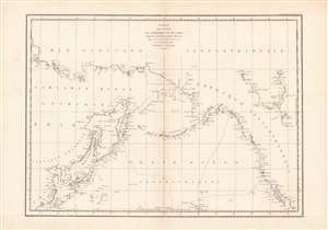
Carte des cotes de l'Amerique et de l'Asie...
$800.00
Acquire
- Digital Map Information
- Suitable for large format printing
- Full resolution TIFF file
- ICC color profile embedded
- Delivered instantly via download link
This is a wonderful example of La Perouse's important 1786 mapping of the North Pacific. When drawn in 1786 La Perouse's map was the only available map of much of this region not based on the survey work of Captain Cook. (more details)
Early map of the Alaska coastline.
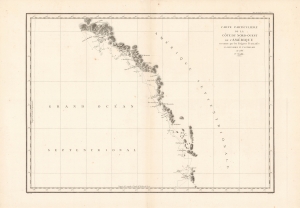
Carte particuliere de la cote du nord-ouest de l'Amerique...
$800.00
Acquire
- Digital Map Information
- Suitable for large format printing
- Full resolution TIFF file
- ICC color profile embedded
- Delivered instantly via download link
This is a beautiful 1786 map of the southern Alaska coastline by the French explorer La Perouse. When drawn, it was the only map of this region not based on the surveys of Captain Cook. (more details)
Earliest detailed map of the Kuril Islands.
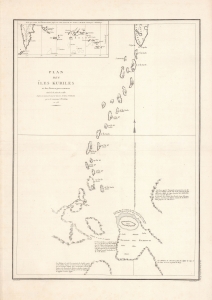
Plan des Iles Kuriles et des terres peu connues situees a la suite de ces Iles...
$400.00
Acquire
- Digital Map Information
- Suitable for large format printing
- DPI: 600
- File Size: 66.84 MB
- File Type: ZIP / TIFF
- ICC color profile embedded
- Delivered instantly via download link
Here is La Perouse's fascinating and pioneering 1788 mapping of the Kuril Islands, which his expedition charted the year prior. It is the earliest detailed chart of the islands by a European explorer, part of La Perouse's groundbreaking work, and a keystone in the developing geographical knowledge of Northeast Asia. (more details)
The earliest obtainable map of San Diego Bay.
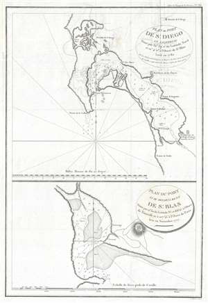
Plan du Port de St. Diego en Californie situe par 32°39'0 de latitude nord et 12°4'0 a l'ouest de St. Blas. Leve en 1782. / Plan du Port de du Departement de St. Blas situe par 21°30' de latitude nd. et 88°15' a l'ouest de Teneriffe et a 107°15' a l'ouest de Paris.
$650.00
Acquire
- Digital Map Information
- Suitable for large format printing
- Full resolution TIFF file
- ICC color profile embedded
- Delivered instantly via download link
The earliest obtainable printed map of San Diego, preceded only by rare maps by Dalyrmple and a few other equally unobtainable works. This map of San Diego was issued for the atlas of Jean-François de Galaup, Comte de La Pérouse's, voyages. The image consists of two maps on a single sheet. The upper map focuses on San Diego Bay, covering from Mission Bay to roughly the Tijuana River, although that river is not shown. The Presidio de St. Diego is identified roughly on the site of the modern-day city of San Diego. Further south, near National City, the Ranchiere de las Choyas is noted. Further south still, near the modern-day Otay River, an American Indian village is noted. Cartographically, this map is derived from the maps of Don Juan Pantoja y Arriola, a Spanish sea captain active on the Acapulco-Manila route in the late 18th century. In addition to crossing the Pacific, he made several coastal runs to San Diego, Monterey, and San Francisco, among other locations on the California coast – where he also completed surveys. Somewhere along this route he must have met La Perouse, who was then surveying the western coast of America, and passed on manuscript versions of his surveys. These found their way into La Perouse's journals and were subsequently published posthumously in Paris. La Perouse probably never actually entered San Diego Bay and relied solely on Pantoja's manuscript charts for his information. (more details)