
Roe, Sir Thomas (sold)
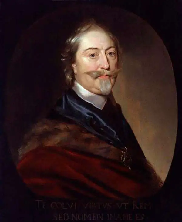
Sir Thomas Roe (c. 1581 – November 6, 1644) was an English scholar, politician and diplomat, who served as England's ambassador to the Mughal Empire, the Ottoman Empire, and the Holy Roman Empire. He was born in Essex, son of Sir Robert Rowe and his wife Elinor Jermy. He entered Magdalen College, Oxford, in 1593, at the age of twelve. In 1597 he became esquire to Queen Elizabeth, and would be knighted by James I in 1604. He became friends with Henry, Prince of Wales, who in 1610 would send him on a mission to the West Indies, during which he would attempt to find El Dorado, at that time believed to be in the vicinity of the Lake Parime in South America. Between 1616 and 1619, at the behest of the East India Company, King James sent Roe to India as ambassador to the Agra court of the Mughal Emperor, Jahangir. A gracious guest, Roe arrived with a large supply of red wine, with the apparent result that he became a favourite of Jahangir and may have been his drinking partner. Roe thus successfully secured permission for the East India Company to establish a factory at Surat, giving The Company a key early foothold in India. Roe made an effort to assemble geographical data of the Mughal Empire, the interior of which was virtually unknown to Europeans. During his 1919 voyage home, he collaborated with the ship's master William Baffin in producing what would be the most influential map of that empire to be produced in the 17th century. Later, he would become ambassador to the Ottoman Empire, negotiating privileges for English merchants and in one instance making treaty with Algeria in order to free captives of the piratical kingdom. During his time in Constantinople, he was able to acquire a wealth of rare manuscripts which he would present to the King, and to the Bodleian Library. He would go on to serve as a diplomat during the Thirty Years War, arranging treaties between Sweden and Poland, Danzig and Denmark. In later years, he would sponsor arctic explorer Luke Fox, and would eventually become a privy councillor and was elected MP. Between 1641 and 1642 he would be appointed ambassador to the Holy Roman Empire, taking part in peace conferences at Hamburg, Regensburg and Vienna.
First accurate mapping of the Indus River and western and central India.
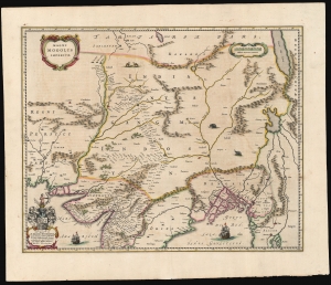
Magni Mogolis Imperium.
sold
- Digital Map Information
- Suitable for large format printing
- Full resolution TIFF file
- ICC color profile embedded
- Delivered instantly via download link
This is an attractive, original color example of Joan and Cornelis Blaeu's 1640 map of the Mughal Empire of Northern India. It is among the most attractively engraved of the 17th-century maps derived from the unacquirable Baffin/Roe map. The map features the first accurate mapping of the Indus River and western and central India. At its heart, the map reveals the vital trade routes between the chief cities of Gujarat, Agra, and Jaisalmer and their linkage to the Silk Road center of Kabul. (more details)
A most attractive Dutch Map of the Mogul Empire.
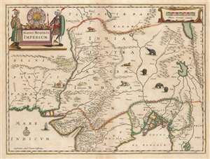
Magni Mogolis Imperium.
sold
- Digital Map Information
- Suitable for large format printing
- DPI: 600
- File Size: 44.94 MB
- File Type: ZIP / TIFF
- ICC color profile embedded
- Delivered instantly via download link
This is an attractive, original color example of Jan Jansson's 1641 map of the Mughal Empire of Northern India. It is the most attractively engraved of the 17th century maps derived from the unacquirable Baffin / Roe map. It features the first accurate mapping of the Indus River, as well as western and central India. At its heart, the map reveals the vital trade routes between the chief cities of Gujarat, Agra, Jaisalmer, and their linkage the Silk Road center of Kabul. (more details)