
Sanuto, Livio (sold)

Livio Sanuto (1520 – 1576) was a Venetian cartographer and scientific instrument maker produced, with his engraver brother, Giulio (fl. 1540-1588) – an array of some of the most important geographical works produced in Venice during the second half of the sixteenth century. These included a 27-inch globe and the 1588 12-sheet atlas, Geografia della Africa. Among Livio and Giulio's works were some, if not all of the maps prepared for Ruscelli's 1561 Ptolemy.
Reconciling Verrazano and Cartier.
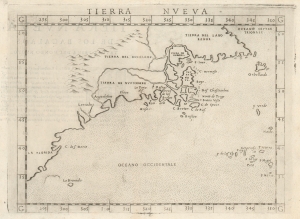
Tierra Nveva.
sold
- Digital Map Information
- Suitable for large format printing
- Full resolution TIFF file
- ICC color profile embedded
- Delivered instantly via download link
This is Girolamo Ruscelli's 1574 map Tierra Nveva, an early and influential map of what would become New England and the Canadian Maritime Provinces. Although the cartography can be confusing by modern standards, the map covers the eastern coastline of North America from somewhere in upper Florida northwards past Cabo de Santa Maria to Larcadia (Kitty Hawk), Angoulesme (New York Harbor), Nova Scotia, and Labrador. Based on the Ptolemaic model, Ruscelli's work follows on the 1548 map of the same region by fellow Venetian Giacomo Gastaldi. (more details)
Geographical Reassessment of the Ethiopian Empire.
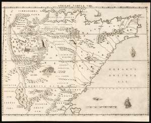
Africae Tabula VIIII.
sold
- Digital Map Information
- Suitable for large format printing
- DPI: 600
- File Size: 49.23 MB
- File Type: ZIP / TIFF
- ICC color profile embedded
- Delivered instantly via download link
This elegant map of East Africa was printed in a single edition in 1588 for Livio and Giulio Sanuto's twelve-sheet 'atlas' of Africa. This map represents a thorough reconsideration of African geography in the light of both conventional and newly available sources. Due to superficial similarities, some have suggested that Sanuto's geography is derived from Gastaldi's seminal 1564 Il disegno della geografia moderna de tutta la parte dell'Africa. This is not the case, as this and the other maps from the Sanuto atlas diverged sharply any contemporaneous or prior map - marking it as a unique and underappreciated masterpiece of geographical thought. (more details)
Geographical Reassessment of the African Red Sea Coast.
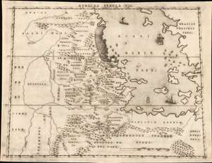
Africae Tabula VIII.
sold
- Digital Map Information
- Suitable for large format printing
- DPI: 600
- File Size: 20.66 MB
- File Type: ZIP / TIFF
- ICC color profile embedded
- Delivered instantly via download link
This elegant map of the Upper Nile and the Red Sea was printed in a single edition in 1588 for Livio and Giulio Sanuto's twelve-sheet 'atlas' of Africa. It is the first detailed and reasonably accurate map of what is today Eritrea, Djibouti, Ethiopia, and Sudan. While the general outline of Sanuto's map superficially resembles the 1564 Gastaldi Il disegno della geografia moderna de tutta la parte dell'Africa, its detail diverges sharply from that source, and any other contemporaneous map. This map thus represents a thorough reconsideration of African geography in the light of both conventional and newly available sources - marking it as a unique and underappreciated masterpiece of geographical thought. (more details)