
Scarborough Company (sold)

Scarborough Company (1885 - 1913) was founded by the brothers Walter C. Scarborough (June 4, 1862 - May 9, 1904) and Howard G. Scarborough (December 23, 1867 - June 10, 1905). Walter, the older brother, was born in Providence, Rhode Island, and studied at the Boston University Law School. The Scarborough brothers founded their map publishing concern in 1885. Initially, there were three separate firms: the National Publishing Company (Portland, Maine, 1897), later based in Boston; the Dominion Publishing Company, based in Canada; and the Scarborough Publishing Company, based in London. These three firms each published semi-independently but were merged with a capital of 1,000,000 USD in 1902, subsequently publishing under the Scarborough imprint. Howard took over full management of the Scarborough in 1904 when Walter died. Howard was also in poor health, suffering from tuberculous, and relocated to Europe in 1900, where he lived in a sanatorium. He returned to the United States in 1902, settling first in Asheville, North Carolina, then at a sanatorium community in Oracle, Arizona. Until his death, he managed the Scarborough Company remotely. From about 1904, there was another branch of the firm located at 227 East Ohio Street in Indianapolis, Indiana. After Howard's 1905 death, the management of the firm, as well as its principal manufacturing and distribution points, was relocated to Indianapolis. In 1913, it became the Scarborough Motor Guide Company (c. 1913 - c. 1933).
Wonderland of Mountains and Forests (without the Forests).
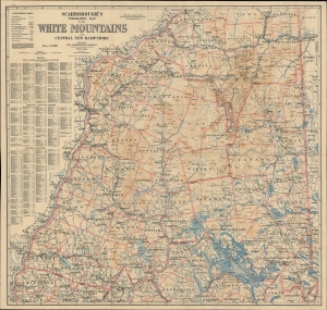
Scarborough's Topographic Map of the White Mountains and Central New Hampshire.
sold
- Digital Map Information
- Suitable for large format printing
- File Size: 77.98 MB
- File Type: ZIP / TIFF
- ICC color profile embedded
- Delivered instantly via download link
This large and impressive map of the White Mountains and central New Hampshire was published by the Scarborough Company, successor to the National Publishing Company, in 1903. It displays the region on the eve of the automobile era, when it was a favorite retreat of well-heeled tourists from Boston, New York, and beyond. (more details)
Wonderland of Mountains and Forests (without the Forests).
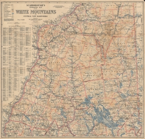
Scarborough's Topographic Map of the White Mountains and Central New Hampshire.
sold
- Digital Map Information
- Suitable for large format printing
- File Size: 191.39 MB
- File Type: ZIP / TIFF
- ICC color profile embedded
- Delivered instantly via download link
This large and impressive map of the White Mountains and central New Hampshire was published by the Scarborough Company, successor to the National Publishing Company, in 1903. It displays the region on the eve of the automobile era, when it was a favorite retreat of well-heeled tourists from Boston, New York, and beyond. (more details)
New Hampshire and World News.
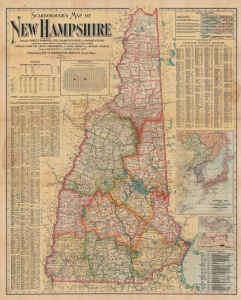
Scarborough's Map of New Hampshire.
sold
- Digital Map Information
- Suitable for large format printing
- File Size: 99.7 MB
- File Type: ZIP / TIFF
- ICC color profile embedded
- Delivered instantly via download link
This is a 1904 Scarborough Company map of New Hampshire. Scarborough maps are widely admired for their boldly distinctive typography, and New Hampshire is among the rarest in the series. The map includes insets illustrating current events: the Russo-Japanese War and the construction of the Panama Canal. Although unfolding far from New Hampshire, their inclusion here is no error and underscores the state's global maritime connections out of Portsmouth. Scarborough maps are much admired for their bold distinctive typography. (more details)
Steamships around the world.
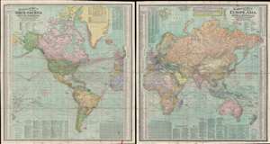
Scarborough's Map of the World North America and South America Shewing Countries and their Colonies Principal Transportation Lines etc. / Scarborough's Map of the World Eruope, Asia, Africa and Australia Shewing Countries and their Colonies Principal Transportation Lines etc.
sold
- Digital Map Information
- Suitable for large format printing
- Full resolution TIFF file
- ICC color profile embedded
- Delivered instantly via download link
This is an impressive double sided 1907 map of the world by the London branch of the Scarborough Company. The map is on a single waxed silk sheet which has been printed on both sides, with one side detailing the Western Hemisphere, including the Americas, and the other side detailing the Eastern Hemisphere, including Europe, Africa, Asia, and Australia. Particular attention has been paid to the global railroad and steamship network at its height. Rail and steam lines are here highlighted in red overprinting. Each side features a wealth of additional information, ranging from the locations of British and American Consulates, to detailed city indexes, and populations statistics. (more details)