
Schmidt, Max Heinrich William (sold) (Max Schmidt)
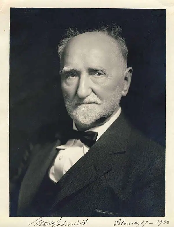
Max Heinrich William Schmidt (February 17, 1850 - May 22, 1936) was a German-American engraver, lithographer, and publisher. Born in Schaemhaum, Germany, Schmidt left home at 14 when he chose to go to sea as a cabin boy instead of pursuing a career in medicine, as was family tradition. He spent the next 7 years traveling the world and developed his artistic skills aboard ship, keeping a meticulously lettered logbook. He arrived in San Francisco in 1871 and left his ship. First finding work in a restaurant, Schmidt soon began working for San Francisco lithographers, and spent the next three years working for Korbell Brothers, Grafton, T. Brown (San Francisco's only African American lithographer), and other San Francisco firms and engravers. He set up his own shop in 1874, called Schmidt and Buehler, in partnership with Frederick Buehler. They made pictorial cuts for local newspapers. Schmidt was on his own two years later, working under the name M. Schmidt and Company and producing stock certificates and colored lithographic labels. Schmidt incorporated the firm in 1883 under the name Schmidt Label and Lithographic Company. His factory burned in 1884 and again in 1886. In 1899, Schmidt acquired the lithographic firm Dickman-Jones and H.S. Crocker's label department and formed a new firm called the Mutual Label Company and Lithographic Company. In the early 1900s, Schmidt expanded to Los Angeles, when the Los Angeles Lithographic Company and the Western Lithograph Company became associated with Mutual. In 1906, the Great San Francisco Earthquake and Fire destroyed his company. He soon rebuilt and named the new firm the Schmidt Lithograph Company. Under this imprint, he printed all of Harrison Godwin's (1899 - 1984) famous pictorial maps. Schmidt continued to find success, and eventually expanded to Southern California, Texas, Utah, the Pacific Northwest, Florida, and Honolulu, making labels for producers and packers in all these areas. Although the firm did produce posters, booklets, and other forms of commercial lithography, it mainly focused on labels. The Stecher-Traung Company bought Schmidt Lithograph in 1966 and formed Stecher-Truang-Schmidt, which operated until 1994.
AKA: Max Schmidt
San Francisco devastated.
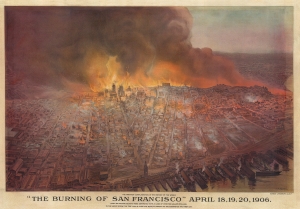
'The Burning of San Francisco' April 18, 19, 20, 1906. The Greatest Conflagration in the History of the World.
sold
- Digital Map Information
- Suitable for large format printing
- File Size: 138.02 MB
- File Type: ZIP / TIFF
- ICC color profile embedded
- Delivered instantly via download link
This is a c. 1906 Schmidt Lithograph Company bird's-eye view of San Francisco burning after the 1906 Great San Francisco Earthquake. It is the best and most dramatic contemporaneous illustration of the Great Fire. (more details)
Best and largest pictorial map of San Francisco.
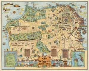
Map of San Francisco Showing Principal Streets and Places of Interest.
sold
- Digital Map Information
- Suitable for large format printing
- File Size: 48.96 MB
- File Type: ZIP / TIFF
- ICC color profile embedded
- Delivered instantly via download link
This is a 1927 Harrison Godwin pictorial map of San Francisco, California - considered the best genre illustration of that city. Comic illustrations appear alongside depictions of San Francisco landmarks, including the Fine Arts Palace, the Twin Peaks, and Fisherman's Wharf. Golden Gate Park appears in detail, with the many animal enclosures, lakes, and buildings all illustrated. The city's schools, churches, hospitals, post offices, and even the U.S. Mint (complete with workers shoveling gold coins into the back of a van) are marked. A surprising number of golfers and golf courses populate the map, with one fellow holding a sign that reads, 'San Francisco has 365 golfing days in the year'. Placards near the bottom border bear facts about the city and list its banks and theaters. Comic panels line the bottom border and present events in San Francisco's history, from its founding to its many fires. An inset in the lower left marks important events, while the inset in the lower right depicts the Greater Bay Area. (more details)
Best and largest pictorial map of San Francisco.
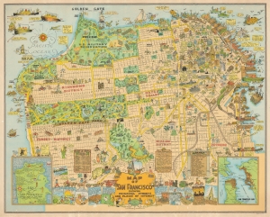
Map of San Francisco Showing Principal Streets and Places of Interest.
sold
- Digital Map Information
- Suitable for large format printing
- File Size: 61.66 MB
- File Type: ZIP / TIFF
- ICC color profile embedded
- Delivered instantly via download link
This is a 1927 Harrison Godwin pictorial map of San Francisco, California - considered the best genre illustration of that city. The map offers a wealth of unique detail that only a local would know - the balloon over the Presidio, a well-known homeless character in Richmond, criminal activity in Sutro Forest, and more. (more details)
Scarce promotional cartoon map illustrating the routes of the Panama Mail Steamship Company.
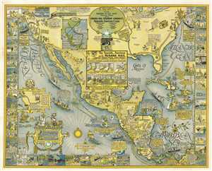
Panama Mail S.S. Co. The Sea Coastes of America shewing the Ports of call of the Panama Mail steamships as the Country there aboutes is lying and situated, with all the havens thereof. Exactly done and corrected with great diligence.
sold
- Digital Map Information
- Suitable for large format printing
- File Size: 51.39 MB
- File Type: ZIP / TIFF
- ICC color profile embedded
- Delivered instantly via download link
An extremely scarce 1928 pictorial map by Harrison Godwin promoting the routes of the Panama Mail Steam Ship Company. In Godwin's classic style, the map humorously covers North American from New York and San Francisco south to Columbia, including all of Central ... (more details)