
Serra y Mas, Pascual (sold)

Pascual Serra y Mas (fl. c. 1853 - 1883) was a Spanish line and letter engraver engaged with the Direccion de Hidrografia or Deposito Hidrografico in the second half of the 19th century.
Most dangerous Maritime passage in West Africa.
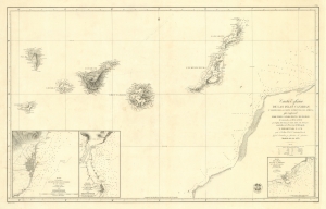
Carta Esférica de las Islas Canarias y Parte de la Costa Ocidental de Africa, que Comprende desde Puerto Cansado Hasta Cabo Bojador, levantada en 1834 á 1838.
sold
- Digital Map Information
- Suitable for large format printing
- DPI: 600
- File Size: 55.49 MB
- File Type: ZIP / TIFF
- ICC color profile embedded
- Delivered instantly via download link
A striking 1853 nautical chart or maritime map of the Canary Islands and the coast of Africa in the vicinity of Cape Bojador. The map depicts one of the most dangerous passages in African navigation - the rounding of Cape Bojador. The Canary Islands were significant to mariners from the 15th through the 19th centuries, when they were considered a vital stopover point and bridge between four continents: Africa, North America, South America, and Europe. (more details)
The Pleasure of Vipers...
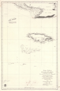
Carta Esférica de la Isla de Jamaica y Parte de la de Cuba.
sold
- Digital Map Information
- Suitable for large format printing
- File Size: 41.35 MB
- File Type: ZIP / TIFF
- ICC color profile embedded
- Delivered instantly via download link
A scarce 1857 Dirección de Hidrografía nautical chart or maritime map of Jamaica, the Little Cayman Islands, and Southern Cuba. Centered on Pendro Bank (Vibora), the map extends as far north as Nipe Bay on Cuba's north coast, and as far west as Little Cayman. The seas to the south are largely empty, but the Serrana Bank atoll in the western Caribbean is noted. (more details)
Philippine-American War reissue of a Spanish Map of the Philippines.
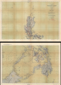
Carta General (en dos hojas) del Archipiélago Filipino.
sold
- Digital Map Information
- Suitable for large format printing
- Full resolution TIFF file
- ICC color profile embedded
- Delivered instantly via download link
This is a 1901 U.S. War Department map of the Philippines. Published during the Philippine-American War (1899 - 1902), the War Department repurposed a Spanish Direccion Hidrografia map originally published in 1870. (more details)