
Seutter, Matthäus
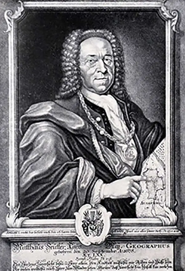
Matthäus Seutter (1678 - 1757) was one of the most important and prolific German map publishers of the 18th century. Seutter was born the son of a goldsmith but apprenticed as a brewer. Apparently uninspired by the beer business, Seutter abandoned his apprenticeship and moved to Nuremberg where he apprenticed as an engraver under the tutelage of the prominent J. B. Homann. Sometime in the early 1700s Seutter left Homann to return to Augsburg, where he worked for the prominent art publisher Jeremiad Wolff (1663 - 1724), for whom he engraved maps and other prints. Sometime around 1717 he established his own independent cartographic publishing firm in Augsburg. Though he struggled in the early years of his independence, Seutter's engraving skill and commitment to diversified map production eventually attracted a substantial following. Most of Seutter's maps are heavily based upon, if not copies of, earlier work done by the Homann and De L'Isle firms. Nonetheless, by 1731/32 Seutter was one of the most prolific publishers of his time and was honored by the German Emperor Karl VI who gave him the title of Imperial Geographer, after which most subsequent maps included the Avec Privilege designation. Seutter continued to publish until his death, at the height of his career, in 1757. Seutter had two engraver sons, Georg Matthäus Seutter (1710 - 173?) and Albrecht Carl Seutter (1722 - 1762). Georg Matthäus quit the business and relocated to Woehrdt in 1729 (and probably died shortly thereafter), leaving the family inheritance to his wastrel brother Albrecht Carl Seutter, who did little to advance the firm until in own death in 1762. Following Albrecht's death, the firm was divided between the established Johann Michael Probst (1727 - 1776) firm and the emerging firm of Tobias Conrad Lotter. Lotter, Matthäus Seutter's son-in-law, was a master engraver and worked tirelessly on behalf of the Suetter firm. It is Lotter, who would eventually become one of the most prominent cartographers of his day, and his descendants, who are generally regarded as the true successors to Matthäus Seutter. (Ritter, M. Seutter, Probst and Lotter: An Eighteenth-Century Map Publishing House in Germany., "Imago Mundi", Vol. 53, (2001), pp. 130-135.)
First Map of the Crownland of Serbia.
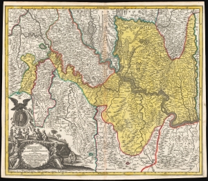
Iustissimae causae heroica virtute propugnatae gloriosiss. Triumphi Praemium, sive accurata delineatio Provinciarum et Urbium quae duabus celeberrimis expeditionibus Iusto Domino ac Victori restitutae et Pace Passarowiziensi : A° 1718 d. 21 Julii a debellatis Turc. concessae et assignatae sunt.
$950.00
Acquire
- Digital Map Information
- Suitable for large format printing
- DPI: 600
- File Size: 70.88 MB
- File Type: ZIP / TIFF
- ICC color profile embedded
- Delivered instantly via download link
This is a beautiful, first state example of Matthias Seutter's 1718 map of Serbia, Timisoara, and parts of modern-day Croatia, Bosnia, and Bulgaria, showing these lands after they passed to the Austrian Empire from the Ottoman Turks following the July 22, 1718, Treaty of Passarowitz. (more details)
Dramatic Map of Conquest.
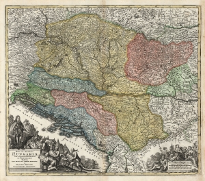
Nova et Accurata Hungariae cum Adiacentibus Regnis et Principatibus Tabula, Aeri Incisa et Venum Exposita À Matthaeo Seütter, Chalcographo Augustano.
$650.00
Acquire
- Digital Map Information
- Suitable for large format printing
- DPI: 600
- File Size: 73.61 MB
- File Type: ZIP / TIFF
- ICC color profile embedded
- Delivered instantly via download link
This is an early 18th century Matthias Seütter map of Hungary and its borderlands. The map follows Habsburg victories over the Ottoman Empire, resulting in the absorption of Ottoman lands by Hungary. It is among Seütter early corpus, prior to his becoming official cartographer for the Holy Roman Emperor - though likely no earlier than 1718, at which point most of the territorial acquisitions mapped here had been set by treaty. (more details)
George II's London in Rich Detail.
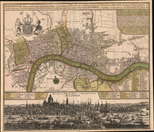
Londinum celeberrima Metropolis, splendidissima Regia et opulentissimum Angliae Emporium, accuratissime delineata per Matthaeum Seutter. / Eigentlicher Grund Riss und Prospect der Weldberühmten Haupt Stadt, Prächtigsten Königl Residenz und reichesten Handel Stadt London in Englland, herauss gegeben von M. Seutter. / Prospect der Konigl Haupt und Residetz Stadt London.
$3,000.00
Acquire
- Digital Map Information
- Suitable for large format printing
- Full resolution TIFF file
- ICC color profile embedded
- Delivered instantly via download link
This is Matthias Seutter's superbly-executed, elegant combined plan and panorama of the City of London, composed and published c. 1727 in honor of British King (and Imperial Elector) George II. (more details)
Struggle between France and Austria for dominance in Italy.
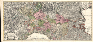
Cursus Padi per Longobardiam a Fonte usque a ostia cum fluminibus que in illum se exonerant et adjacentibus Ducatibus ac Principatibus quos interluit et qui confinis sunt, Tribus Combinandis tabellis...
$2,400.00
Acquire
- Digital Map Information
- Suitable for large format printing
- File Size: 110.69 MB
- File Type: ZIP / TIFF
- ICC color profile embedded
- Delivered instantly via download link
This is Mattheus Seutter's stunning c. 1734 large-scale three-sheet map of the Po River Valley, covering much of northern Italy. The map was issued during the War of the Polish Succession (1733 - 1735). It does not reflect struggles in Poland directly but rather the wider strategic struggle between France and Austria for dominance in Europe and Italy. (more details)
The Riches of the Orient.
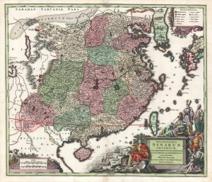
Opulentissimum Sinarum imperium juxta recentissimam delineationem in suas provincias disterminatum, cura et sumtibus Matthaei Seutteri, Sac. Caes. et Reg. Cath. Majest. Geogr. August. Vindelic.
$1,500.00
Acquire
- Digital Map Information
- Suitable for large format printing
- Full resolution TIFF file
- ICC color profile embedded
- Delivered instantly via download link
A striking example of Matthias Seutter's 1732 map of China and Korea, also showing Formosa (Taiwan), and western Japan. It is considered one of the more attractive maps of China to appear in Europe in the first half of the 18th century. (more details)
War and Privateering in the West Indies.
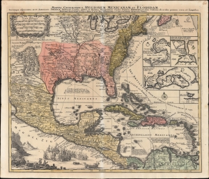
Mappa Geographica Regionem Mexicanam et Floridam Terrasque adjacentes, ut et Anteriores Americae Insulas, Cursus itidem et Reditus Navigantium versus flumem Missisipi et alias Colonias ob oculos ponens cura et sumtibus.
$1,000.00
Acquire
- Digital Map Information
- Suitable for large format printing
- File Size: 28.51 MB
- File Type: ZIP / TIFF
- ICC color profile embedded
- Delivered instantly via download link
An old-color example of Mattheus Seutter's c. 1740 map of North America below the Great Lakes, including Mexico and the Caribbean. It reflects improvements in European cartography of the New World in the late 17th and early 18th centuries, as well as the ongoing competition between colonial empires, namely the contemporaneous War of Jenkins' Ear (1739-1748). (more details)
Luminous comet in Draco.
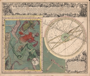
Cometa qui Anno Christi 1742. Apparuit, Ex Observationibus, a die 13 Marty usque ad 15 Aprilis, plusquam Vigesies quinquies institutis ...
$2,500.00
Acquire
- Digital Map Information
- Suitable for large format printing
- File Size: 29.01 MB
- File Type: ZIP / TIFF
- ICC color profile embedded
- Delivered instantly via download link
A striking 1743 Seutter illustration of the Comet of 1742, an exceptionally bright comet whose appearance inspired a wave of intellectual thought and scientific study. (more details)
The Holy City for the Armchair Pilgrim.
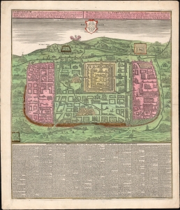
Ierusalem, cum suburbiis prout tempore Christi floruit...
$1,500.00
Acquire
- Digital Map Information
- Suitable for large format printing
- File Size: 39.56 MB
- File Type: ZIP / TIFF
- ICC color profile embedded
- Delivered instantly via download link
This is an attractive example of Matthias Seutter's c. 1745 map of Jerusalem following the influential 1584 model of Christian van Adrichem's. For centuries, Adrichem's portrayal of Jerusalem provided the basis for a sort of 'virtual pilgrimage' to the holy sites when actual travel there was, for most, impossible. Seutter's version of the plan here appears in its Lotter imprint of 1756. (more details)
One of the few views of to show a walled New York.
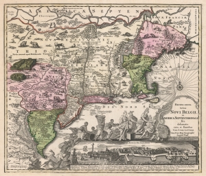
Recens Edita Totius Novi Belgii, in America Septentrionali siti, delineatio cura et sumtibus Tob. Conr. Lotteri, Sac. Caes. Maj. Geographi August. Vind.
$3,500.00
Acquire
- Digital Map Information
- Suitable for large format printing
- DPI: 600
- File Size: 74.88 MB
- File Type: ZIP / TIFF
- ICC color profile embedded
- Delivered instantly via download link
This is Conrad Tobias Lotter's 1757 map of New York, New England, and the mid-Atlantic colonies. It represents the final map in the Jansson-Visscher series. Despite the map's cartography being over a century old, this map continued to capture the idea of this part of the world for Europeans in general and a German audience in particular. (more details)
The early days of St. Petersburg.
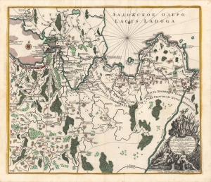
Ладожское озеро [Lake Ladoga], Conspectus recens et accuratus magnae partis Lacus Ladogae et Sinus Finnici.
$1,800.00
Acquire
- Digital Map Information
- Suitable for large format printing
- Full resolution TIFF file
- ICC color profile embedded
- Delivered instantly via download link
A scarce c. 1760 Russian-language map of Lake Ladoga, St. Petersburg, and environs, produced by Johann Elias Grimmel, based on an original published by Matthäus Seutter. It depicts the region as St. Petersburg was growing considerably and attracting intellectuals from throughout Europe, including Grimmel. (more details)
The Silver Mines of Saxony.
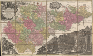
Mappa Geographica Circuli Metalliferi Electoratus Saxoniae cum omnibus quae in eo comprehenduntur Praefecturis...
$1,600.00
Acquire
- Digital Map Information
- Suitable for large format printing
- Full resolution TIFF file
- ICC color profile embedded
- Delivered instantly via download link
A spectacular c. 1760 map of Saxony by Matthäus Seutter, engraved by Tobias Conrad Lotter. Brightly colored and richly illustrated, it focuses on the region's important silver mining operations, which were a major source of silver throughout Europe dating back to the Middle Ages. (more details)
Superb 18th century flag chart identifying the flags of the Dutch East India Company and Dutch West India Company.
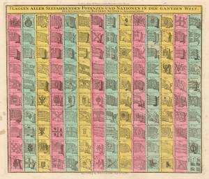
Flaggen aller Seefahrenden Potenzen und Nationen in der gantzen Welt.
$950.00
Acquire
- Digital Map Information
- Suitable for large format printing
- DPI: 600
- File Size: 28.9 MB
- File Type: ZIP / TIFF
- ICC color profile embedded
- Delivered instantly via download link
An attractive c. 1765 flag chart by Matthias Seutter and Tobias Conrad Lotter. The chart features 139 flags of various nations, factions, and trading companies. Among the more interesting flags are those of the Dutch West India Company (G.W.C. / Geoctroyeerde Westindische Compagnie) and the Dutch East India Company (V.O.C. / Vereenigde Oostindische Compagnie). The premier placement of English flags in the upper left quadrant suggests that this chart may have been originally derived from an English source. (more details)
Thirteen Colonies on the Brink of Revolution.
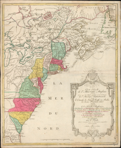
Carte Nouvelle de L'Amerique Angloise contenant tout ce que les Anglois possedent sur le Continent de L'Amerique Septentrionale savoir le Canada, la Nouvelle Ecosse ou Acadie, les treize Provinces unies
$1,800.00
Acquire
- Digital Map Information
- Suitable for large format printing
- Full resolution TIFF file
- ICC color profile embedded
- Delivered instantly via download link
This is an uncommon 1776 French-language map of the Thirteen Colonies and emerging United States by Augsburg cartographer Matthias Albrecht Lotter, published at the outbreak of the American Revolutionary War. Drawing heavily on French cartographic traditions, the map presents British North America at the very moment the colonies declared independence and the United States began to take shape. Issued two years before France formally entered the Revolutionary War on the American side, it captures the continent on the cusp of a geopolitical transformation that would redraw North America. (more details)