
Seutter, Matthäus (sold)
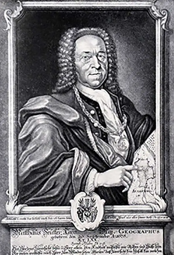
Matthäus Seutter (1678 - 1757) was one of the most important and prolific German map publishers of the 18th century. Seutter was born the son of a goldsmith but apprenticed as a brewer. Apparently uninspired by the beer business, Seutter abandoned his apprenticeship and moved to Nuremberg where he apprenticed as an engraver under the tutelage of the prominent J. B. Homann. Sometime in the early 1700s Seutter left Homann to return to Augsburg, where he worked for the prominent art publisher Jeremiad Wolff (1663 - 1724), for whom he engraved maps and other prints. Sometime around 1717 he established his own independent cartographic publishing firm in Augsburg. Though he struggled in the early years of his independence, Seutter's engraving skill and commitment to diversified map production eventually attracted a substantial following. Most of Seutter's maps are heavily based upon, if not copies of, earlier work done by the Homann and De L'Isle firms. Nonetheless, by 1731/32 Seutter was one of the most prolific publishers of his time and was honored by the German Emperor Karl VI who gave him the title of Imperial Geographer, after which most subsequent maps included the Avec Privilege designation. Seutter continued to publish until his death, at the height of his career, in 1757. Seutter had two engraver sons, Georg Matthäus Seutter (1710 - 173?) and Albrecht Carl Seutter (1722 - 1762). Georg Matthäus quit the business and relocated to Woehrdt in 1729 (and probably died shortly thereafter), leaving the family inheritance to his wastrel brother Albrecht Carl Seutter, who did little to advance the firm until in own death in 1762. Following Albrecht's death, the firm was divided between the established Johann Michael Probst (1727 - 1776) firm and the emerging firm of Tobias Conrad Lotter. Lotter, Matthäus Seutter's son-in-law, was a master engraver and worked tirelessly on behalf of the Suetter firm. It is Lotter, who would eventually become one of the most prominent cartographers of his day, and his descendants, who are generally regarded as the true successors to Matthäus Seutter. (Ritter, M. Seutter, Probst and Lotter: An Eighteenth-Century Map Publishing House in Germany., "Imago Mundi", Vol. 53, (2001), pp. 130-135.)
Highly decorative 18th century map of Brazil.
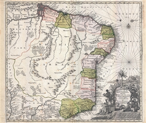
Recens elaborata mappa geographica regni Brasiliae in America Meridionali maxime celebris…
sold
- Digital Map Information
- Suitable for large format printing
- Full resolution TIFF file
- ICC color profile embedded
- Delivered instantly via download link
A very attractive 1730 map of Brazil by the Augsburg cartographer Matthaeus Seutter. The map covers Brazil from the mouth of the Amazon River to the city of São Paulo and from the Paraguay River to the Atlantic seaboard. In addition to Brazil, it also features ... (more details)
Seutters depiction of the Duchy of Luxembourg.
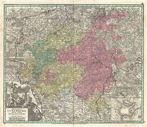
Ducatus Luxemburg.
sold
- Digital Map Information
- Suitable for large format printing
- DPI: 300
- File Size: 25.59 MB
- File Type: ZIP / TIFF
- ICC color profile embedded
- Delivered instantly via download link
This is a lovely 1730 map of Luxembourg and surroundings by the important Augsburg map publisher Georg Matthaus Seutter. It extends from Ulmen in Germany west to Rocroi in France and from Amneville, France north as far as Huy in Belgium, covering all of ... (more details)
Defense of Malta.
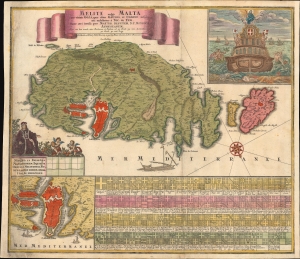
Melite, vulgo Malta cum vicinis Goza, quae olim Gaulos, et Comino insulis / uti exhibetur á Nic. de Fer, nunc aeri incisa per Matth. Seutter, S.C.M. Geogr.
sold
- Digital Map Information
- Suitable for large format printing
- File Size: 27.75 MB
- File Type: ZIP / TIFF
- ICC color profile embedded
- Delivered instantly via download link
With this dramatic 1730 map of Malta, Gozo, and Comino, Matthias Seutter celebrates the Venetian victory over the Ottoman Turks in the 1565 Siege of Malta - an event so momentous that even in the 18th century it remained a signal event in European consciousness. Along the bottom of the map are a series of armorial crests representing Grand Masters of the Order of Knights of the Hospital of Saint John of Jerusalem, commonly known as the Knights Hospitaller or the Order of Saint John, a militant monastic order dating to the Crusades. (more details)
Chronicling Jesuit Activity in and around the Rio de la Plata.
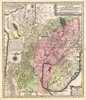
Paraquariae Provinciae Soc. Iesu com Adjacentibus Novissima Descriptio Post iteratas peregrinationes, et plures observationes Patrum Missionariorum eiusdem Soc. tom huius Provinciae cum et Peruvanae accuratissime delin. a Matthaeo Seuttero, S.C.M.G. August.
sold
- Digital Map Information
- Suitable for large format printing
- DPI: 600
- File Size: 28.85 MB
- File Type: ZIP / TIFF
- ICC color profile embedded
- Delivered instantly via download link
This is Matthias Seutter's 1730 map of Paraguay, showing specifically the Jesuit province of Paraguay and the surrounding regions including present-day Uruguay, and parts of Argentina and Brazil. This map, commonly given a date of 1730, is a faithful copy of a 1722 map of the same area produced by Juan Francisco D'Avila, which substantially improved from earlier maps of the region and provided what was the most complete map of the Rio de la Plata watershed available at the time. Furlong, in his Cartografia jesuttica del Rio de la Plata hailed the D'Avila map as 'without doubt the most complete and most comprehensive map undertaken by the Jesuits up to the middle of the eighteenth century' (Buenos Aires, 1936, p. 44). This map does not exhibit any of the added missionary tracks that appear on Antonio Marchoni's corrected 1732 iteration of the map, supporting a 1730 date. The map shows the full length of the Rio de la Plata from its source at the mythical Lake Xarayes (see below) to its mouth, at Buenos Aires and Montevideo. The map embraces central South America, and includes the Pacific coast from Peru to Coqimbo in Chile. Lake Titicaca (Chiquito, on the map) is shown, as is the famous Cerro Potosi, location of the Spanish Colonial silver mint - source of the massive wealth of silver drawn from South America by Spain via slave labor throughout the sixteenth and seventeenth centuries. Throughout the map are shown Jesuit missions - both active, and those destroyed by the indigenous population. Cities with Jesuit colleges are shown as well. As is not atypical for Jesuit maps, the locations of martyrdoms are also shown. (more details)
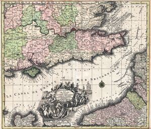
La Plus Grande Partie de la Manche, qui continent Les Cotes D'Angleterre et cells de France les Bords Maritimes de Picardie.
sold
- Digital Map Information
- Suitable for large format printing
- Full resolution TIFF file
- ICC color profile embedded
- Delivered instantly via download link
A highly decorative c. 1730 map of the english Channel, southeastern england, and the coasts of Normandy by Matthius Seutter. The map covers southeastern england, including London and the full length of the Thames River, from Gloucester and Salisbury to ... (more details)
Beautiful map of southern Russia and Ukraine.
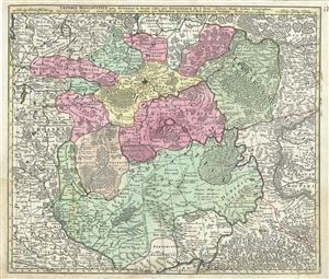
Imperii Moscovitici pars Australis in lucem edita per Guillielmum de l'Isle, Regis Galliae Geographum.
sold
- Digital Map Information
- Suitable for large format printing
- Full resolution TIFF file
- ICC color profile embedded
- Delivered instantly via download link
This is an attractive 1730 map of southern Russia and Ukraine by the important Augsburg map publisher Georg Matthaus Seutter. It depicts from Novgorod south to Lutik and east as far as Kokchaga. Includes towns, roads rivers, lakes, mountains, forests and ... (more details)
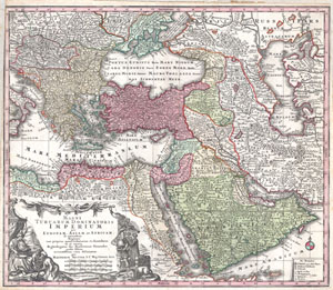
MAGNI TURCARUM DOMINATORIS IMPERIUM per EUROPAM, ASIAM ET AFRICAM, se extendens Regiones tam proprias, quan tributarias et clientelares ut et omnes Beglerbegatus sive Praefecturas Generales oculis sistens accuratissima cura delineatum per MATTHAEUM SEUTTER, S.C. Maj. Geogr. Aug.
sold
- Digital Map Information
- Suitable for large format printing
- DPI: 300
- File Size: 11.5 MB
- File Type: ZIP / TIFF
- ICC color profile embedded
- Delivered instantly via download link
A spectacular c. 1730 map of the Ottoman Empire, including Greece, Turkey, Persia, Egypt and Arabia, by the important Augsburg map publisher Gerog Matthaus Seutter. Depicts from Italy eastward to the Caspian Sea, which is depicted in its entirety. ... (more details)
Superb Plan of 'The Gibraltar of the North'.

Luxembourg, une Fortresse tres celebre de la Duché de cette Nom dans Pais-bas. Grave par M. Seutter, S.C.M. Geogr.
sold
- Digital Map Information
- Suitable for large format printing
- Full resolution TIFF file
- ICC color profile embedded
- Delivered instantly via download link
This is as beautiful, rare, separately issued plan and view of the city of Luxembourg by Matthias Seutter, c. 1734. It illustrates the situation of the fortified city during the renovation of its defenses in the 1730s. (more details)
1734 Map of the Holy Land.with Beautifully Engraved Bible Scenes
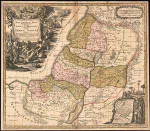
Regio Canaan Seu Terra Promissionis, Postea Iudaea Vel Palestina Nominata, Hodie Terra Sancta Vocata : Quae Olim XII Hoc Autem Aevo In VI Provincias Distincta Est Iuxta Recentissimas et Accuraissimas Descriptiones Adornata Per Matth. Seutter, Sac. Caes. Maj. Geographo Augusta.
sold
- Digital Map Information
- Suitable for large format printing
- DPI: 600
- File Size: 36.81 MB
- File Type: ZIP / TIFF
- ICC color profile embedded
- Delivered instantly via download link
This 1734 Seutter map of the Holy Land reproduces the authoritative cartography of Nicolas Sanson with the bold, richly decorative cartouches of Seutter’s master engraver, Gottfried Rogg. The primary map shows Judaea, divided into the territories of the 12 Tribes. The tribal regions are distinguished from one another in rich, period wash and outline color. Mountains and forests are shown pictorially. The map uses a key to distinguish Royal Cities, Cities of Refuge, and Levite Cities from each other. It includes, also, cities the Bible records were destroyed: Sodom, Gomorrah, and Seboim. All of these can be found within the bounds of the Dead Sea. The superbly engraved cartouche shows a New Testament scene of Christ drawing a demon - appearing in the form of a wriggling, winged creature in a puff of smoke - out of the mouth of a possessed man, while a crowd of onlookers gasp in amazement. An inset map in the lower right shows the track of the Israelites out of Egypt and into Canaan: Moses appears to the right of the inset, and above is a depiction of Numbers 21:4-9 in which the Israelites gather close to a brazen serpent, set up by Moses to protect them from the flying fiery serpents assailing them. The presence of this allegory here is not accidental: it is placed in support of the crucifixion scene appearing in the background of the main cartouche (in John 3:14-16 an explicit comparison was drawn between the raising of the Brazen Serpent and the Crucifixion.) (more details)
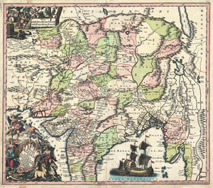
Imperii Magni Mogolis sive Indici Padschach, juxta recentiissimas Navigationes accurata delineato Geographica studio et sumtibus.
sold
- Digital Map Information
- Suitable for large format printing
- DPI: 300
- File Size: 23.09 MB
- File Type: ZIP / TIFF
- ICC color profile embedded
- Delivered instantly via download link
Representing 18th century Germany cartography at its finest; this is an absolutely spectacular c. 1740 map of northern India by Matthias Seutter. Showing the extent of the powerful Mughal Empire in the late 17th century, this map details the ... (more details)
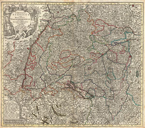
Circulus Suevicus in quo Ducatus Wirtenbergensis cum reliquis Statibus et Provinciis curate defiguatus propomtur Studio et eaelo Matthaei Seutteri.
sold
- Digital Map Information
- Suitable for large format printing
- DPI: 300
- File Size: 24.85 MB
- File Type: ZIP / TIFF
- ICC color profile embedded
- Delivered instantly via download link
This is a rare c. 1740 map of Swabia and Wittenberg, Germany. Covers from Strasburg eastward as far as Landsperg, north as far as Nuremberg and south to Lucern. Includes Nuremberg, Heidelberg, Strasburg, Manheim, Lucerne (Lucern, Luzern), ... (more details)
A land of plenty.
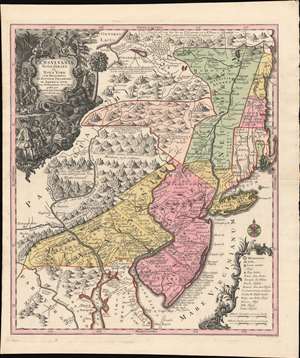
Pensylvania Nova Jersey et Nova York cum Regionibus Ad Fluvium Delaware In America Sitis, Nova Delinatione ob oculos posita ...
sold
- Digital Map Information
- Suitable for large format printing
- DPI: 600
- File Size: 40.3 MB
- File Type: ZIP / TIFF
- ICC color profile embedded
- Delivered instantly via download link
A c. 1750 example of Matthäus Seutter's map of the Middle Atlantic and New England regions during the British colonial period. It encompasses the Middle English Colonies, particularly New York, New Jersey, and Pennsylvania, capturing a period of rapid westward expansion and encouraging German emigration and settlement. (more details)
The 1755 Great Earthquake of Lisbon.
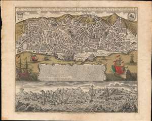
Lisabona magnificentissima Regia Sedes Portugalliae et florentissimum Emporium ad ostia Tagi situm... / Lisabon die prächtige Konigl. Residenz. Statt in Portugall ù florisanteste Handels Plaz am Ausfluss des Tagi.../ Ruinae eversae olysipponis. / Ruin der Stadt Lisabona.
sold
- Digital Map Information
- Suitable for large format printing
- Full resolution TIFF file
- ICC color profile embedded
- Delivered instantly via download link
An extraordinary 1756 Seutter / Lotter map and view of Lisbon, Portugal, in the wake of its near total destruction by the Great Lisbon Earthquake of 1755. The map is divided into two sections. The upper section features a view and map of Lisbon as it appeared in 1735, 20 years prior. The lower section, entitled 'Ruinae Eversae Olysipponis' is a dramatic bird's eye view of Lisbon being consumed by the Great Earthquake and related fires. (more details)
Spectacular old color Seutter map of Artesia in northern France.
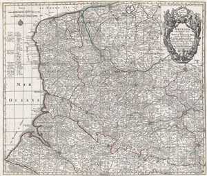
Artesia cum finitimis locis velut Sedes Ac Theatrum Belli : curiosis Spectatoribus ob oculos positum et ad normam Guilielmi de l'Isle celeberrimi Reg. Gal. Geogr. repraesentatum, excusum et venum expositum a Matthaæo Seutter, S.C.M.G. Augustæ Vindelic.
sold
- Digital Map Information
- Suitable for large format printing
- DPI: 300
- File Size: 15.5 MB
- File Type: ZIP / TIFF
- ICC color profile embedded
- Delivered instantly via download link
This spectacular old color 1760 Matthäus Seutter map of Artois (Artesia) in northern France. The map covers a large portion of northern France and notes the cities of Dunkerque (Dunkerke), Ypres, Lille (Ryssel Lille), Lens (which is home ... (more details)
Beautifully engraved miniature world map.
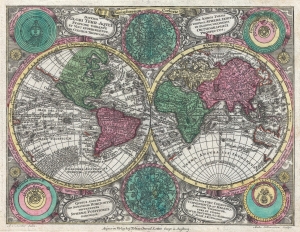
Diversi Globi Terr-Aquei Statione Variante et Visu Intercedente, Per Coluros Tropicorum Per Ambos Polos et Particul, Sphaerae Zenith in Planum Deleati Orthographici Prospectus.
sold
- Digital Map Information
- Suitable for large format printing
- DPI: 300
- File Size: 3.44 MB
- File Type: ZIP / TIFF
- ICC color profile embedded
- Delivered instantly via download link
A full-color c. 1762 double-hemisphere map of the world by Tobias Conrad Lotter. Published for the Atlas Minor, this is a small yet dense map, with the hemispheres surrounded by two celestial charts and four conflicting cosmographical hypotheses (Ptolemaica, Copernicana, Decarta, and Tychonica), as well as rich decorative embellishments. The map includes several oddities and cartographic anomalies, including an illustration of Insular California on the Luke Foxe / Sanson model, an expanse of land leading west from northwestern North America associated with Juan de Gama, an ephemeral New Zealand, the routes of various important explorers, and a loosely defined Australian coastline. (more details)
Superb 18th century flag chart identifying the flags of the Dutch East India Company and Dutch West India Company.
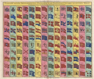
Flaggen aller Seefahrenden Potenzen und Nationen in der gantzen Welt.
sold
- Digital Map Information
- Suitable for large format printing
- DPI: 300
- File Size: 12.76 MB
- File Type: ZIP / TIFF
- ICC color profile embedded
- Delivered instantly via download link
A c. 1765 flag chart issued by Matthias Seutter and Tobias Conrad Lotter. The flag features 139 flags of various nations, factions, and trading companies. Among the more interesting flags are those of the Dutch West India Company (G.W.C. /Geoctroyeerde Westindische Compagnie) and the Dutch East India Company (V.O.C. / Vereenigde Oostindische Compagnie). The premier placement of English flags in the upper left quadrant suggest that this chart may have been copied from an English source. (more details)
The American Colonies on the Brink of Revolution.
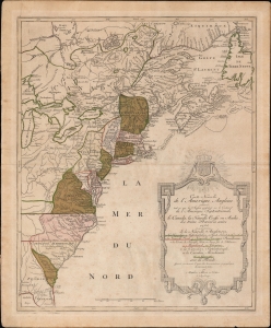
Carte Nouvelle de L'Amerique Angloise contenant tout ce que les Anglois possedent sur le Continent de L'Amerique Septentrionale savoir le Canada, la Nouvelle Ecosse ou Acadie, les treize Provinces unies
sold
- Digital Map Information
- Suitable for large format printing
- Full resolution TIFF file
- ICC color profile embedded
- Delivered instantly via download link
An uncommon French-language 1776 Mathais Albrecht Lotter map of the American colonies on the cusp of the American Revolutionary War. (more details)
One of the few views of to show a walled New York.
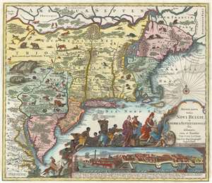
Recens Edita Totius Novi Belgii, in America Septentrionali siti, delineatio cura et sumtibus Tob. Conr. Lotteri, Sac. Caes. Maj. Geographi August. Vind.
sold
- Digital Map Information
- Suitable for large format printing
- Full resolution TIFF file
- ICC color profile embedded
- Delivered instantly via download link
This is Conrad Tobias Lotter's 1777 map of the Northeast and New York, the final map in the Jansson-Visscher series. Despite the map's cartography being over a century old, this map continued to capture the idea of this part of the world for Europeans in general and a German audience in particular. (more details)
Late Appearance of California as an Island.
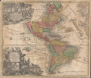
Novus Orbis Sive America Meridionalis et Septentrionalis...
sold
- Digital Map Information
- Suitable for large format printing
- File Size: 27.44 MB
- File Type: ZIP / TIFF
- ICC color profile embedded
- Delivered instantly via download link
This is Johann Michael Probst's rare 1784 issue of Mattheus Seutter's map of the Americas. Among other features, it includes a very late representation of California as an island, a cartographic myth that had largely been dispelled decades earlier. (more details)