
Sleigh, Bernard (sold)
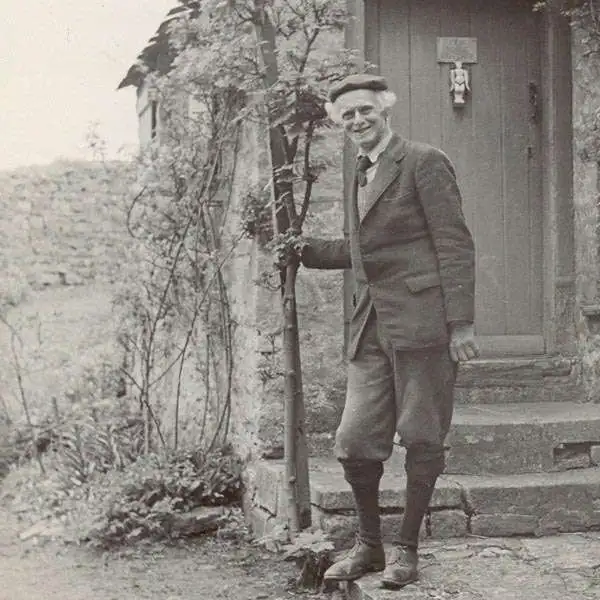
Bernard Sleigh (1852 - December 7, 1954) was a British author, muralist, stained-glass artist, illustrator and wood engraver active in London in the late 18th and early 19th centuries. Sleigh was born in Birmingham, England and studied at the Birmingham School of art. He was a student of Arthur Gaskin. His work is deeply influenced by his early association with William Morris and the Arts and Crafts Movement. He was a member of the Royal Birmingham Society of Artists between 1923 and 1928. His most famous cartographic work is An Ancient Mappe of Fairyland, Newly Discovered and Set Forth, published at the end of the Great War or World War I. He also published several less well known maps of Birmingham and other parts of England. Sleigh retired to Chipping Campden in 1937. For those who are unacquainted with 'Chipping Campden' or 'Chippy,' in the heart of England's picturesque Cotswolds, it is a place that seems more akin to 'Fairy Land' than to the modern industrial world.
An idyllic land created at the end of the Great War. A sharp juxtaposition to bomb-blasted Europe.
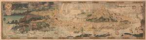
An Anciente Mappe of Fairy Land newly discovered and set forth.
sold
- Digital Map Information
- Suitable for large format printing
- Full resolution TIFF file
- ICC color profile embedded
- Delivered instantly via download link
An extraordinary 6-foot-long masterpiece, this is Bernard Sleigh's 1918 fantastical map of Fairy Land - in tis deluxe first edition. This wonderful map offers a wide birds-eye view panorama of the island of 'Fairy Land' which it describes as 'newly discovered and set forth'. Fairy Land is a wonderful juxtaposition of European fairy tales, literature, and Greek mythology. One can travel from King Arthur's Tomb to Peter Pan's House to the 'Bay of Moaning,' or the visit the roost of Dragons, watch Perseus save Andromeda, chat with Hercules, or visit the 'Harbour of Dreamland.' A red line indicates the route of passage 'From the World' to 'a place that never was and always will be.'
As pointed out by map historian Tim Bryars, this map was printed in 1918, the final year of World War I. Bryars astutely asks,
As pointed out by map historian Tim Bryars, this map was printed in 1918, the final year of World War I. Bryars astutely asks,
Could the map constitute a yearning for a return to pre-1914 Edwardian innocence? Compared with the devastated, bomb-blasted landscape of northern France, this vision of a make-believe land may have seemed a seductive escape for a European society bearing the psychological and physical scars of mass conflict.Another approach to this map is to study it within the context of the Arts and Crafts Movement. Sleigh was a close associate of Robert Morris and this map clearly follows Arts and Crafts Movement ideology. The typeface and decoration are very much in the style of Morris's Kelmscott Press and its embrace of traditional pre-industrial era production techniques. (more details)
An idylic fantastical land created by Bernard Sleigh at the end of the Great War and which then stood in sharp justaposition to bomb-blasted Europe.
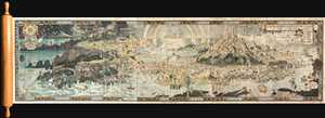
An Anciente Mappe of Fairy Land newly discovered and set forth.
sold
- Digital Map Information
- Suitable for large format printing
- Full resolution TIFF file
- ICC color profile embedded
- Delivered instantly via download link
An extraordinary 6 foot long presentation edition of Bernard Sleigh's 1918 fantastical map of Fairy Land. This wonderful map offers a wide birds-eye view style panorama of the island of 'Fairy Land' which it describes as 'newly discovered and set forth'. Fairy ... (more details)
An idyllic fantastical land created by Bernard Sleigh at the end of the Great War and which then stood in sharp juxtaposition to bomb-blasted Europe.
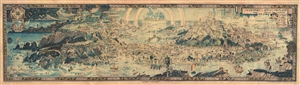
An Anciente Mappe of Fairy Land newly discovered and set forth.
sold
- Digital Map Information
- Suitable for large format printing
- File Size: 30.8 MB
- File Type: ZIP / TIFF
- ICC color profile embedded
- Delivered instantly via download link
An extraordinary 5 foot long edition of Bernard Sleigh's 1918 fantastical map of Fairy Land. This wonderful map offers a wide birds-eye view style panorama of the island of 'Fairy Land' which it describes as 'newly discovered and set forth'. Fairy Land, as set ... (more details)
An idylic fantastical land created by Bernard Sleigh at the end of the Great War and which then stood in sharp justaposition to bomb-blasted Europe.
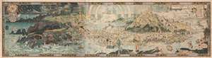
An Anciente Mappe of Fairy Land newly discovered and set forth.
sold
- Digital Map Information
- Suitable for large format printing
- File Size: 55.17 MB
- File Type: ZIP / TIFF
- ICC color profile embedded
- Delivered instantly via download link
An extraordinary 6-foot-long edition of Bernard Sleigh's 1918 fantastical map of Fairy Land. This wonderful map offers a wide birds-eye view style panorama of the island of 'Fairy Land' which it describes as 'newly discovered and set forth'. Fairy Land, as ... (more details)
An idyllic fantastical land created by Bernard Sleigh at the end of the Great War and which then stood in sharp juxtaposition to bomb-blasted Europe.
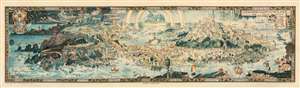
An Anciente Mappe of Fairy Land newly discovered and set forth.
sold
- Digital Map Information
- Suitable for large format printing
- Full resolution TIFF file
- ICC color profile embedded
- Delivered instantly via download link
An extraordinary 5-foot-long edition of Bernard Sleigh's 1918 fantastical map of Fairy Land. This fanciful map offers a wide birds-eye view style panorama of the island of 'Fairy Land' which it describes as 'newly discovered and set forth'. Fairy Land, as set for the by Sleigh, is a wonderful juxtaposition of European fairy tales, literature, and Greek mythology. One can travel from King Arthur's Tomb to Peter Pan's House to the 'Bay of Moaning,' or the visit the roost of Dragons, watch Perseus save Andromeda, chat with Hercules, or visit the 'Harbour of Dreamland.' There are in essence four sections, the leftmost section represents a Tolkien-like world of elves and dragons. This segues into a land populated by children's fairytales. The third section features figures from Arthurian legends and medieval myth. The rightmost, fourth, segment draws its inhabitants from Greek and Roman mythology. A red line indicates the route of passage 'From the World' to 'a place that never was and always will be.' (more details)
Longing for what was loss in the Great War.
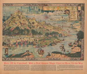
An Anciente Mappe of Fairy Land newly discovered and set forth.
sold
- Digital Map Information
- Suitable for large format printing
- Full resolution TIFF file
- ICC color profile embedded
- Delivered instantly via download link
An unusual discovery. This is a period magazine promotion of Bernard Sleigh's fantastical 1921 map of Fairyland - one of the great masterpieces of fantasy cartography. Bernard Sleigh produced the original to wide acclaim in the aftermath of World War I (1914 - 1918). The present double page presentation, issued by The World magazine, offers a teaser glimpse of the right side of Sleigh's 6-foot-long masterpiece, as well as fascinating content offering unique insights into the map's publication. (more details)