
Smith, George Girdler (sold)

George Girdler Smith (September 8, 1795 – December 18, 1878) was an American map and bank note engraver based in Boston throughout the 19th century. Smith was born in Danvers Massachusetts, the son of George Girdler Smith Sr. of Danvers and Sarah Girder of Marblehead. He was the grandson of Silas Smith, a privateer in the early part of the American Revolutionary War. He studied engraving under Abel Bowen Smith until 1815 and subsequently maintained an engraving studio on Boston’s Washington Street. In 1823 (although some suggest as early as 1818) he partnered with fellow Bowen apprentice, William B. Annin to found ‘Annin and Smith’. They were one of Boston’s earliest lithographic printers. As an engraver he worked with several other engravers and printers. In the 1850s he partnered with Charles A. Knight and George H. Tappan as ‘Smith, Knight, and Tappan’. In addition to his engraving work, he was an active churchman and a high-ranking Freemason
19th Century reissue of the earliest Printed Map of Boston.
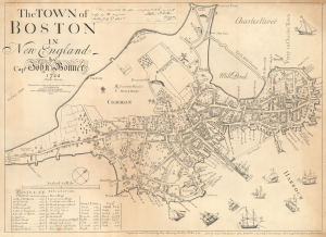
The Town of Boston in New England by Capt. John Bonner 1722.
sold
- Digital Map Information
- Suitable for large format printing
- File Size: 14.26 MB
- File Type: ZIP / TIFF
- ICC color profile embedded
- Delivered instantly via download link
This is George Girdler Smith's rare 1835 reissue of John Bonner's 1722 city map or plan of Boston. Considered the first printed map of Boston, Bonner's map covers the city's location on the Shawmut Peninsula, nearly an island, as it appeared in the early 18th century. (more details)
19th Century reissue of the earliest Printed Map of the City - with distinguished provenance.
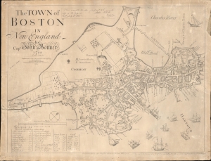
The Town of Boston in New England by Capt. John Bonner 1722.
sold
- Digital Map Information
- Suitable for large format printing
- Full resolution TIFF file
- ICC color profile embedded
- Delivered instantly via download link
An illuminating window into the early history of Boston, this is George Girdler Smith's rare 1835 reissue of John Bonner's 1722 city map or plan of Boston. Considered the first printed map of Boston, Bonner's map covers the city's location on the Shawmut Peninsula, nearly an island, as it appeared in the early 18th century. Distinguished provenance linking the map to Deacon John Price of Manchester, New Hampshire. (more details)
Smith edition of the first printed map of Boston!
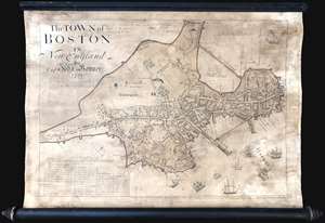
This is George Girdler Smith’s (1795-1878) rare 1835 reissue of John Bonner’s 1722 map of Boston. Considered the first printed map of Boston, Bonner’s map covers the peninsula of Boston as it appeared in the early 18th century. The map includes a wealth of fascinating information about pre-Revolutionary War Boston, including street layouts, the Boston Common, Beacon Hill, the Mill Dam, churches, public buildings, and more. Bonner also illustrates Boston's importance as a port city, detailing the location of docks, shipyards, wharves, and ropewalks. An index in the lower left helps to identify various locales on the map. The harbor around Boston is full of engraved sailing ships – evidence of Boston’s lively trade and prosperity. (more details)
First edition of Boardman's important map.
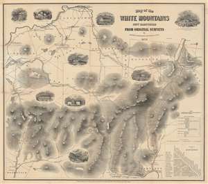
Map of the White Mountains New Hampshire from Original Surveys.
sold
- Digital Map Information
- Suitable for large format printing
- Full resolution TIFF file
- ICC color profile embedded
- Delivered instantly via download link
This is a first edition of Harvey Boardman's 1858 map of the White Mountains, New Hampshire. The remarkably useful map features roads, carriage ways, and summit trails throughout the presidential range as well as Mount Moriah, Mount Lafayette, Mount Willard, and Cannon Mountain. It notes the locations of public buildings, churches, mills, and hotels. It is attractively decorated with vignettes of public houses and hotels throughout the region, naming their proprietors. Two tables in the lower right allow easy calculation of distances between lodgings, making it relevant to the traveler. While Boardman is known to have surveyed the distances of the roads on his maps personally - contemporary reports have him trekking about the mountains with an odometer - he relied on the 1853 work of George Bond for elevations. (more details)
A Beautifully Engraved, Practical Tourists Map of New Hampshire's White Mountains
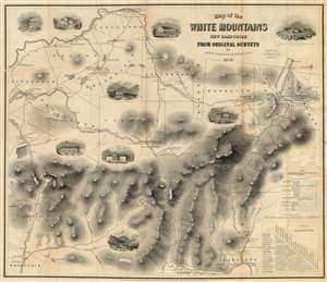
Map of the White Mountains New Hampshire from Original Surveys.
sold
- Digital Map Information
- Suitable for large format printing
- File Size: 33.25 MB
- File Type: ZIP / TIFF
- ICC color profile embedded
- Delivered instantly via download link
This is Harvey Boardman's 1859 map of the White Mountains, New Hampshire. The remarkably useful map features roads, carriage ways and summit trails throughout the presidential range as well as Mount Moriah, Mount Lafayette, Mount Willard and Cannon Mountain. It notes the locations of public buildings, churches, mills and hotels. It is attractively decorated with vignettes of public houses and hotels throughout the region, naming their proprietors. Two tables in the lower right-hand corner allow easy calculation of distances between lodgings in the area, making it particularly relevant to the tourist traveler relying on such dwellings. While Boardman is known to have surveyed the distances of the roads on his maps personally - contemporary reports have him trekking about the mountains with an odometer - he relied on the 1853 work of George Bond for the mountain elevations marked on the map, with few deviations. (more details)
Boardman's important map of the White Mountains - with striking arsenic-green covers.
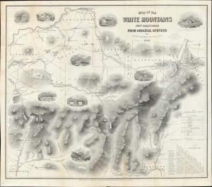
Map of the White Mountains New Hampshire from Original Surveys.
sold
- Digital Map Information
- Suitable for large format printing
- Full resolution TIFF file
- ICC color profile embedded
- Delivered instantly via download link
This is a first edition of Harvey Boardman's 1858 map of the White Mountains, New Hampshire. The remarkably useful map features roads, carriage ways, and summit trails throughout the presidential range as well as Mount Moriah, Mount Lafayette, Mount Willard, and Cannon Mountain. It notes the locations of public buildings, churches, mills, and hotels. It is attractively decorated with vignettes of public houses and hotels throughout the region, naming their proprietors. Two tables in the lower right allow easy calculation of distances between lodgings, making it relevant to the traveler. While Boardman is known to have surveyed the distances of the roads on his maps personally - contemporary reports have him trekking about the mountains with an odometer - he relied on the 1853 work of George Bond for elevations. (more details)