
Taiwan Times (sold)

Taiwan Times (January 8, 1919 – March, 1945) was a government issued Japanese newspaper published in Taiwan from 1919 – 1945. There were three publications that bore the name Taiwan Times, each was very different, and they are considered separate publications, but in fact, each succeeds its predecessor. First was the Taiwan Association Newspaper, which was published from 1898 to 1907. In Meiji 40 (1907) the defunct publication was taken over by the Taiwan branch of the Toya Association, which published as the Taiwan Times until 1919. In that year, it was taken over by the Taiwan Governor's Office (台湾總督府情報部), for which it was a propaganda tool for the Japanese Imperial Government. The newspaper focused on government and military affairs, the war progress, and general issued associated with the South China Sea region. It is considered the longest-lived and most far-reaching periodical issued during the Japanese occupation.
Enormous World War II map of the Philippines.
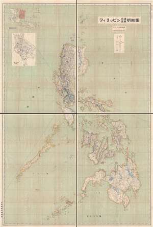
フィリッピン交通產業明細圖 / Philippines Detailed Traffic and Industry Map.
sold
- Digital Map Information
- Suitable for large format printing
- File Size: 62.52 MB
- File Type: ZIP / TIFF
- ICC color profile embedded
- Delivered instantly via download link
An important November 15, 1941 (Showa 16) wall map of the Philippines published by the Taiwan Governor's Office intelligence division on the day the Southern Expeditionary Army (南方軍) confirmed its plans to invade the archipelago. The December 1941 invasion of the Philippines followed shortly thereafter. As such, this is arguably one of the most important Japanese maps of the Philippines published in the 20th century.
The focus of the map is the Philippine transportation network. The level of detail evident in this map illustrates the extreme interest the Japanese had in the Philippines, not only as a source of personnel and resources, but as a steppingstone to Southeast Asia and Melanesia. (more details)
The focus of the map is the Philippine transportation network. The level of detail evident in this map illustrates the extreme interest the Japanese had in the Philippines, not only as a source of personnel and resources, but as a steppingstone to Southeast Asia and Melanesia. (more details)
Issued on the very day the Taiwan-based Japanese Southern Army finalized plans to invade the Philippines.
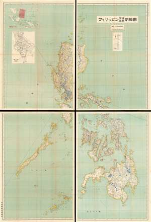
Philippines Detailed Traffic and Industry Map. / フィリッピン交通產業明細圖
sold
- Digital Map Information
- Suitable for large format printing
- File Size: 179.57 MB
- File Type: ZIP / TIFF
- ICC color profile embedded
- Delivered instantly via download link
An impressive 1941 Showa 16 Japanese map of the Philippines. This enormous production covers the entirety of the Philippines in incredible detail. It was issued by the Japanese Bureau of Information just months before the December 1941 invasion of the Philippines. The focus of the map is the Philippine transportation network. The level of detail evident in this map illustrates the extreme interest the Japanese had in the Philippines, not only as a source of personnel and resources, but as a stepping stone to Southeast Asia and Melanesia. (more details)