
Thornton, John (sold)

John Thornton (October 8, 1641 - January 23, 1708) was a British chartmaker, sea captain, publisher and engraver active in London during the late 18th and early 19th centuries. Thornton apprenticed to John Burston where mastered the art of manuscript maritime cartography as practiced by the Thames School. By the 1660s Thornton, working with John Seller and William Fisher, began publishing printed nautical charts and was the only Thames School cartographers to successfully transition to print. Thornton published numerous maps both independently and with some of the most prominent British publishers of his day, including the aforementioned as well as Herman Moll, Robert Morden, James Clark, Robert Greene, and Philip Lea. From around 1665 Thornton took over from Seller the production of the English Pilot. Upon his death in 1708 Thornton willed his charts, copper plates, instruments, and 'all things belonging to my calling' to his son, Samuel Thornton, who continued to republished his father's work, with few updates, until about 1715.
The earliest recognizable printed map of Bombay, India.
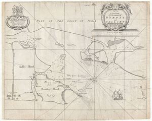
A New Mapp of the Island of Bombay and Sallset.
sold
- Digital Map Information
- Suitable for large format printing
- DPI: 300
- File Size: 12.17 MB
- File Type: ZIP / TIFF
- ICC color profile embedded
- Delivered instantly via download link
An extremely scarce map, this is John Thornton's 1711 map of Bombay Harbor, India. First drawn in 1685 for the Atlas Maritimus , this map is the first printed map to offer any real detail of Bombay harbor. Following in the style of the Thames School, this map ... (more details)
A reformed 'Republic of Pirates'.
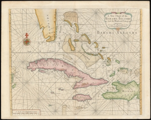
A New Chart of the Bahama Islands and the Windward Passage.
sold
- Digital Map Information
- Suitable for large format printing
- DPI: 600
- File Size: 20.26 MB
- File Type: ZIP / TIFF
- ICC color profile embedded
- Delivered instantly via download link
A rare 1737 map of the Bahamas, Florida, Cuba, and Jamaica issued by Mount and Page for the first edition of The English Pilot: The Fourth Book. The map, based upon a 1698 work by Samuel Thornton, illustrates the Bahamas during the 'Republic of Pirates' era (1698 - 1718), but has here been re-engraved by Mount and Page to capitalize on British interest in this region following increased Anglo-Franco-Spanish tensions surrounding the 1732 the founding of Georgia. (more details)
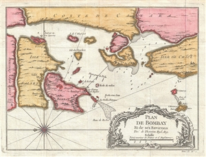
One of the earliest obtainable maps of Bombay or Mumbai, India.
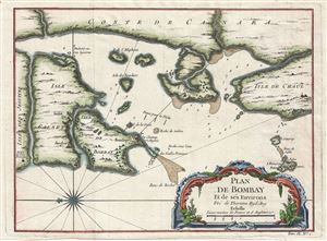
Plan De Bombay et de Ses Environs, Tire de Thornton Hyd. Ang.
sold
- Digital Map Information
- Suitable for large format printing
- Full resolution TIFF file
- ICC color profile embedded
- Delivered instantly via download link
This beautifully hand colored c. 1750 Jacques Nicolas Bellin map of Bombay (Mumbai), India. Bellin's map illustrates Bombay as it was becoming the British East India Company's primary base of operations in India, replacing Surat to the north in light of ... (more details)
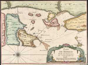
One of the earliest obtainable maps of Bombay or Mumbai, India.
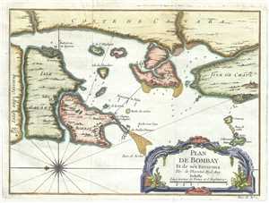
Plan De Bombay et de Ses Environs.
sold
- Digital Map Information
- Suitable for large format printing
- Full resolution TIFF file
- ICC color profile embedded
- Delivered instantly via download link
This beautifully hand colored c. 1750 Jacques Nicolas Bellin map of Bombay (Mumbai), India. Bellin's map illustrates Bombay as it was becoming the British East India Company's primary base of operations in India, replacing Surat to the north in light of ... (more details)
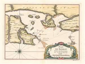
One of the earliest obtainable maps of Bombay or Mumbai, India.
Plan De Bombay et de Ses Environs.
sold
- Digital Map Information
- Suitable for large format printing
- Full resolution TIFF file
- ICC color profile embedded
- Delivered instantly via download link
This beautifully hand colored c. 1750 Jacques Nicolas Bellin map of Bombay (Mumbai), India. Bellin's map illustrates Bombay as it was becoming the British East India Company's primary base of operations in India, replacing Surat to the north in light of ... (more details)
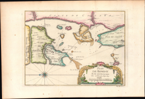
One of the earliest obtainable maps of Bombay or Mumbai, India.
Plan De Bombay et de Ses Environs.
sold
- Digital Map Information
- Suitable for large format printing
- Full resolution TIFF file
- ICC color profile embedded
- Delivered instantly via download link
This is a beautifully hand colored c. 1750 Jacques Nicolas Bellin map of Bombay (Mumbai), India. Bellin's map illustrates Bombay as it was becoming the British East India Company's primary base of operations in India, replacing Surat to the north in ... (more details)
Bellin's beautiful mapping of Bombay (Mumbai).
Plan De Bombay et de Ses Environs.
sold
- Digital Map Information
- Suitable for large format printing
- DPI: 600
- File Size: 13.14 MB
- File Type: ZIP / TIFF
- ICC color profile embedded
- Delivered instantly via download link
This is a beautifully hand-colored c. 1750 Jacques Nicolas Bellin map of Bombay (Mumbai), India. Bellin's map illustrates Bombay as it was becoming the British East India Company's primary base of operations in India, replacing Surat to the north. It is oriented towards the east, with north at left. (more details)
Bellin's beautiful mapping of Bombay (Mumbai).
Plan De Bombay et de Ses Environs.
sold
- Digital Map Information
- Suitable for large format printing
- File Size: 5.78 MB
- File Type: ZIP / TIFF
- ICC color profile embedded
- Delivered instantly via download link
This is a beautifully hand-colored c. 1757 Jacques Nicolas Bellin map of Bombay (Mumbai), India. Bellin's map illustrates Bombay as it was becoming the British East India Company's primary base of operations in India, replacing Surat to the north. (more details)
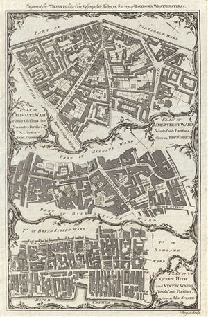
Plan of Aldgate Ward with its Divisions into Precints and Parishes from a New Survey. Plan of Lime Street Ward Divided into Parishes from a new Survey. Plan of Queen Hith and Vintry Wards Divided into Parishe, from a New Survey.
sold
- Digital Map Information
- Suitable for large format printing
- DPI: 300
- File Size: 5.32 MB
- File Type: ZIP / TIFF
- ICC color profile embedded
- Delivered instantly via download link
An uncommon and appealing c. 1780 ward plan of parts of London, England, by Alexander Hogg. Essentially three maps in one, this chart covers, from top down Aldgate Ward, Lime Street Ward, and Queen Hith and Vintry Wards. The Aldgate Map is centered ... (more details)