
Tiddeman, Mark (sold)

Mark Tiddeman (fl. c. 1724 - c. 1760) was a British navigator, surveyor, chartmaker, and hydrographer active in the early 18th century. Tiddeman was sailing master of the English ship Tartar. From 1724 to 1728 he completed a hydrographic survey of New York Harbor and the mouth of the Chesapeake. These surveys were eventually adopted by Mount and Page for inclusion in the 1732 fourth book of the English Pilot. On returning to England Tiddeman completed several surveys of the Highlands of Scotland for Admiral Wagner, who was then stationed on the Coast of Scotland. On March 27th of 1741 he was commissioned as a Lieutenant in the Royal Navy. He later became a Captain and piloted several ships to and from the British West Indies.
Scarce Grierson's Piracy of Tiddeman's important map of New York City and Harbor.
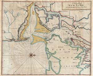
A Draught of New York from the Hook to New York Town.
sold
- Digital Map Information
- Suitable for large format printing
- DPI: 300
- File Size: 18.87 MB
- File Type: ZIP / TIFF
- ICC color profile embedded
- Delivered instantly via download link
A scarce and impressive colonial period 1749 George Grierson / Mark Tiddeman nautical chart of New York City and harbor. Oriented to the west and centered on Coney Island (Cunny I.), Grierson's chart covers from Staten Island to Jamaica Bay and from Sandy Hook to ... (more details)
A scarce early map of the Entrance to the Chesapeake drawn from original survey work by Mark Tiddeman.
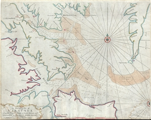
A Draught of Virginia from the Capes to York in York River and to Kuiquotan or Hamton in James River.
sold
- Digital Map Information
- Suitable for large format printing
- DPI: 300
- File Size: 13.39 MB
- File Type: ZIP / TIFF
- ICC color profile embedded
- Delivered instantly via download link
An important c. 1755 map of the Chesapeake Bay entrance by Mark Tiddemen. Oriented to the north, the map covers from the York River and Williamsburg to Norfolk and from Williamsburg to Cape Charles. It includes the mouths of the York River, The James River, the ... (more details)
Colonial era nautical chart of New York City and Harbor.
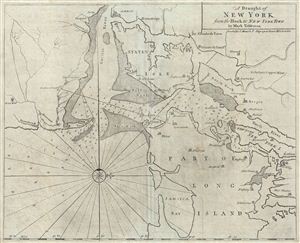
A Draught of New York from the Hook to New York Town.
sold
- Digital Map Information
- Suitable for large format printing
- DPI: 300
- File Size: 17.42 MB
- File Type: ZIP / TIFF
- ICC color profile embedded
- Delivered instantly via download link
A scarce and impressive colonial period c. 1773 Mark Tiddeman nautical chart of New York City and harbor. Oriented to the west and centered on Coney Island (Cunny I.), Tiddeman's chart coves from Staten Island to Jamaica Bay and from Sandy Hook to Harlem ... (more details)