
Tokyo Nichi Nichi Shimbun / (sold)

The Tokyo Nichi Nichi Shimbun (東京日日新聞; Tōkyō Nichi Nichi Shinbun), whose names translates literally as the Tokyo Daily News was a newspaper printed in Tokyo, Japan from 1872 to 1943. It began daily distribution to individual addresses in 1875, making it the world's first daily newspaper delivery service. In 1911, the paper merged with Osaka Mainichi Shimbun (大阪毎日新聞, Osaka Daily News) to form the Mainichi Shimbun (毎日新聞, Daily News) company. The two newspapers continued to print independently until 1943.
How a wood and paper city burns.
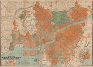
帝都大震火災系統地圖 / Map of the Fire of Tokyo.
sold
- Digital Map Information
- Suitable for large format printing
- File Size: 191.05 MB
- File Type: ZIP / TIFF
- ICC color profile embedded
- Delivered instantly via download link
An infographic masterpiece detailing the ignition and development of the Great Fire of Tokyo following the 1923 Great Kanto Earthquake. This partially bilingual 1923 map of the Great Tokyo Fire was issued by the Relief Information Bureau of Tokyo Imperial University just four months after the disaster. It focuses on ignition points and on the strong winds that coincided with the earthquake, which caused fire to spread rapidly and eventually burn down much of the dense wooden city. (more details)
How a wood and paper city burns.
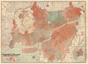
帝都大震火災系統地圖 / Map of the Fire of Tokyo.
sold
- Digital Map Information
- Suitable for large format printing
- File Size: 69.11 MB
- File Type: ZIP / TIFF
- ICC color profile embedded
- Delivered instantly via download link
An astounding infographic masterpiece detailing the ignition and development of the Great Fire of Tokyo following the 1923 Great Kanto Earthquake. This is a partially bilingual 1923 map of Great Tokyo Fire was issued by the Bureau of Tokyo Imperial University just four months after the disaster. It focuses ignition points and on the strong winds that coincided with the earthquake, which caused fire to spread rapidly and eventually burn down much of the city - which was constructed of tightly packed wooden buildings. (more details)
How a wood and paper city burns.
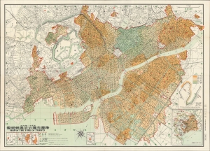
帝都大震火災系統地圖 / Map of the Fire of Tokyo.
sold
- Digital Map Information
- Suitable for large format printing
- File Size: 70.51 MB
- File Type: ZIP / TIFF
- ICC color profile embedded
- Delivered instantly via download link
An infographic masterpiece detailing the ignition and development of the Great Fire of Tokyo following the 1923 Great Kanto Earthquake. This partially bilingual 1923 map of the Great Tokyo Fire was issued by the Relief Information Bureau of Tokyo Imperial University just four months after the disaster. It focuses on ignition points and on the strong winds that coincided with the earthquake, which caused fire to spread rapidly and eventually burn down much of the dense wooden city. (more details)
Uncommmon World War II Pictorial Map of Singapore Island.
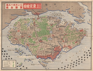
写真特報, 東京日日, シンガポール島, 要塞全貌 / Tokyo Daily Photo Dispatch - Singapore Island Fortress, Full Picture / Shashin tokuhō, Tōkyō nichinichi, shingapōru shima, yōsai zenbō.
sold
- Digital Map Information
- Suitable for large format printing
- File Size: 27.26 MB
- File Type: ZIP / TIFF
- ICC color profile embedded
- Delivered instantly via download link
A remarkable 1942 World War II (WWII) era map of Singapore Island issued by the Japanese newspaper Tokyo Nichi Nichi Shimbun . The map details the island of Singapore with a focus on resources and fortifications. Airfields, naval bases, artillery batteries, ... (more details)