
Toudy, Henry J. (sold)

Henry J. Toudy (fl. c. 1857 - c. 1877) was an American lithographer, engraver, and map publisher active in Philadelphia during the middle part of the 19th century. Little is known of Toudy's parentage or early life, but he established a steam lithography press in Philadelphia around 1856. Toudy was best known as a printer of city and town views, with many such productions bearing his imprint. He also published portraits, railroad bonds, stock certificates, and map. Toudy's original offices were located at 503 and 505 Chestnuts Streets. Insurance records suggest that Toudy's Chestnut Street offices were gutted by fire on March 25, 1879. Records suggest that the Toudy firm was reestablished in 1884 at 829 Walnut Street. In 1892 a Henry J. Toudy is recorded as the owner of the Greenback Coilliery, a mine in Shamokin, PA famous for a terrible explosion that had occurred years earlier under another owner. It is unclear if they are the same person or possibly related, but such is neither unlikely nor impossible.
Important early view of Salt Lake City, Utah.
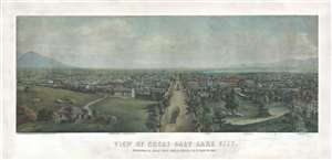
View of Great Salt Lake City.
sold
- Digital Map Information
- Suitable for large format printing
- File Size: 54.36 MB
- File Type: ZIP / TIFF
- ICC color profile embedded
- Delivered instantly via download link
This is a very rare 1867 Christian Inger view of Salt Lake City, Utah. The view illustrates Salt Lake City looking down Main Street as it appeared roughly 20 years following the arrival of the Mormons. The development, in such a short period of time, is ... (more details)
One of only three known examples, this map marks a major milestone in the urban mapping of Philadelphia, and is one of the first to show Fairmount Park's design.
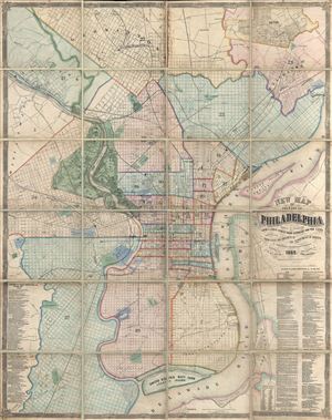
New Map of the City of Philadelphia, reduced by Photography from a large survey made expressly for the City and corrected from Plans and Draughts in the Department of Surveys, by John. H. Dye, Draughtsman and Surveyor.
sold
- Digital Map Information
- Suitable for large format printing
- File Size: 104.62 MB
- File Type: ZIP / TIFF
- ICC color profile embedded
- Delivered instantly via download link
An exceptional 1869 folding wall map of Philadelphia, Pennsylvania by John H. Dye and Henry J. Toudy. This map covers the urban center of Philadelphia along both sides the Delaware and Lehigh Rivers from roughly Germantown to Red Bank and from Haddington ... (more details)
Inspiring view of Fairmount Park.
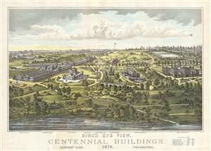
Bird's Eye View, Centennial Buildings, 1876. Fairmount Park, Philadelphia.
sold
- Digital Map Information
- Suitable for large format printing
- File Size: 18.5 MB
- File Type: ZIP / TIFF
- ICC color profile embedded
- Delivered instantly via download link
This is the impressive first edition 1875 H. J. Toudy bird's-eye view of Fairmount Park, the grounds for the Centennial International Exhibition, the first world's fair held in the United States. Held in Philadelphia, Pennsylvania, the view illustrates the fairgrounds from high above the Schuylkill River. This view was issued one year before the actual event based upon architectural plans and landscape renderings. Multiple buildings are recognizable, including the Art Gallery and Machinery Hall, wide boulevards, fountains, and bridges. A key below the bottom border identifies the main buildings. Toudy issued a second edition of his view of Fairmount Park after the fairgrounds were completed as he knew that visitors would want a more accurate depiction. Philadelphia commercial engravers published several different views of Fairmount Park to capitalize on the fair's tourist economy. (more details)