
Ulloa y de la Torre-Giral, Antonio de (sold)
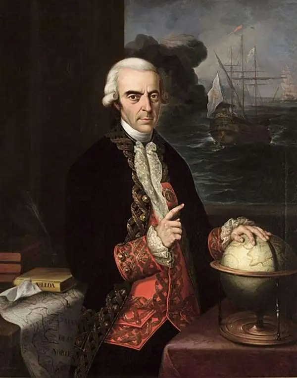
Antonio de Ulloa y de la Torre-Giral (January 12, 1716 – July 3, 1795) was a Spanish general of the navy, explorer, scientist, author, astronomer, colonial administrator and the first Spanish governor of Louisiana. He took part in the French Geodesic Mission in present-day Ecuador. During this expedition and in conjunction with his colleague Jorge Juan, he discovered the element platinum, and was the first person to write a scientific description of the new metal. In 1748 he published an account of the people and countries he had encountered during the French Geodesic Mission. He was a Fellow of the Royal Society and a foreign member of the Royal Swedish Academy of Sciences. He is credited with the establishment of the first museum of natural history, the first metallurgical laboratory in Spain, and the observatory of Cadiz.
The First Scienific Survey of the Andes Mountains and Central Ecuador
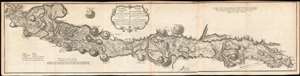
Carte de la Meridiene mesurée au Royaume de Quito; Par ordre du Roy notre Souverain pour parvenir à la Connoissance du Dégré Teirestre et de la figure de la teire par D. Jorge Juan et D. Ant. de Ulloa en 1744./ Karte von der gemessenen Mittagslinie in dem Koenigreiche Quito Auf Befehl Sr. Koenigl. Majest. in Spanien zur Erkentniss des rechten Gehalts eines Erdgrades und der Gestalt der Erde von dem Hrn Georg Juan und dem Hrn Antonio de Ulloa im Jahre 1744 zu Stande gebracht.
sold
- Digital Map Information
- Suitable for large format printing
- DPI: 600
- File Size: 20.88 MB
- File Type: ZIP / TIFF
- ICC color profile embedded
- Delivered instantly via download link
This is a rare, 1752 map of Ecuador's La Sierra region, from Carchi Province in the north to Cañar Province in the south. It encompasses one full degree of arc along the Quito meridian, and represents the first scientific survey of this high Andes valley. It appeared in the 1752 French and German editions of Antonio de Ulloa and Jorge Juan's Relacion Historica del Viaje a la America Meridional, a landmark work of South American geography, culture, history and science produced to report the two scientist's labors for the French Geodesic Mission, which were carried out in what is modern Ecuador over ten years. Specifically, the map shows the triangulations performed by Juan (his work indicated by solid lines) and Ulloa (dotted lines) during the expedition. It mapped Ecuador's Central Valley with unparalleled precision, marking rivers, towns and major peaks from El Angel, to Quito, to El Tambo. Towns of various sizes are differentiated with a key; relief is shown in hachure. Forests and plains are shown pictorially. Roads are marked with a dotted line, and bridges over rivers are indicated as well. (more details)