
Van Keulen, Johannes
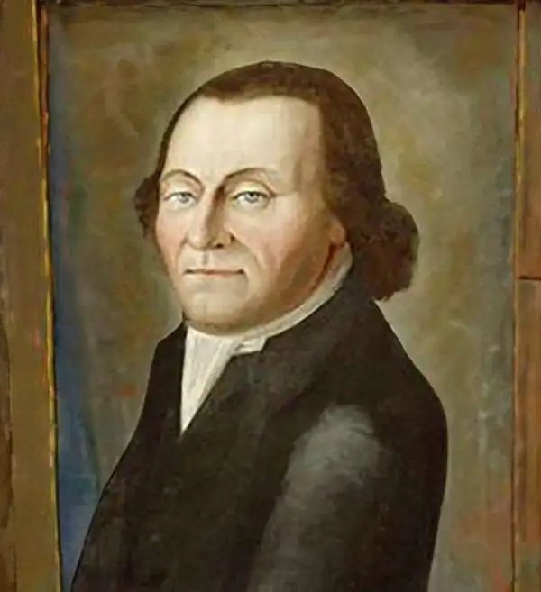
Johannes Van Keulen (1654 – 1715) was a Dutch cartographer active in Amsterdam during the late 17th century. Van Keulen was the son of Lucas van Keulen. Van Keulen's firm, ‘In de Gekroonde Lootsman' (In the Crowned Pilot), was founded in 1678 and registered with the Amsterdam bookseller's guild as 'Cross staff-maker and bookseller.' (The cross-staff is a nautical instrument used to determine latitude.) Two years later, in 1680, they obtained a patent from the States General of Holland and West Friesland to publish nautical charts and atlases. Together with his partner, the cartographer Claes Janz Vooght, Van Keulen published numerous atlases and nautical charts, including the Zee Atlas and Nieuwe Lichtende Zee-Fakkel. It was a massive five-volume atlas containing more than 130 nautical charts. The Zee-Fakkel established the Van Keulen firm as the pre-eminent maker of Dutch sea charts in the late 17th and early 18th century. In 1714, one year before Johannes Van Keulen's death, his son, Gerard van Keulen (1678 - 1726), took charge. Gerard continued to update and republish the Zee-Fakkel until his own death in 1726. The firm was later passed on to Gerard's son, Johannes II Van Keulen (1704 - 1755), who significantly updated the atlas, especially with regard to Asia, issuing the 1753 4th Volume, known as the 'Secret Atlas'. The final editions of the atlas were published by Gerard Hulst van Keulen (1733 - 1801), Joannes II's son. The final true Van Keulen edition of the Zee-Fakkel was published posthumously in 1803. It is noteworthy that though ostensibly controlled by the Van Keulen men, it was the Van Keulen widows who maintained and managed the firm in the periods following their husbands' deaths. After the death of Gerard Hulst Van Keulen's son, Johannes Hulst Van Keulen, ownership of the family plates and business fell into the hands of the Swart family, who continued to publish until the company closed its doors 1885, ending a cartographic legacy spanning nearly 207 years.
In Scarce Original Color.
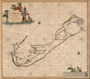
Pas Kaart van I. La Barmuda Anders Somer Islands int Groot Door Vooght Geometra.
$5,000.00
Acquire
- Digital Map Information
- Suitable for large format printing
- File Size: 24.21 MB
- File Type: ZIP / TIFF
- ICC color profile embedded
- Delivered instantly via download link
This is Johannes van Keulen's beautiful 1684 chart of Bermuda. This grand, desirable work is one of the earliest acquirable nautical charts of Bermuda; the present example is embellished with beautiful original color. (more details)
The Yucatan Peninsula and Coast of Honduras.
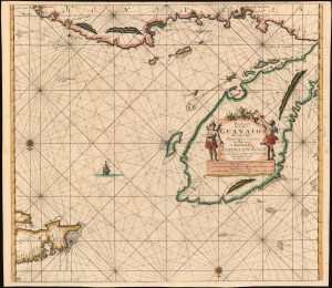
Pas-kaart van de Golff de Guanaios met 't Canaal Tusschen Yucatan en I. Cuba.
$1,000.00
Acquire
- Digital Map Information
- Suitable for large format printing
- DPI: 600
- File Size: 30.67 MB
- File Type: ZIP / TIFF
- ICC color profile embedded
- Delivered instantly via download link
A superb 1687 Johannes van Keulen nautical chart or maritime map of the coasts of Honduras, Belize, Mexico, and Cuba. It is one of the first, if not the first printed chart to focus on the Yucatan Peninsula. (more details)
One of the Earliest Charts of the Bahamas: a Pirates Playground.
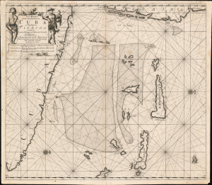
Pas Kaart Vande Noord Oost Kust van Cuba en d'Oost Kust van FLORIDA vervaatende de Canal van Bahama met de Bahaamse Eylende Door Vooght Geometra…
$1,200.00
Acquire
- Digital Map Information
- Suitable for large format printing
- DPI: 600
- File Size: 28.67 MB
- File Type: ZIP / TIFF
- ICC color profile embedded
- Delivered instantly via download link
A bold example of Claes Jansz Vooght and Johannes Van Keulen's 1684 nautical map of the Straits of Florida. Issued at the peak of the Golden Age of Caribbean Piracy (c. 1650 - 1730), this is the first published nautical chart to specifically detail these waters. (more details)
Earliest Acquirable Dutch Chart of the Yucatan Peninsula.
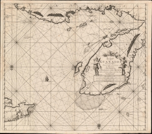
Pas-kaart van de Golff de Guanaios met 't Canaal Tusschen Yucatan en I. Cuba.
$1,200.00
Acquire
- Digital Map Information
- Suitable for large format printing
- DPI: 600
- File Size: 30.61 MB
- File Type: ZIP / TIFF
- ICC color profile embedded
- Delivered instantly via download link
A boldly engraved 1684 nautical chart or maritime map of the coasts of Honduras, Belize, Mexico and Cuba: it is one of the first, if not the first printed chart to focus on the Yucatan Peninsula. (more details)
West Africa at the Dawn of the Atlantic Age.
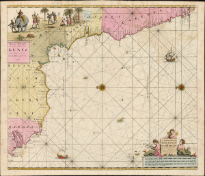
Niewe paskaart van de zee kusten van Gunea van Cabo Verde tot Cabo de Bona Esperanca.
$1,600.00
Acquire
- Digital Map Information
- Suitable for large format printing
- Full resolution TIFF file
- ICC color profile embedded
- Delivered instantly via download link
This is Johannes van Keulen's scarce 1696 chart of the west coast of Africa, from Cape Verde to the Cape of Good Hope; here in striking original color. The map captures West Africa at a transitional moment: Atlantic commerce and the slave trade were expanding rapidly, European commercial rivalry was intensifying, and new African powers were emerging that would reshape the region. (more details)
The Aegean Sea during the Venetian-Ottoman War of 1714-1718.
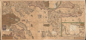
Paskaart Van de Archipelagusche Eylanden.
$1,200.00
Acquire
- Digital Map Information
- Suitable for large format printing
- DPI: 600
- File Size: 125.46 MB
- File Type: ZIP / TIFF
- ICC color profile embedded
- Delivered instantly via download link
An attractive old color c. 1717 Johannes van Keulen nautical chart or maritime map of the northern Aegean, Sea of Marmara, and the surrounding islands. Although critical to regional trade, the Aegean at this time was a hotbed of piracy - much associated with the ongoing Venetian-Ottoman War of 1714-1718. (more details)
Rare updated chart of Florida's West Coast and Cuba.
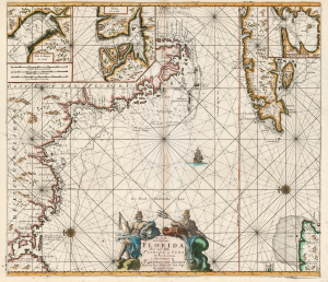
Pas kaart Van de Boght van Florida Met de Canaal Tusschen Florida en Cuba.
$2,500.00
Acquire
- Digital Map Information
- Suitable for large format printing
- DPI: 600
- File Size: 78.13 MB
- File Type: ZIP / TIFF
- ICC color profile embedded
- Delivered instantly via download link
This is a striking, original-color example of Gerard van Keulen's thoroughly updated 1723 version of 'the first sea chart of the eastern portion of the Gulf of Mexico detailing the west coast of Florida' (Burden). It is an exceptionally rare chart that appeared late in the van Keulen record, exhibiting meticulous and important revisions unique to this edition. (more details)
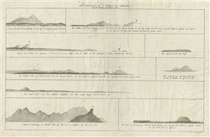
Landvertoningen op de Westkust van Sumatra, by de Keyzers of Lampons Piek.
$100.00
Acquire
- Digital Map Information
- Suitable for large format printing
- DPI: 300
- File Size: 9.22 MB
- File Type: ZIP / TIFF
- ICC color profile embedded
- Delivered instantly via download link
This is an impressive example of Joannes van Keulen's 1728 chart depicting the elevations of the western coast of Sumatra, Indonesia. The chart includes nine beautifully rendered elevation profiles, each depicting a different region of western Sumatra, including a ... (more details)
First printed map to show Hong Kong in any form.
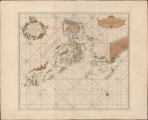
Pas-Kaart van het in en opkomen van de Rivier van Quantong aan de Zuid Kust van China strekkende van het eiland S. Joan, tot aan de Noorder Lemes, met alle tot hiertoe bekende ankerplaatzen, dieptens en droogtens.
$18,000.00
Acquire
- Digital Map Information
- Suitable for large format printing
- DPI: 600
- File Size: 828.08 MB
- File Type: ZIP / TIFF
- ICC color profile embedded
- Delivered instantly via download link
The rare 1753 Johannes II van Keulen / Jan de Marre nautical map of the Pearl River Delta (廣東河口海圖), including Macau (Macao), Lantao (Lantoan), Guangzhou (Quantong), and the first printed mapping of Hong Kong (Lantaon Falso). This rare map in fine original color was compiled for the sixth volume of the Zee-Fakkel - the legendary Dutch East India Company (VOC / Vereenigde Oostindische Compagnie) 'Secret Atlas.' (more details)